Col du Tronchet, starting from Brunissard

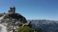
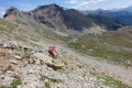
A climb through woodland and pastures to the Col du Tronchet from the hamlet of Brunissard. The viewpoint at the pass is superb. Please note that during the summer of 2026, the circular route via Les Aiguilles will not be possible due to forestry work.

Details

102878939
Creation:
Last update:
Last review:
  • Walking
    Activity: Walking
  • ↔
    Distance: 3.99 mi
  • ◔
    Average duration: 3h 30 
  • ▲
    Difficulty: Moderate

  • ⚐
    Back to start: Yes
  • ↗
    Ascent: + 1,916 ft
  • ↘
    Descent: - 1,923 ft

  • ▲
    Highest point: 7,687 ft
  • ▼
    Lowest point: 5,764 ft

Description of the walk

Park at Brunissard after the Chez Marius bar.

(S/E) Cross the road, then follow the GR®58, which shares the route with the GRP® Tour de la Dent de Ratier. Join a wider track.

(1) Continue straight ahead on the GR®, then leave the woodland and reach the Torrent du Pinet.

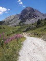
(2) Cross the stream. Continue the climb up through the mountain pasture; after a series of hairpin bends, you’ll reach the path coming from the Col d’Izoard.

(3) Keep to the right on the GR® to complete the climb to the Col du Tronchet. Take the path on the right to reach the viewpoint.

(4) Retrace your steps along the same route to return to the Brunissard car park (S/E).

Waypoints

  1. S/E : mi 0 - alt. 5,771 ft - Brunissard car park
  2. 1 : mi 0.28 - alt. 5,925 ft - Trail junction
  3. 2 : mi 1.1 - alt. 6,739 ft - Torrent du Pinet
  4. 3 : mi 1.82 - alt. 7,569 ft - Izoard trail junction
  5. 4 : mi 2 - alt. 7,687 ft - Viewpoint from the - Col du Tronchet
  6. S/E : mi 3.99 - alt. 5,764 ft - Brunissard car park

Worth a visit

(S/E) On the way back, it’s lovely to stop for a break on the terrace at Chez Marius.

Always be cautious and plan ahead when you're outdoors. Visorando and the author of this route cannot be held responsible for any accidents occurring on this route.

The GR® and PR® markings are the intellectual property of the Fédération Française de Randonnée Pédestre.

Other walks in the area

For more walks, use our search engine .

The GPS track and description are the property of this route's author. Please do not copy them without permission.