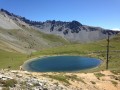
Glaisette Ridge via the Col du Tronchet

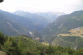
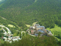
A lovely circular walk alternating between woodland and ridges. Perfect for hot weather with breathtaking views.

Details

n°39476934
Creation:
Last update:
Last review:
  • Walking
    Activity: Walking
  • ↔
    Distance: 7.08 mi
  • ◔
    Average duration: 5h 20 
  • ▲
    Difficulty: Difficult

  • ⚐
    Back to start: Yes
  • ↗
    Ascent: + 2,352 ft
  • ↘
    Descent: - 2,352 ft

  • ▲
    Highest point: 7,802 ft
  • ▼
    Lowest point: 5,528 ft

Description of the walk

Park in the car park at La Chalp d’Arvieux ski resort.

(S/E) Cross the road and head up the track that branches off to the left, beneath the ski lifts, running parallel to the D902. Pass behind the Granges blocks of flats and head up towards Brunissard. Make your way to the Brunissard hikers’ car park.

(1) Turn right at a 90° angle; at the next junction, keep right, heading south-east, on the yellow-marked track. Continue to the end of this track at the confluence of the Torrents du Pinet and the Aiguillettes.

(2) Cross over, take the ascending path and reach the junction withthe GRP® Tour de la Dent de Ratier trail.

(3) Take this path to the right and follow it for one final climb to reach the Col Tronchet.

(4) Leave theGRP® here and continue along the ridge to the right, heading due south. Follow the yellow markings downhill to reach the top stations of the Catinat and Clot ski lifts.

(5) Once past the top stations of the two ski lifts, a track branches off slightly to the left, heading due south. Continue to a crossroads at a place called Camp Catinat.

(6) Turn right, follow the track, and after a few hairpin bends you’ll reach the lower stations of the two ski lifts, where you’ll find the mountain restaurant Le Martagon.

(7) Continue down the track until you reach the Revue chairlift. Turn right onto the footbridge to return to the La Chalp d’Arvieux car park (S/E).

Waypoints

  1. S/E : mi 0 - alt. 5,528 ft - Car park at La Chalp d’Arvieux ski resort
  2. 1 : mi 0.8 - alt. 5,837 ft - Brunissard hikers’ car park
  3. 2 : mi 1.4 - alt. 6,138 ft - Les Aiguillettes
  4. 3 : mi 2.67 - alt. 7,290 ft - GRP
  5. 4 : mi 3.12 - alt. 7,687 ft - Col du Tronchet
  6. 5 : mi 4.49 - alt. 6,909 ft - Upper ski lift station
  7. 6 : mi 4.98 - alt. 6,657 ft - Camp Catinat
  8. 7 : mi 6.38 - alt. 6,010 ft - Le Martagon
  9. S/E : mi 7.08 - alt. 5,528 ft - Car park at La Chalp d’Arvieux ski resort

Notes

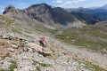
Between (4) and (5): the ridge path is steep and requires sturdy footwear.
Make sure you take enough water with you; there are no springs along the route.
It is possible to shorten the walk by descending via the ski runs (be careful around cow pastures: do not damage anything, do not disturb the animals).

Worth a visit

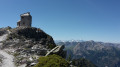
(5) Top of the ski lifts: enjoy the 360° panoramic view over the Arvieux and Souliers valleys. Picnic tables available.

Reviews and comments

5 / 5
Based on 1 review

Reliability of the description
5 / 5
Ease of following the route
5 / 5
Route interest
5 / 5
abeauville
abeauville

Overall rating : 5 / 5

Date of your route : Jul 08, 2024
Reliability of the description : ★★★★★ Very good
Ease of following the route : ★★★★★ Very good
Route interest : ★★★★★ Very good
Very busy route : No

A lovely, not-too-long walk, perfect for getting back into the swing of things. The descent along the ridge is superb, with stunning views on both sides. The top of the ridge (elevation 2383 on the IGN map) is the perfect spot for lunch, with a 360° view: Font Sancte, Pelvoux...

Machine-translated

Other walks in the area

For more walks, use our search engine .

The GPS track and description are the property of this route's author. Please do not copy them without permission.