The Hohwald Waterfall and the Andlau Valley

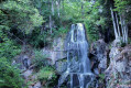
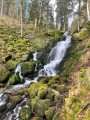
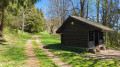
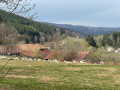
This walk along the western slopes of the Champs du Feu takes you through splendid scenery towards the village of Hohwald. During this route, you’ll discover the source of the Andlau, the Chaume des Veaux, the village of Hohwald and, of course, the waterfall of the same name. Particularly popular for its cool waters in summer, it takes on a magical quality in winter, when, in the bitter cold, it transforms into a majestic ice sculpture.

Details

30161249
Creation:
Last update:
Last review:
  • Walking
    Activity: Walking
  • ↔
    Distance: 9.28 mi
  • ◔
    Average duration: 5h 50 
  • ▲
    Difficulty: Difficult

  • ⚐
    Back to start: Yes
  • ↗
    Ascent: + 1,834 ft
  • ↘
    Descent: - 1,844 ft

  • ▲
    Highest point: 3,524 ft
  • ▼
    Lowest point: 1,923 ft

Description of the walk

From Le Hohwald, take the D130 then the D214 towards Champ du Feu. Park at the Crête des Myrtilles car park.

Red Disc signposting

(S/E) From the Crête des Myrtilles car park, cross the road and take the path leading down into the forest opposite. At each junction, continue straight ahead until this is no longer possible.

Markings:GR®, Blue Triangle, Red Rectangle and Blue Rectangle

Then turn sharply right. Keep left at the junction with the track, then right at the next one.

Signposting: Blue Triangle

At the crossroads, leave theGR® by turning left. Continue straight on at the next junction until you reach an X-shaped junction.

Red Rectangle signpost

(1) Take the first path on the right. At each junction, continue straight ahead along the path until you reach the edge of the forest.

Blue Saltire Sign

(2) Then turn off onto the path leading down to the left and cross a clearing. Carry on straight ahead at every junction until you reach the first four-way crossroads (Hochfeld Forest Road). Head straight on and keep going until you reach the edge of the forest near the Chaume des Veaux refuge. Once past the edge of the forest, carry on straight ahead, then turn right to reach the road.

Red Disc markings

(3) Turn left onto the road and follow it to the next junction.

Blue Saltire sign

Take the path leading down to the right. At the second road, turn right and cross a stream straight away.

Blue Cross signpost

Stay on the descending road. Continue to the Col du Kreuzweg.

(4) Carry on straight ahead twice to continue along a forest track. Then take the first track on the left, then left again onto the path. Keep going straight on until you reach the path marked with a Red Cross coming from the left.

(5) Keep going straight ahead until you reach the road. Then carry on straight ahead again towards Witterthalhof. Follow the road to the first junction.

(6) Turn left onto the Cherry Tree Trail. Turn right when you reach the road, then cross the Andlau to reach Rue de la Mairie in Hohwald.

Red Disc markings

(7) Turn left onto the street. Walk past the school and the Protestant church (ignore the path branching off to the right in front of the church). When you reach a gate, follow the path on the right. This leads to the district road.

(8) Turn left with care onto the D425, then right at the first junction. At the car park, before the stream, follow the path running alongside it to the Andlau Waterfall.

(9) Take in the view from the viewing platform.

Red Rectangle markings

From the upper viewing platform at the waterfall, turn left then right. Then cross a forest track to reach a second one.

(10) Head straight ahead. Carry on straight when you reach the third forest track. After this, in the bend, pass close to the Source de l’Andlau.

(11) Continue along the path to the junction at the start of the circular route.

(1) Turn right and return to the starting point by following the route in reverse (S/E).

Waypoints

  1. S/E : mi 0 - alt. 3,478 ft - Car park
  2. 1 : mi 0.9 - alt. 3,379 ft - Junction of the circular loop
  3. 2 : mi 1.35 - alt. 3,524 ft - Edge of the forest
  4. 3 : mi 2.32 - alt. 3,038 ft - Chaume des Veaux
  5. 4 : mi 3.38 - alt. 2,523 ft - Buchbuckel
  6. 5 : mi 3.97 - alt. 2,448 ft - Junction
  7. 6 : mi 5.38 - alt. 2,028 ft - Witterthalhof
  8. 7 : mi 5.57 - alt. 1,926 ft - The Hohwald - Andlau (rivière)
  9. 8 : mi 6.03 - alt. 2,047 ft - D425
  10. 9 : mi 6.67 - alt. 2,346 ft - The source of the Andlau - La cascade de l'Andlau
  11. 10 : mi 7.3 - alt. 2,779 ft - Rohrbach Forest Road Dairy Farm
  12. 11 : mi 8.11 - alt. 3,281 ft - Source of the Andlau - Andlau (rivière)
  13. S/E : mi 9.28 - alt. 3,478 ft - Car park

Notes

Walking shoes, drinks, and suitable clothing and protective gear depending on the weather.

Worth a visit

Find more walking routes on rando-bruche.fr, the Bruche Valley Tourist Office’s walking website.

  • The lords of the Val de Villé, the Habsburgs, aimed to settle the highlands. They brought in settlers from Switzerland, who built dairy farms and developed cattle farming. These pastures were therefore used for this purpose for a long time, as their names still attest: the “Chaume des Veaux”, also known in the past as “Altmelkerei” (meaning ‘old dairy’ in German), the “Hochfeld” (meaning ‘high field’ in German), etc.
  • (7) The village of Hohwald was officially recognised as a municipality in 1867, making it a relatively young village. Long dependent on livestock farming and forestry, the village enjoyed a golden age during the interwar period as a holiday and spa destination.
  • Relax with a visit to the Hohwald ‘foot bath’. Based on the philosophy of Father Kneipp in the 19th century,

using the footbath after physical exertion (hiking, running, cycling, etc.) is said to be very beneficial for the body.

  • (9) The Hohwald Waterfall, or Andlau Waterfall (named after the Andlau stream), rises below the Champ du Feu and is nearly 15 metres high. At the foot of the waterfall, a platform has been set up with tables and benches for picnicking and admiring the view.
  • The name ‘Andlau’ is of Celtic origin, deriving from ‘Andon’. It took the form ‘Andelhoha’ around the year 1000 before becoming its current form, ‘Andlau’. Starting as a stream rising at an altitude of 1,000 metres, it then becomes a river, flowing for 42 km before joining the Ill 850 metres lower down, near the village of Fegersheim.

Always be cautious and plan ahead when you're outdoors. Visorando and the author of this route cannot be held responsible for any accidents occurring on this route.

The GR® and PR® markings are the intellectual property of the Fédération Française de Randonnée Pédestre.

Reviews and comments

4.4 / 5
Based on 3 reviews

Reliability of the description
5 / 5
Ease of following the route
4.3 / 5
Route interest
4 / 5
OT VALLEE DE LA BRUCHE

Hello Chilles,
Thank you for your detailed feedback.
Choosing to start from Hohwald is indeed a wise decision to better manage the effort towards the end. Regarding the difficulty, you are right to point out that it depends greatly on each person’s fitness level, but for an experienced hiker, it is mainly the distance that can pose a challenge rather than the terrain itself.
Please feel free to explore our other routes.
The Bruche Valley Tourist Office.

Machine-translated

Chilles
Chilles

Overall rating : 4.7 / 5

Date of your route : Apr 05, 2026
Reliability of the description : ★★★★★ Very good
Ease of following the route : ★★★★★ Very good
Route interest : ★★★★☆ Good
Very busy route : No

It really is a lovely circular walk that takes you through a variety of landscapes, with the Andlau waterfall as a bonus. Personally (I did the walk with my wife and daughter), I preferred to start from Hohwald, the lowest point, so that we could finish with the descent when we were a bit tired. Finally, the walk is described as ‘very difficult’, which seems to me to be a huge exaggeration. The only difficulty is the length, which shouldn’t be a cause for concern for the average walker.

Machine-translated

User 25539173

Overall rating : 4.3 / 5

Date of your route : Mar 16, 2026
Reliability of the description : ★★★★★ Very good
Ease of following the route : ★★★★☆ Good
Route interest : ★★★★☆ Good
Very busy route : Yes

An original route, covering snow-covered ground, begins with a long descent, followed by a pleasant climb past a beautiful waterfall.

Machine-translated

User 21370000
• Edited:

Overall rating : 4.3 / 5

Date of your route : Jun 11, 2025
Reliability of the description : ★★★★★ Very good
Ease of following the route : ★★★★☆ Good
Route interest : ★★★★☆ Good
Very busy route : No

Tour completed during the week, very quiet, despite ideal weather (around 25 degrees with a slight breeze).

The route is not very exposed to the sun, which makes it really pleasant to cycle, with lots of downhill at the beginning and then you have to climb back up at the end, but the gradient is never too steep. I completed it in exactly 3 hours without pushing myself too hard (and despite taking two wrong turns, which cost me a 2 km detour). For me, it was more of a long walk than a real hike, but I really enjoyed it! There are no technical sections, and 99% of the trails are perfectly passable and clean!

Have fun!

Machine-translated

Other walks in the area

For more walks, use our search engine .

The GPS track and description are the property of this route's author. Please do not copy them without permission.