


 Country:

 City:
City:


From Fouday, take the D57 towards Belmont and Champ du Feu. Park near the Serva ski resort and the Champ du Feu chalet. Champ du Feu is the only ski resort in the Bas-Rhin region, perched at an altitude of 1,100 metres.
Signposted with a Yellow Triangle and Blue Cross
(S/E) With your back to the chalet, take the road on the right towards Belmont, following the Yellow Triangle–Blue Cross signposting. Pass the first downhill track and you’ll come to a second one.
(1) Take the path leading down to the left, signposted with a Yellow Triangle and Blue Cross, to the village of Belmont. This was the only possible route to Belmont until 1970, when the D414 road opened. Continue to the Maison du Temps Libre.
(2) Continue your walk through this charming little village, which is the highest village in the Bas-Rhin, perched at an altitude of 800 metres. Carry on to the town hall.
(3) Head straight ahead. At the church, turn right of the building onto Rue de la Cruze towards La Perheux, signposted with a Yellow Triangle.
Pass beneath the cemetery and continue along this path until you reach the hamlet of Solomont
(4) This hamlet was inhabited until 2007. Carry on following the Yellow Triangle markings, staying on level ground, until you reach the Col de la Perheux (a large open crossroads where you’ll find a bench under a large oak tree).
(5) Please note: the Col de la Perheux is a junction of seven paths. There is also a path marked only with a Yellow Ring a little further down on the left through the pastures (you’ll need to go through the gate). Do not take this path.
- To continue the route from the bench at the Col de la Perheux, retrace your steps for 20 metres, this time continuing straight ahead. Take the first path that branches off slightly to the left. Continue keeping to the left on the path marked with two symbols – a Red Rectangle crossed with white and a Yellow Ring (visible after 20 metres) – which climbs gently through the meadows. Your path, marked with a red Rectangle crossed by a white bar and a yellow ring, runs partly alongside the pasture fence on your left. From here, you can enjoy a magnificent view over the Wildersbach hills. The path then continues through the forest.
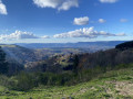
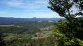
(6) Further on, your route (same markings) leaves the forest track and turns right onto a winding, unspoilt path that climbs more steeply through the fir forest. As you emerge from the forest, still following the trail marked with a Red Rectangle crossed by a White Ring and a Yellow Ring, you can take a short detour by leaving the path briefly to the right towards a wooden table to enjoy an exceptional view of the Schirgoutte valley. Below you can see the Fougères farm; on the left, the Haut Lachamps farm; and in the background, the Vosges mountains. A magnificent spot for a picnic. Continue along the route marked with a red Rectangle crossed out in white and a yellow Ring to reach the edge of the forest once more.
(7) Still following the route marked with a red Rectangle crossed by a white ring and a yellow Ring, at the entrance to the forest, at a spot known as ‘Le Banc du Centenaire’, there’s a magnificent view of Fouday below and Plaine above. On the left, you can see the village of Saulxures. Carry on and walk through a beautiful beech wood, keeping to the right at the junction, then continue until you reach the back of the Les Sapins holiday centre, which you’ll need to go round via the path on the right to join the Route de la Serva (D414).
Turn left and follow the Route de la Serva back to the starting point (S/E).

 Visorando Member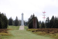

 Tourist office
 Difficult
 Easy
Easy 
