


OT VALLEE DE LA BRUCHE

 Tourist office
PRO  Premium user
Premium user Sign up:
Published route(s)
 The Mutzig Rock and the Porte de Pierre from the Place des Musiciens
 9.67 mi
 +2,106 ft
 -2,133 ft
 6h 15
6h 15
 Difficult
 Departure from Lutzelhouse (Bas-Rhin)
A very pretty hike on the western side of the Bruche Valley. The Mutzig Rock, rising to 1,010 metres, offers remarkable views of the valley and the surrounding mountains, such as the Donon, the Schneeberg and the Champ du Feu. The Porte de Pierre is a natural monument of pink sandstone sculpted by erosion. It is an astonishing discovery, this block perched there as if it came from nowhere, plunging you into a half-dream.
The sculpture trail – In situ around the Kegelplatz
4.24 mi
+604 ft
-577 ft
2h 30
 Easy
Departure from Lutzelhouse (Bas-Rhin)
Easy
Departure from Lutzelhouse (Bas-Rhin)
Two sculpture symposia in 2007, in Lutzelhouse, and in 2010, in the Champenay quarry, gave rise to 17 monumental works under the titles In situ and La Roche Solaire. This trail will allow you to discover three of them.
The Sculpture Trail – Solar Rock from L’Ordon
4.12 mi
+315 ft
-295 ft
2h 10
Easy
Departure from Wisches (Bas-Rhin)
Far from the city yet close by in the depths of the forest, the Giants’ Trails were born from an open-air artistic adventure initiated by Sylvain Chartier and the Les Géants du Nideck Association in Oberhaslach. Two sculpture symposia in 2007 in Lutzelhouse and in 2010 at the Champenay quarry saw the creation of seventeen monumental works under the titles "In situ" and "La Roche Solaire". This trail will allow you to discover three of them.
Waterfall and stream around Nideck
9.08 mi
+1,942 ft
-1,923 ft
5h 50
 Moderate
Departure from Oberhaslach (Bas-Rhin)
Moderate
Departure from Oberhaslach (Bas-Rhin)
This route allows you to discover the iconic Nideck Waterfall and two streams: the Luttenbach and the Weinbaechel. All three flow into the Hasel stream, which gave its name to this valley. During this walk along the water, you will also pass close to the Hirschfels Rock and the ruins of the Nideck and Hohenstein castles.
Around the smallest village in Alsace
4.61 mi
+787 ft
-764 ft
2h 50
Easy
Departure from Blancherupt (Bas-Rhin)
There is a proverb that says that everything small is cute. And it's true. With its 38 inhabitants, Blancherupt is the smallest municipality in Alsace and has a charm all of its own. In the 1990s, an award-winning advertising campaign described the commune as "In Blancherupt, there is nothing... nothing but the essentials", an invitation to discover this little corner of paradise without further delay.
Les Hauts du Ban de la Roche
 6.71 mi
+1,365 ft
-1,358 ft
4h 15
Moderate
Departure from Fouday (Bas-Rhin)
6.71 mi
+1,365 ft
-1,358 ft
4h 15
Moderate
Departure from Fouday (Bas-Rhin)
This superb walk in the heart of the Vosges mountains is, in itself, an open-air history book. From Foudray, the route climbs towards Solbach and the legendary Col de la Perheux, reaching the green landscapes around Belmont before descending towards Waldersbach and then Foudray. Its church, with its 13th-century Romanesque bell tower, is now a temple, beside which lies the tomb of Pastor Oberlin.
The Natzviller panoramic trail
 4.04 mi
+489 ft
-472 ft
2h 15
Easy
Departure from Neuviller-la-Roche (Bas-Rhin)
4.04 mi
+489 ft
-472 ft
2h 15
Easy
Departure from Neuviller-la-Roche (Bas-Rhin)
This balcony trail offers a pleasant walk to discover the trees and plants of the local flora overlooking the village of Natzwiller and offers beautiful views of the picturesque landscape of the Rothaine valley. A variant along the way gives you the option of a round trip to a important memorial site.
Champenay sandstone
10.34 mi
+1,916 ft
-1,909 ft
6h 25
Moderate
Departure from Plaine (Bas-Rhin)
Champenay is known for its quartzite sandstone quarry. This is a red sandstone veined with white, known as ‘grès des Princes’ in reference to the former status of this territory, which was the Principality of Salm. At the highest point of the route, there are old France–Germany boundary markers dating from 1870–1918. Finally, the route passes through the refreshing Falle Valley and past the lake of the same name.
The seigneury of Ban de la Roche
 4.91 mi
+850 ft
-840 ft
3h 00
Easy
Departure from Bellefosse (Bas-Rhin)
4.91 mi
+850 ft
-840 ft
3h 00
Easy
Departure from Bellefosse (Bas-Rhin)
Bellefosse, known as ‘Béfoss’ in the local dialect, was part of the former seigneury of Ban de la Roche. This walk will take you up to the heights of Bellefosse to explore the ruins of La Roche Castle, known as ‘zum Stein’ or ‘Steinschloss’, then across the peaks, where you’ll discover the former seigneurial farmstead of Lachamp. Finally, you’ll have the chance to enjoy a meal at one of the two farmhouse inns: the Ban de la Roche or the Promont.
In the land of the Haxes
 5.57 mi
+1,073 ft
-1,093 ft
3h 30
Moderate
Departure from Belmont (Bas-Rhin) (Bas-Rhin)
5.57 mi
+1,073 ft
-1,093 ft
3h 30
Moderate
Departure from Belmont (Bas-Rhin) (Bas-Rhin)
A lovely hike of moderate difficulty, alternating between pastures and shaded sections, following in the footsteps of the witchcraft legends of the Ban de la Roche. Inthe 17th century, around fifty alleged witches and warlocks were executed at the Col de la Perheux. Between witches and magical treasures, the place still exudes a unique energy and offers magnificent views of the Donon massif, the Climont and the Chirgoutte valley.
The Champ du Feu circuit
 7.50 mi
+1,289 ft
-1,289 ft
4h 35
Moderate
Departure from Belmont (Bas-Rhin) (Bas-Rhin)
7.50 mi
+1,289 ft
-1,289 ft
4h 35
Moderate
Departure from Belmont (Bas-Rhin) (Bas-Rhin)
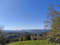
Champ du Feu is the highest point in the Bas-Rhin at 1,099 m. At the summit, the viewing tower was erected in 1898 by the Club Vosgien. It is the symbol of Champ du Feu. There are many theories about the origin of the name Champ du Feu. It may derive from Vehfeld or ‘cattle field’, a corruption of the name Champ des Fées or Champ du Faîte (the summit), or even the charcoal burners’ fires...
The Serva Waterfall from the Champ du Feu
 3.37 mi
+866 ft
-866 ft
2h 20
Moderate
Departure from Belmont (Bas-Rhin) (Bas-Rhin)
3.37 mi
+866 ft
-866 ft
2h 20
Moderate
Departure from Belmont (Bas-Rhin) (Bas-Rhin)
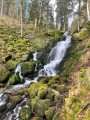
A short hike with steep climbs, taking you to the Serva Waterfall, directly from the Champ du Feu. The trail runs alongside this pretty waterfall, which originates in the high pastures of the Champ du Feu, at an altitude of 1,000 metres. It then joins the Rothaine, a stream crossing the valley of the same name, 350 metres below, through the forest, until it reaches the Bruche.
The Hohwald Waterfall and the Andlau Valley
9.28 mi
+1,834 ft
-1,844 ft
5h 50
Difficult
Departure from Belmont (Bas-Rhin) (Bas-Rhin)
This walk along the western slopes of the Champs du Feu takes you through splendid scenery towards the village of Hohwald. During this route, you’ll discover the source of the Andlau, the Chaume des Veaux, the village of Hohwald and, of course, the waterfall of the same name. Particularly popular for its cool waters in summer, it takes on a magical quality in winter, when, in the bitter cold, it transforms into a majestic ice sculpture.
The Hang clearing at the foot of Climont
6.95 mi
+860 ft
-876 ft
3h 55
Moderate
Departure from Bourg-Bruche (Bas-Rhin)
This walk winds through a haven of peace and tranquillity at the foot of one of the valley's legendary peaks: Climont (966 m). The Bruche river rises at an altitude of 660 m and then crosses a vast basin: the Hang clearing. This is where families of glassmakers settled in 1723. Le Hang continued to prosper thanks to the arrival of Mennonite farmers of Swiss origin. They found here a place conducive to their pastoral and community life.
Le Climont and the source of the Bruche
6.74 mi
+1,250 ft
-1,247 ft
4h 10
Moderate
Departure from Bourg-Bruche (Bas-Rhin)
This walk winds through a haven of peace and tranquillity towards one of the legendary peaks of the Bruche Valley. Surrounded by green, wooded landscapes, Le Climont is the region's water tower. Three rivers originate in its vicinity: the Bruche, Giessen and Fave. This spot is marked by a stele created by sculptor Raymond Keller from a block of sandstone donated by the Champenay quarry.
The Saâles ridges
6.67 mi
+1,063 ft
-1,063 ft
4h 00
Moderate
Departure from Saales (Bas-Rhin)
Set in the centre of a two-kilometre-long plateau, surrounded by mountains, the village of Saâles was built on the Via Salinaria at a convenient crossing point over the Vosges. The village has maintained its role as a market town throughout history. As early as 1743, it was granted the privilege of holding a fair and a market. In 1924, the rebuilt town hall housed the market halls on its ground floor.
The banks of the Bruche from Saint-Blaise-la-Roche
10.83 mi
+1,155 ft
-1,171 ft
6h 00
Difficult
Departure from Saint-Blaise-la-Roche (Bas-Rhin)
Situated at the bottom of the valley, Saint-Blaise-la-Roche experienced significant population growth during the19th century with the establishment of weaving industries. The village is also situated on the first Strasbourg–Saâles–Saint-Dié-des-Vosges railway line, inaugurated in 1929 by Raymond Poincaré. Numerous engineering structures (including the Fouday viaduct further downstream) made it possible to create the first railway route through the Vosges.
From Haut-Ranrupt to Hauts-Bois
3.98 mi
+584 ft
-584 ft
2h 20
Easy
Departure from Ranrupt (Bas-Rhin)
Following the course of the Haut Bois stream, set off to explore the hills above the village of Ranrupt, where you’ll enjoy unobstructed views over the Climontaine valley. On your way, stop off at the Hauts-Bois farm inn to sample some local cuisine.
Farms and farmhouse inns around Ranrupt
7.42 mi
+1,316 ft
-1,286 ft
4h 35
Moderate
Departure from Ranrupt (Bas-Rhin)
Explore the trails above the village of Ranrupt and discover the hamlet of Fonrupt, a haven of tranquillity. Along the way, treat your taste buds to authentic local produce while enjoying splendid views of the Climontaine and Chiregoutte valleys.