Country:

 City:
City:


To reach the starting point, head to the Champ du Feu car park near the junction of the D124 and D414 (plenty of parking available).
(S/E) From the car park, walk to the end of it and cross the D414 with care. Turn right and head towards the D214; take it to the right towards Villé, on the same side of the road as the sign pointing in that direction. Carry on until, a little further on, you spot a picnic table on the left.
(1) Take the path on the left, marked with a Red Rectangle, towards Source de l’Andlau and Waterfall Le Hohwald. At the first junction with a forest track, carry on straight ahead, still following the Red Rectangle markings, until you reach the next fork.
(2) Leave the Red Rectangle markings and take a sharp right-hand bend. Head straight on; after a short climb, follow the path that branches off to the left and continue to a junction marked by a Blue Saltire. Carry on to the left along the main forest track until you reach a three-way junction with a wide path.
(3) Leave the Blue Saltire signpost and take the fairly wide path on the right. Ignore the next three junctions and carry on straight ahead. At the T-junction, turn left and, after a climb, you’ll reach a four-way junction.
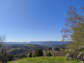
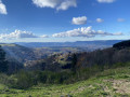
(4) Follow the wide tarmac path to the left until you reach a road with a small chalet. Enjoy a magnificent view of the mountains and the plain.
(5) Take the grassy path leading down to the left, enter the Hohwald State Forest Biological Reserve and head for the edge of the woodland opposite.
(6) Enter the woodland and, once you’ve come out the other side, follow the edge of the woodland for a good fifty metres until you come to a path on the right. Take this path, then turn left a few metres further on.
Ignore the side paths branching off to the left and right and head for a signposted forest track.
(7) Continue to the right and head for the Col de la Charbonnière.
(8) Cross the D214 with care and take the path running alongside the inn on your right. At the sign for Route Forestière Jeu de Quille, veer to the right, then follow the road for a few metres on your right before taking the path to the left, marked with a Blue Rectangle and a Yellow Cross, until you reach the next junction.
(9) Turn right, go through a gate and continue towards Champ du Feu.
(10) At the fork where the Yellow Cross and Blue Rectangle markings split, turn left, following the Blue Rectangle. At the three-way junction, veer left, cross a clearing and arrive at a crossroads marked with a Yellow Saltire.
(11) Continue along the path on the right, quickly cross a track and then follow it. Ignore the paths branching off on either side and carry on to the edge of the forest opposite the Chalet du Champ de Feu (ski resort).
(12) Do not cross the road but take the path branching off to the right and follow the edge of the woodland. You’ll come to a isolated house at the bottom of the ski slopes.
(13) Turn onto the grassy path, veering slightly to the left, and climb to the top of the hill. During the climb, note the car park on your left, on the other side of the ski slopes.
(14) At the top, enjoy the view, then head left and you’ll soon reach the clearly visible car park (S/E).

 Visorando Member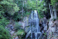

 Tourist office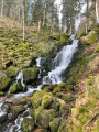
 Difficult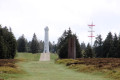
 Easy
Easy