La Butte du Puy Saint-Gulmier

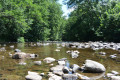
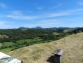
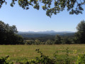
Right from the start of the route on a basalt plateau, you’ll enjoy a superb view of the Sancy and the Chaîne des Puys. The path skirts the volcano and winds through wooded countryside and along the Via Agrippa. The landscapes are peaceful, alternating between meadows, woods and ponds.

Details

n°25732236
Creation:
Last update:
Last review:
  • Walking
    Activity: Walking
  • ↔
    Distance: 6.79 mi
  • ◔
    Average duration: 3h 50 
  • ▲
    Difficulty: Moderate

  • ⚐
    Back to start: Yes
  • ↗
    Ascent: + 804 ft
  • ↘
    Descent: - 814 ft

  • ▲
    Highest point: 2,730 ft
  • ▼
    Lowest point: 2,218 ft

Photos

Description of the walk

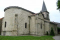
On the D941, 1 km south of Pontaumur, take the D987 towards Combrailles, as far as Puy-Saint-Gulmier. Turn right onto the D573 to drive up the hill. Park on the esplanade opposite the church.

(S/E) From the starting point sign on the esplanade (orientation board, view of the Sancy massif), walk round the church along the small road leading uphill (view of the Chaîne des Puys).

(1) Take the first path on the right and, ignoring three paths on the left, head down to the road (hairpin bend).

(2) Turn left onto it and head down to the crossroads in the hamlet of La Croix.

(3) Follow the D987 to the right for 100 metres and turn left, towards Courtille.

(4) At the hamlet of Les Sagnes, take the path on the left, then the first on the right towards Courtille.

(5) At the T-junction, take the small road on the right. At the last house, turn left uphill and continue along this small road. Ignore the road on the left towards Neuviale and carry on straight ahead.

(6) After 750 m, leave the road and carry on straight ahead along the path that goes round the hamlet of La Grolle.

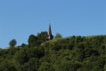
(7) Return to the road at the T-junction. Turn right onto it, pass the first road on the left, and 100 m further on, turn left. At the next Fork in the road, turn left onto the path that descends into a small valley (view of Saint-Gulmier and its hill). Continue to the junction after the stadium.

(8) Take the road on the left, then, 200 m further on, turn right onto the track and then keep to the right again. Walk along the edge of a wood.

(9) At the T-junction, turn right onto a road.

(10) Follow it to the right for 100 m, turn left, cross the Ganne and arrive at a junction.

(11) At the junction, head up the road to the right to join the D573 and then return to the starting point (S/E).

Waypoints

  1. S/E : mi 0 - alt. 2,664 ft - Esplanade opposite the - Église Saint-Galmier (Puy-Saint-Gulmier)
  2. 1 : mi 0.39 - alt. 2,661 ft - Fork in the path
  3. 2 : mi 0.88 - alt. 2,474 ft - D573 road
  4. 3 : mi 1.29 - alt. 2,343 ft - D987 road
  5. 4 : mi 1.63 - alt. 2,359 ft - Peatlands
  6. 5 : mi 2 - alt. 2,510 ft - Courtille
  7. 6 : mi 2.89 - alt. 2,700 ft - La Grolle
  8. 7 : mi 3.16 - alt. 2,703 ft - La Grolle Crossroads
  9. 8 : mi 4.21 - alt. 2,372 ft - Stade – D987 road
  10. 9 : mi 5.15 - alt. 2,287 ft - T-junction
  11. 10 : mi 5.56 - alt. 2,218 ft - Road
  12. 11 : mi 5.95 - alt. 2,267 ft - Crossroads
  13. S/E : mi 6.79 - alt. 2,667 ft - Esplanade opposite the - Église Saint-Galmier (Puy-Saint-Gulmier)

Notes

For your safety, always take a bottle of water, a hat, warm and rainproof clothing with you, and wear suitable walking shoes.
Depending on weather conditions, some routes are not recommended in bad weather (fog) or are impassable, or even off-limits, during the winter season.
Some sites are fragile; please stay on the designated paths. Avoid picking wild flowers and disturbing wildlife. Please pick up your rubbish.
On some routes, pets are not allowed.

Reviews and comments

4.7 / 5
Based on 1 review

Reliability of the description
5 / 5
Ease of following the route
5 / 5
Route interest
4 / 5
Masson Michèle
Masson Michèle

Overall rating : 4.7 / 5

Date of your route : Aug 31, 2026
Reliability of the description : ★★★★★ Very good
Ease of following the route : ★★★★★ Very good
Route interest : ★★★★☆ Good
Very busy route : No

A fairly easy walk with a slightly steep climb towards the end, though this is along a minor road. There’s a lovely viewpoint at the start on the hill, with an orientation board and picnic tables. The only slight downside is that there are quite a few roads along the route, but they’re very quiet.

Machine-translated

Other walks in the area

For more walks, use our search engine .

The GPS track and description are the property of this route's author. Please do not copy them without permission.