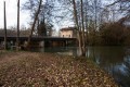
The Haut d’Aza circular starting from Chevillon

A very enjoyable walk with lovely views of the area around Chevillon.

Details

n°2642918
Creation:
Last update:
Last review:
  • Walking
    Activity: Walking
  • ↔
    Distance: 6.35 mi
  • ◔
    Average duration: 3h 20 
  • ▲
    Difficulty: Easy

  • ⚐
    Back to start: Yes
  • ↗
    Ascent: + 476 ft
  • ↘
    Descent: - 479 ft

  • ▲
    Highest point: 1,047 ft
  • ▼
    Lowest point: 597 ft
  • ⚐ Country: France
  • ⚐ City: Chevillon (52170)
  • ⚑
    Start/End: N 48.527861° / E 5.134449°
  • ❏
    IGN map(s): Ref. 3116SB
  • Hour-by-hour weather

Description of the walk

Park at Place de l’Ariet in Chevillon.

(S/E) Follow Rue du Moulin westwards to the small bridge. Just after the bridge, take the road on the right towards the cemetery, Rue des Juifs. Then turn right onto Rue du Val Saint-Germain until you reach the RD9. Follow this road to the left. You will arrive at the Fourneau foundry.

(1) Turn right onto the road that climbs up to the telecommunications mast.

(2) Immediately after the mast, take the forest track branching off to the right towards the north-east. Walk through the Bois de Rebouchon, then follow the edge separating the forest from the fields of Basse Crémont. Re-enter the forest at the Bois de la Bouloire. You’ll reach a T-junction.

(3) Turn right towards the south to join the Chemin du Val Saint-Hilaire. Follow it to a three-way junction. Take the left-hand branch to reach the Haut d’Aza.

(4) Continue along the track due east, crossing a copse to reach another T-junction.

(5) Turn 90° to the right onto a road suitable for motor vehicles – this is the Route du Val de Trempolle. Follow it to the left; you’ll very quickly come to another road at the next junction.

(6) Turn right onto it and follow it downhill; this is the Montcoulinval road, which joins the RD9.

(7) Turn right onto it towards Chevillon; at the entrance to Chevillon, you’ll come to a crossroads with several directions.

(8) Cross the bridge and immediately turn right onto the path running alongside the Chevillon stream. Stay on this path, following the stream, and cross it again to reach the car park at Place de l’Ariet (S/E).

Waypoints

  1. S/E : mi 0 - alt. 623 ft - Place de l’Ariet
  2. 1 : mi 0.61 - alt. 597 ft - Foundry
  3. 2 : mi 0.99 - alt. 866 ft - Telecom pylon
  4. 3 : mi 2.11 - alt. 932 ft - T-junction
  5. 4 : mi 3.09 - alt. 1,017 ft - Le Haut d’Aza
  6. 5 : mi 3.57 - alt. 1,040 ft - 90° junction
  7. 6 : mi 4.07 - alt. 1,010 ft - Val de Trempolle Route
  8. 7 : mi 5.05 - alt. 705 ft - RD9
  9. 8 : mi 5.84 - alt. 656 ft - Crossroads at the entrance to Chevillon
  10. S/E : mi 6.35 - alt. 620 ft - Place de l’Ariet

Notes

Take care on the section along the D9; walk in single file if you are in a group.

Worth a visit

Wildlife, flora, Chevillon Church. A very scenic route along the stream

Reviews and comments

4.7 / 5
Based on 1 review

Reliability of the description
5 / 5
Ease of following the route
5 / 5
Route interest
4 / 5
POTAUFEUX Thierry
POTAUFEUX Thierry

Overall rating : 4.7 / 5

Date of your route : Feb 17, 2020
Reliability of the description : ★★★★★ Very good
Ease of following the route : ★★★★★ Very good
Route interest : ★★★★☆ Good

A lovely walk with varied scenery. Beautiful views! I had a really lovely time.

Machine-translated

Other walks in the area

For more walks, use our search engine .

The GPS track and description are the property of this route's author. Please do not copy them without permission.