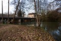
The Sommeville circular route via the Butte du Châtelet and the towpath

An easy route in the Marne valley, ideal for warming up. The Butte du Châtelet is the site of an ancient Gallo-Roman town, and the towpath runs alongside the “canal between Champagne and Burgundy”.

Details

n°867114
Creation:
Last update:
Last review:
  • Walking
    Activity: Walking
  • ↔
    Distance: 3.61 mi
  • ◔
    Average duration: 1h 40 
  • ▲
    Difficulty: Easy

  • ⚐
    Back to start: Yes
  • ↗
    Ascent: + 30 ft
  • ↘
    Descent: - 30 ft

  • ▲
    Highest point: 587 ft
  • ▼
    Lowest point: 541 ft
  • ⚐ Country: France
  • ⚐ City: Chevillon (52170)
  • ⚑
    Start/End: N 48.539415° / E 5.104261°
  • Accessible from the train station Gare de Bayard.
  • ❏
    IGN map(s): Ref. 3116SB
  • Hour-by-hour weather

Photos

Description of the walk

Car park in front of Sommeville church
(S/E) Head towards Fontaines-sur-Marne via the Grande Rue (D8).

(1) Cross the square to the left, passing the wash house, then the Saint-Louvent spring and its cross. Continue along the path through the woodland.

(2) Turn right at the Fork in the road and head uphill. Carry on, passing behind the Pont-à-Mousson foundry, then past the fire station.

(3) Turn left towards the railway line and the canal via the D184.

(4) After crossing the drawbridge, join the towpath and walk past the Gourzon drawbridge, which is no longer in use. Continue to the Fontaines-sur-Marne lock.

(5) Cross the lock via the small bridge, passing the former lock-keeper’s cottage. Head down to the left to pass under the railway line via a footbridge.
Head towards Fontaines-sur-Marne via the “Chemin de l’Écluse” (footpath) and emerge onto Rue de l’Église.
Turn right to return to Sommeville (S/E).

Waypoints

  1. S/E : mi 0 - alt. 558 ft - Sommeville Church
  2. 1 : mi 0.36 - alt. 558 ft - Place
  3. 2 : mi 0.9 - alt. 545 ft - Fork in the road to the right
  4. 3 : mi 1.68 - alt. 545 ft - Fire station - Marne (la)
  5. 4 : mi 1.86 - alt. 545 ft - Drawbridge - Canal entre Champagne et Bourgogne
  6. 5 : mi 3.03 - alt. 551 ft - Small bridge, footbridge - Marne (la)
  7. S/E : mi 3.61 - alt. 558 ft - Sommeville Church

Worth a visit

(4) View of the Châtelet hill.

(5) Panoramic view of the dam and the Marne diversion channel known as “La Nabline”, which runs to Bayard-sur-Marne and was once used to power turbines for the foundry.

(Note: Sommeville is a commune associated with Chevillon).

Reviews and comments

4.7 / 5
Based on 1 review

Reliability of the description
5 / 5
Ease of following the route
5 / 5
Route interest
4 / 5
lamotodufredo
lamotodufredo

Overall rating : 4.7 / 5

Date of your route : Aug 27, 2020
Reliability of the description : ★★★★★ Very good
Ease of following the route : ★★★★★ Very good
Route interest : ★★★★☆ Good
Very busy route : No

The section of the route through Sommeville and Fontaine is a bit uninteresting. There’s a lovely wash house and a beautiful fountain in Fontaine. There’s an unusual view of the Bayard foundries. The drawbridge over the canal in Bayard is lovely. I loved the canal bridge and the lock in Fontaine. The sections through the forest and along the canal are relaxing.

Machine-translated

Other walks in the area

For more walks, use our search engine .

The GPS track and description are the property of this route's author. Please do not copy them without permission.