Around the Forest of Saint-Jean via Tarquimpol and Les Essarts

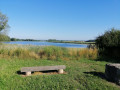
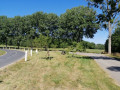
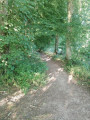
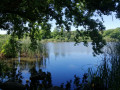
Much of the route runs through woodland along very pleasant paths. The Tarquimpol peninsula offers the chance to really immerse yourself in the Lindre Pond. Of particular note is the beauty of the Étang des Essarts, which has been very well developed by the municipality of Dieuze. Here you’ll find a fitness trail and very well-organised picnic areas. During the route, the section along the route of the old railway line is particularly picturesque.

Details

24006867
Creation:
Last update:
Last review:
  • Walking
    Activity: Walking
  • ↔
    Distance: 8.68 mi
  • ◔
    Average duration: 4h 05 
  • ▲
    Difficulty: Moderate

  • ⚐
    Back to start: Yes
  • ↗
    Ascent: + 148 ft
  • ↘
    Descent: - 141 ft

  • ▲
    Highest point: 748 ft
  • ▼
    Lowest point: 679 ft
  • ⚐ Country: France
  • ⚐ City: Dieuze (57260)
  • ⚑
    Start/End: N 48.803023° / E 6.717179°
  • ❏
    IGN map(s): Ref. 3514E, 3515E
  • Hour-by-hour weather

Photos

Description of the walk

Large car park in Dieuze, Chemin du Fort, at the Étang des Essarts

(S/E) With your back to the car park, follow Chemin du Fort for 900 m. Walk alongside the forest, then enter it and continue until you reach a Fork in the road.

(1) Take the path on your left into the Bois du Loup to reach the D999; cross this with care and take the path (called Chemin de la Promenade) directly in front of you. After 1 km, you’ll reach a junction with a wide path.

(2) Take the path directly in front of you (signpostedGR®5) and follow it for 1.7 km.

(3) Ignore a forest track on the right (return route) and continue along theGR® until you reach the D199 departmental road (large picnic area).

(4) Follow the D199, heading left towards the Tarquimpol peninsula (be careful, as the road is quite busy). At the junction, turn left onto the D199F to reach Tarquimpol.

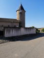
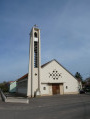
(5) At the church, carry straight on. As you leave the village, the road becomes a track which you follow to go round the peninsula. There are superb views of the Étang de Lindre all along the route. You’ll end up on Rue de l’Étang, which takes you back to the church.

(5) Then head back to the picnic area by following the route you took on the way there in reverse.

(4) Then rejoin theGR®5, which you have already followed, for 650 metres.

(3) Turn left onto a wide path and follow it for 1.4 km until you reach the old railway line (signposted ‘Dieuze 5 km’). (Take care when crossing the D999).

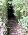
(6) Turn right onto the old railway line and continue straight on for 2.2 km, crossing the Route Forestière du Chemin Noir. You’ll reach the edge of the forest and come out onto a path on your left which leads to the Étang des Essarts.

(7) Follow the path to reach the pond’s embankment (a heavily developed area).

(8) At the end of the dyke, turn right along the ‘Promenade des Essarts’ past the barracks and head back to the car park (S/E).


Waypoints

  1. S/E : mi 0 - alt. 689 ft - Étang des Essarts car park - Seille (Affluent de la Moselle)
  2. 1 : mi 0.5 - alt. 679 ft - Chemin du Fort
  3. 2 : mi 1.41 - alt. 715 ft - Junction with the GR5, near the - Seille (Affluent de la Moselle)
  4. 3 : mi 2.13 - alt. 738 ft - Common start and finish point
  5. 4 : mi 2.56 - alt. 699 ft - Picnic area
  6. 5 : mi 3.4 - alt. 719 ft - Tarquimpol Church - Étang de Lindre
  7. 6 : mi 6.55 - alt. 732 ft - Former railway line
  8. 7 : mi 8.13 - alt. 696 ft - Étang des Essarts
  9. 8 : mi 8.42 - alt. 699 ft - To the right, along the barracks
  10. S/E : mi 8.69 - alt. 692 ft - Étang des Essarts car park

Worth a visit

Tarquimpol
The village forms a peninsula on the Lindre Lake and offers a prime vantage point from which to admire the local flora and fauna. In Gallo-Roman times, Tarquimpol was situated on the Roman road from Metz to Strasbourg. It boasted a temple and a theatre capable of seating around 16,000 people, making it one of the largest in the whole of Eastern Gaul.

Alteville Castle
The château consists of two buildings facing each other (one dating from the 16th century and the other from the 18th). The first is a typical fortified house with a turret, loopholes and mullioned windows. The second, built in 1698 by Charles Palléot, a cavalry officer, is a two-storey square pavilion flanked by two wings. The Alteville estate was severely damaged during the Second World War by German troops, who destroyed the chapel and stripped away the wood panelling and fireplaces. It has since been restored, and part of it has been converted into guest rooms. There is also a shop on the estate selling produce from the estate.

The Maison du Pays des Étangs
Situated within the Lorraine Regional Nature Park, in the heart of the Lindre lake, the Association for the Management of the Maison du Pays des Étangs has, since its creation in 1996, been committed to local development through initiatives promoting the environment and natural and historical heritage.

Lindre Lake
The creation of Lindre Pond probably dates back to the 11th or 12th century for fish farming, to supply the local population with fish and waterfowl. Its name is thought to derive from ‘linter’, a type of flat-bottomed boat. The current reservoir is believed to have been created by the Dukes of Lorraine in the 15th century. The pond also took on strategic importance for the defence of the Marsal stronghold built by Vauban, as breaching its dyke would allow its waters to flood the Seille valley, thereby protecting Marsal – a major centre of the salt industry – as well as Dieuze and, potentially, Metz. The pond is part of the ‘Pays des Étangs’, a region of gently sloping hills comprising a total of 134 ponds. Covering 1,000 hectares, it is one of the largest lakes in the department. Shaped over the centuries by human activity – which created lakes, forests, hedgerows, fields and meadows – the Lindre Lake retains its natural character to this day. It has been spared the urbanisation of recent decades that has encroached upon the surroundings of the other major lakes in the Moselle region.

Always be cautious and plan ahead when you're outdoors. Visorando and the author of this route cannot be held responsible for any accidents occurring on this route.

The GR® and PR® markings are the intellectual property of the Fédération Française de Randonnée Pédestre.

Reviews and comments

4.5 / 5
Based on 2 reviews

Reliability of the description
Not used
Ease of following the route
Non utilisé
Route interest
4.5 / 5
franchie
franchie

Overall rating : 4 / 5

Date of your route : Sep 03, 2024
Reliability of the description : Not used / Not applicable
Ease of following the route : Not used / Not applicable
Route interest : ★★★★☆ Good
Very busy route : No

A lovely walk through the woods at the start and end, and a bit of a drive to the Tarquimpol peninsula, but there really is no other way round it. It’s a shame the Maison des Etangs is only open from Thursday to Sunday – the Bistrot des Oiseaux looked very cosy!
The Étang des Essarts offers a real sense of serenity and tranquillity.

Machine-translated

valeriede M
valeriede M
• Edited:

Overall rating : 5 / 5

Date of your route : May 08, 2023
Reliability of the description : Not used / Not applicable
Ease of following the route : Not used / Not applicable
Route interest : ★★★★★ Very good
Very busy route : No

Hello, and thank you for this walk
I didn’t use the description or map as I followed the route on my hiking GPS. No problems at all.
A lovely walk and the only one over 10 km around Lindre Pond.
A lovely route through a beautiful, well-maintained forest; the return leg was a bit monotonous on the straight stretches, but it made for a pleasant change of pace at this time of year, thanks to the old railway line.
The detour via Tarquimpol is well worth it, despite the short stretch of road, but there’s no other way round it.
Arrival at the Étang des Essarts was very pleasant for a final break.
Any tourist information on the route description would be welcome
I recommend it.

Machine-translated

Other walks in the area

For more walks, use our search engine .

The GPS track and description are the property of this route's author. Please do not copy them without permission.