


Refine your search for walks in Houffalize
Houffalize walks


 The Eastern Ourthe between Taverneux and Cetturu
 Visorando Member
 10.10 mi
 +1,079 ft
 -1,066 ft
 5h 35
5h 35
 Moderate
 Departure from Houffalize (Province de Luxembourg)
Starting from the viewpoint overlooking the village of Tarverneux, the route heads east at first, then north-east as far as the Sommerain stream.After crossing it, the route heads out into the countryside on the heights of Brisy. A long descent towards the Ourthe follows… here it is the river’s eastern branch; the western branch flows successively through the communes of Libramont-Chevigny, Sainte-Ode, Tenneville and Bertogne before joining the main river at the Nisramont dam. The long climb that follows reaches the outskirts of Cetturu before descending again towards the Tavigny Stream. The next highest point of the walk is at a place known as ‘Les Deux Hêtres’. From there, the route descends towards the Ourthe, passing the Blancs Bois picnic shelter and barbecue area. Near the confluence of the Eastern Ourthe and the Cowan Stream, a little further upstream along the latter, stands the Moulin de l’Ermitage, which gave its name to the locality known as l’Hermitage. All that remains is to head back up to the starting point.
Achouffe and the Martin Moulin Stream
 5.44 mi
+604 ft
-597 ft
3h 00
Moderate
Departure from Houffalize (Province de Luxembourg)
5.44 mi
+604 ft
-597 ft
3h 00
Moderate
Departure from Houffalize (Province de Luxembourg)
Starting from Achouffe, discover the valley of the Ruisseau de Martin Moulin. The route follows forest paths and trails, ending with your feet in the water, and sometimes mud, on the path along the stream at the Moulin de Wihogne.
Walk around Houffalize
 11.24 mi
+1,079 ft
-1,070 ft
6h 05
Moderate
Departure from Houffalize (Province de Luxembourg)
11.24 mi
+1,079 ft
-1,070 ft
6h 05
Moderate
Departure from Houffalize (Province de Luxembourg)
The countryside around Houffalize town centre is open and hilly, offering beautiful views of this lush green region.The eastern Ourthe and its tributaries are (still) fairly wild streams with sometimes rushing waters. The forests are mainly fir forests... there are not many deciduous forests in this area.
Circular Ardennes route between Brisy, Taverneux, Alhoumont and Cetturu
 10.85 mi
+1,227 ft
-1,257 ft
6h 05
Moderate
Departure from Gouvy (Province de Luxembourg)
10.85 mi
+1,227 ft
-1,257 ft
6h 05
Moderate
Departure from Gouvy (Province de Luxembourg)
Typical of the Ardennes, alternating between countryside (fields and pastures) and woodland (deciduous and coniferous), this circular walk through the valley and across the hills of the eastern Ourthe, to the east of Houffalize, is a wonderful experience to be enjoyed in all seasons.
Between the two Ourthes from Mabompré
 14.51 mi
+1,837 ft
-1,847 ft
8h 15
14.51 mi
+1,837 ft
-1,847 ft
8h 15
 Difficult
Departure from Houffalize (Province de Luxembourg)
Difficult
Departure from Houffalize (Province de Luxembourg)
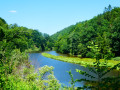
The two Ourthes – the Eastern Ourthe and the Western Ourthe – join at Engreux to form the Ourthe. Slightly downstream from their confluence, man has built the Nisramont dam to create Lake Nisramont.
Between two Ourthes
 8.59 mi
+1,191 ft
-1,191 ft
5h 00
Moderate
Departure from Houffalize (Province de Luxembourg)
8.59 mi
+1,191 ft
-1,191 ft
5h 00
Moderate
Departure from Houffalize (Province de Luxembourg)
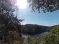
A waterside route passing several viewpoints, notably the confluence of the two Ourthes. The Nisramont Dam and two footbridges are essential for crossing from one bank to the other.Please note: this is a challenging walk (see practical information)
In the heart of one of our Ardennes forests around Montleban
6.40 mi
+564 ft
-564 ft
3h 25
Moderate
Departure from Gouvy (Province de Luxembourg)
As a resident of the pretty little village of Montleban, I’d like to suggest a route to my fellow walkers and/or joggers that consists of 90% wooded paths and 10% quiet, unpaved roads.
Throughout the walk, you may be lucky enough to encounter a family of wild boars or deer.
Rachamps
5.84 mi
+404 ft
-433 ft
3h 00
 Easy
Departure from Bastogne (Province de Luxembourg)
Easy
Departure from Bastogne (Province de Luxembourg)
Between the three villages of Rachamps, Hardigny and Neufmoulin, nestled between woods and countryside
 Circular route to Luxembourg from Hardigny
 Association / Club / Walk leader35.79 mi
+1,959 ft
-1,962 ft
5 hrs
Moderate
Departure from Bastogne (Province de Luxembourg)
Association / Club / Walk leader35.79 mi
+1,959 ft
-1,962 ft
5 hrs
Moderate
Departure from Bastogne (Province de Luxembourg)
This ride takes you into Luxembourg. It starts in Hardigny, passing through Haut-Bellain in Luxembourg, as well as Huldange, Wilwerdange, Drinklange, Binsfeld, Troisvierges and Hachiville, before returning to Belgium to rejoin the RAVEL...
Cherain - Rettigny et la vallée de l' Ourthe
8.46 mi
+846 ft
-827 ft
4h 40
Moderate
Departure from Gouvy (Province de Luxembourg)
This is a reposing walk between the fields and along small rivers. Recommend for people who love the country and nature.
The two Ourthes rivers and the Nisramont Dam
4.71 mi
+850 ft
-846 ft
2h 55
Moderate
Departure from La Roche-en-Ardenne (Province de Luxembourg)
Superb walk, relatively difficult in its first part
Around the Bernistap Canal
 11.96 mi
+860 ft
-886 ft
6h 15
Moderate
Departure from Houffalize (Province de Luxembourg)
11.96 mi
+860 ft
-886 ft
6h 15
Moderate
Departure from Houffalize (Province de Luxembourg)
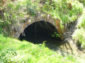
The Bernistap Canal is a section of the canal that the Dutch had planned to build to link the Rhine to the Meuse via the Moselle and the Ourthe. Begun in 1827 during the reign of WilliamI, King of the Netherlands, work was suspended in 1830 during the Belgian revolution and finally abandoned when the Grand Duchy of Luxembourg gained independence. This canal has an underground section, the entrance to which on the Belgian side is still visible at km 1, if you are feeling adventurous. A few information panels are located along the canal between km 1 and km 2, as well as on the Luxembourg side (except for the section leading to the village of Hoffelt).
From Cheslé to Hérou
 6.28 mi
+981 ft
-981 ft
3h 45
Difficult
Departure from Houffalize (Province de Luxembourg)
6.28 mi
+981 ft
-981 ft
3h 45
Difficult
Departure from Houffalize (Province de Luxembourg)
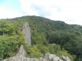
A challenging walk in the Upper Ourthe region, along the wildest and most picturesque section of the valley. Discover an ancient Celtic fortress and the Hérou panorama, rated 2 stars by Michelin.
Nature getaway in Sterpigny
 14.68 mi
+1,214 ft
-1,227 ft
7h 50
Difficult
Departure from Gouvy (Province de Luxembourg)
14.68 mi
+1,214 ft
-1,227 ft
7h 50
Difficult
Departure from Gouvy (Province de Luxembourg)
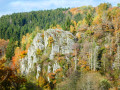
Crossed by the Ourthe Orientale, Gouvy boasts magnificent landscapes to discover as you follow the river, with countryside and forests alternating between deciduous and coniferous trees. In autumn, it is of course the deciduous trees that leave the greatest impression!
In the Two Ourthes Nature Park, starting from Compogne
 10.28 mi
+1,168 ft
-1,145 ft
5h 45
Moderate
Departure from Bertogne (Province de Luxembourg)
10.28 mi
+1,168 ft
-1,145 ft
5h 45
Moderate
Departure from Bertogne (Province de Luxembourg)
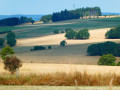
Alternating between countryside and woodland sections, this circular route starting from Compogne allows you to discover a small part of the magnificent landscapes of the Two Ourthes Nature Park. There’s no Ourthe here, just the Cornaille stream and two of its tributaries. To see both Ourthes at a glance, the easiest way is to head to Engreux and walk down to the Adeps Centre at their confluence.
Sterpigny – Rodt Sankt-Vith
 14.25 mi
+840 ft
-587 ft
7h 15
Difficult
Departure from Gouvy (Province de Luxembourg)
14.25 mi
+840 ft
-587 ft
7h 15
Difficult
Departure from Gouvy (Province de Luxembourg)
Here we are in the Eastern Cantons. This region isn’t part of Wallonia, but I’ve included it in my ‘Parkin’son tour of Wallonia’ all the same. Through a succession of climbs, some of which are quite steep, as are the descents, we gradually make our way towards the highest altitudes in Belgium. Mainly via paths, tracks and back roads, we link up the various villages and small towns situated between Sterpigny and Rodt, namely Gouvy, Aldringen, Maldingen and Crombach.
Mer and Belle Meuse starting from Bérismenil
 9.75 mi
+1,175 ft
-1,145 ft
5h 30
Moderate
Departure from La Roche-en-Ardenne (Province de Luxembourg)
9.75 mi
+1,175 ft
-1,145 ft
5h 30
Moderate
Departure from La Roche-en-Ardenne (Province de Luxembourg)
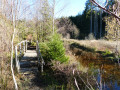
Mer or Mère … signposts and place-name signs use both spellings. This stream rises in the hills south of Samrée and flows gently from cascade to cascade as far as Maboge, where it joins the Ourthe.Further on, the other main stream on this walk is indeed called the Belle Meuse and has recently been colonised by beavers, judging by photos taken in 2017 – when there was virtually no sign of them and fording the stream posed no major problem – and in 2022, when crossing the path at km 14 is impossible without the small wooden bridges added at the side or without putting on waders. It, too, rises in the hills, at La Fange aux Mochettes to the north-east of Samrée, and flows southwards to join the Martin Moulin stream between Achouffe and Engreux.
An Ardennes getaway in the heart of the forest at Borzée
 10.66 mi
+1,358 ft
-1,385 ft
6h 05
Moderate
Departure from La Roche-en-Ardenne (Province de Luxembourg)
10.66 mi
+1,358 ft
-1,385 ft
6h 05
Moderate
Departure from La Roche-en-Ardenne (Province de Luxembourg)
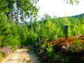
The forest completely surrounds Borzée. Borzée is a hamlet of La Roche-en-Ardenne. La Roche-en-Ardenne lies at the heart of the Ardennes. This circular tour takes you on a tour of the hamlet of Borzée and a section of the valleys of the Mer and Belle Meuse streams, two tributaries of the Ourthe.
Circular loop at the source of the Aisne
 10.00 mi
+715 ft
-715 ft
5h 15
Moderate
Departure from Manhay (Province de Luxembourg)
10.00 mi
+715 ft
-715 ft
5h 15
Moderate
Departure from Manhay (Province de Luxembourg)
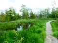
The Tailles plateau rises to an altitude of around 650 metres, where fagnes, fanges, pools and peat bogs are home to the sources of many of the Ourthe’s tributaries. Two of the best-known streams are the Henri Moulin, which flows southwards and joins the Eastern Ourthe just before the Nisramont dam, and the Aisne, which flows northwards and joins the Ourthe at Bomal.This walk explores the northern part of the Plateau des Tailles and the wetlands where the Aisne has its source. The boardwalks installed in recent years at the bottom of the Fagne de Pouhon will save you from the wet feet that were a certainty in previous years! While you’re unlikely to spot any beavers, a bit of careful observation is all it takes to discover their handiwork.
Around the Aisne tourist tramway between Dochamps and Lamorménil
 11.05 mi
+1,119 ft
-1,129 ft
6h 05
Moderate
Departure from Manhay (Province de Luxembourg)
11.05 mi
+1,119 ft
-1,129 ft
6h 05
Moderate
Departure from Manhay (Province de Luxembourg)
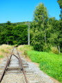
Since 1965, the Tramway Touristique de l'Aisne (TTA) has been operating an old Ardennes local railway line between Pont d'Érezée and Lamorménil. This long walk allows you to discover the last two (old) stations or stops.
More walks in Houffalize
Select a point of interest below: