Country:
 City:


Start: The walk starts at the car park in front of the Felsland Badeparadies on Eybergstraße; alternatively, you can use one of the other car parks in the immediate vicinity.
Signposting (throughout): Kaisertour (crown on a yellow background)
(S/E) From here, we continue along Eybergstraße out of the village and turn right at the fork.
(1) The Kaisertour markings are already visible here, and we’ll follow them for the entire route. After just over 50 metres, we turn left onto the sandy footpath, which leads us up the hill and then turns right at the top towards the Büttelfels massif.
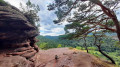
(2) After just a few metres, the rock massif rises skywards on the left-hand side, right next to the edge of the path. In some places, it is up to 44 metres high. Roughly in the middle, there is a hole in the rock containing a viewing platform. This can be reached via a steel ladder.
We walk a little further along the slope in front of the Büttelfelsen, then the path leads us through a crevice in the rocks to the left and immediately back to the right, behind the rocks, through the mixed woodland. At the fork behind a wide left-hand bend, we keep to the left.
(3) At the junction 50 metres further on, we turn right. Smaller red sandstone outcrops appear repeatedly along the edge of the path. A good 400 metres later, we keep left at both forks and then turn left again at the T-junction. The forest path leads to another junction, where we take the right-hand path.
(4) This takes us round the flank of the Kleiner Eyberg. After about 300 m, we take the right-hand path at the fork and, at the next opportunity (about 50 m), turn left onto the path. This leads us down the slope.
(5) After a short zigzagging stretch, we come to a small grotto, where it’s worth taking a short break. Continuing down the mountain in a zigzag pattern, the root-entwined footpath meets a wider forest track, where we turn left. From here, we continue along the ‘Napoleonsteig’ trail. At the next junction, we turn right, then left after about 120 metres.
At the fork 50 metres further on, we take the left-hand branch; at the next junction, we carry on straight ahead. The forest path traces a wide S-bend, then leads straight ahead, climbing gently up the slope, and joins a forest track, along which we walk straight ahead (slightly to the left) before turning right at the following junction.
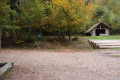
(6) At the next star-shaped junction, which has a picnic area, take care not to miss the sign on the left-hand side, which guides us up the short stretch to the Napoleon Rock. After walking round it, we return along the same path and turn left.
(7) After a few metres, you’ll see a long bench carved from a thick tree trunk on the right-hand side. We walk past the small clearing with a view of the Napoleon Rock on the left-hand side and back into the woods.
At the junction, we turn right, then about 600 metres further on, we turn left onto the narrow footpath. If we keep to the right at the fork, we’ll soon reach a tarmac road.
(8) There, we walk a short distance to the left, cross the road and head into the woods on the opposite side.
Beyond the stream, we turn left at the rock face and follow the course of the stream across the meadow floor to a junction, where we continue to the right. At a slightly spread-out crossroads, we carry on straight ahead (initially slightly to the left, then slightly to the right). The wide forest track leads us through the woods to a fork, where we continue to the left.
From here, the woodland thins out and we come to a wide meadow. At the edge of the woodland, we take the right-hand branch, and shortly afterwards the right-hand path of the two again. The path leads us in an S-bend across the meadows and fields.
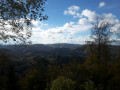
(9) Here at the so-called Steinhohl, there is a wonderful view: on the opposite side of the valley, the remains of the Altdahn castle ruins can be seen, whilst a little further to the left, the rocks of the Hochstein massif rise above the trees.
At the end of the path, we turn right and follow the route of the Kaisertour, first straight ahead, then round a wide left-hand bend. We continue along a wide path at the edge of the forest, which leads us to the railway tracks. After a short stretch alongside the tracks, we take the left-hand path at the fork, which leads us away from the tracks and back into the forest. From here, we continue walking slightly above the banks of the Wieslauter.
(10) About 200 m past the sewage treatment works on the opposite side (there is a sort of jetty or weir by the stream at the sewage treatment works), we turn left.
At the next fork, we keep to the left; at the following two forks, we continue straight ahead; and at the junction, we turn right.
(S/E) If we continue straight on along the path from here, we’ll arrive back at the starting point, the car park at the Felsland Badeparadies.


 Visorando Member


 Difficult