Country:
 City:


Car park at the entrance/exit to Darstein on the Hauptstraße, opposite a small playground.
(S/E) With your back to the car park, cross the Hauptstraße and turn right. Turn left immediately at the junction. Take the road furthest to the right, Rimbachstraße.
Signposted with a blue ‘R’ and a small cross on a white background
Walk to No. 4. Take the dirt track right next to it and walk to a junction.
(1) Carry on straight ahead. At the next junction (not shown on the map), carry on straight ahead again. A little further on, at the Fork in the road, turn left and walk to another Fork in the road.
(2) Keep to your right and take the dirt track. Further on, ignore the path to the left and, at the next Fork in the road, keep to your left. Walk to the signpost in the bend.
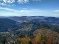
(3) At the signpost, continue along the path on the left towards Häuselstein. Follow the winding path uphill. At the next signpost, turn right towards the Immersberg Viewpoint. With your back to the viewpoint, take the ridge path. Follow the signposting and continue along the ridge. You’ll come to an area with picnic tables and boundary markers, including a signpost.
(4) Head to the left of the signpost. At the next one, turn left. Head downhill and, before reaching the rocky plateau – which is a former viewpoint – look out for the trail markings on your left.
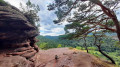
(5) Head down and walk along the base of the rocky outcrop. You’ll come to the Häuselstein viewpoint. Continue along the path to the right of the rock. Head down and, when you reach the track, turn right. Walk for about 850 m. A path joins from your right. Head down a little further until you reach another path on your right.
(6) Turn right and follow this path for 500 m until you reach a junction with a signpost. Continue to the left towards Hockerstein. Walk until you reach a pile of flat rocks.
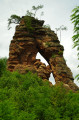
(7) Take a sharp left-hand bend, walk along the base of the rocks and, via a cable-assisted passage, reach the viewpoint overlooking Schwanheim. Retrace your steps and continue downhill. Cut across the track and carry on along the path opposite. You’ll come to a Marian grotto on your left. Turn right and walk down the Way of the Cross. Join the road again and continue downhill. At the T-junction, turn right and, at the Fork in the road near the building, continue to the left. You are now on a cycle path. Walk for just under 800 m.
(8) Before the junction with its picnic table, turn left onto the path running alongside the fence. Cross the small bridge over the Rimbach and you’ll come to the L490 road. Cross carefully, head right and then turn into thefirst forest track on your left. Walk uphill and turn right halfway up the slope. The track becomes a footpath. Walk on until you reach a Fork in the road.
(9) Keep to your left, take an immediate hairpin bend to the left and climb the winding path. Cross the track and continue along the path starting at the foot of the rock. At the top, head left of the rock face. The path takes a hairpin bend to the right. Climb close to the rocks and head right towards the Nesselberg viewpoint.
(10) Retrace your steps and this time head to the right of the rocks. Further on, go round the mast, carry on walking and, at the bend, follow the path on your left towards Hühnerstein. Discover thesecond Nesselberg viewpoint. With your back to the viewpoint, follow the descending path on your left and make your way down the switchbacks. Ignore the hairpin bend on your right and continue down until you emerge from the woods.
(11) Carry on along the dirt track. When you reach the road, cross carefully and continue along the stony path opposite for 600 m. At the T-junction, turn left. At the crossroads (not fully shown on the map), turn right, ignore the side paths and walk until you reach a three-way junction with a bench on the embankment.
(12) Carry on to the left, pass the Barenhöhle cave and continue along the forest track. Before emerging into the open, take the path on the right at the signpost, heading towards Hühnerstein. Climb the winding path, pass a viewpoint and carry on to the T-junction.
(13) Turn right, then further on turn left and, at the signpost, carry on straight ahead. Discover Hühnerstein, a rock with a ladder to climb up to the viewpoint. Continue along the descending path, ignoring the adjacent paths, until you reach the signpost.
(14) Take the path opposite, climbing the slope towards Darstein (5.9 km). Turn right past the first rocks, then left, and, on your left, enjoy a view of the Haselstein rock ridge, then head downhill. At the signpost, turn right then left. Ignore the path leading back up on your left and, at the next junction with a signpost, take the path up the slope, right next to the signpost.
(15) Head up towards Wolfshorn. At the top, turn left, take the path to the left of the sign and head downhill. At the track, cross over and continue along the path leading from the signpost towards Kühungerfelsen. The path curves and descends. At the track, turn left, still heading towards Kühungerfelsen. When you reach the mast, turn right and make a round trip to the Kühungerfelsen viewpoint.
(16) View of the Haselstein rock ridge. Once back at the mast, turn right and head downhill. Take the path through the small gorge and, when you reach the track, turn right towards the chalet. Before you reach it, turn right at the signpost towards Haselstein. Walk for just over 1 km along a path that loops back to your right. Follow the path leading down in front of you to the Fork in the road with a picnic table.
(17) Carry on to the left and, when you reach the track, turn left. At the next junction, carry on straight ahead.
Red dot signposting
Walk straight on for about 600 m, ignoring the cross-cutting paths, until you reach the open crossroads with a picnic table and signpost.
(18) Carry on straight ahead.
Blue ‘R + small cross’ sign on a white background
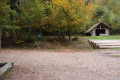
Carry on with woodland on your left and a meadow on your right. At the Fork in the road, keep left. At the forest roundabout on the right, look out for picnic tables and a shelter a little further on your right. At the next junction, keep right; you’ll come out onto the road, turn left and return to the car park (S/E).

 Visorando Member
 Moderate

 Easy