


A circular route around Dimbach via the Dimberg, the Rotzenberg and the Hockkopfel


A walk through the German forest north of Wissembourg, featuring some stunning views and sandstone outcrops (very similar to those in Colorado – Altschlossfelsen). There are a few sections with steep ascents and descents. This walk should be classified as moderate to difficult
Details
Creation:
Last update:
Last review:
–
–
-
 Activity: Walking
 -
 Distance: 5.94 mi
 -
 Average duration: 4h 00
 -
 Difficulty: Moderate
 -
-
 Back to start: Yes
 -
 Ascent: + 1,440 ft
 -
 Descent: - 1,450 ft
 -
-
 Highest point: 1,539 ft
 -
 Lowest point: 807 ft
 Country:
 City:
City:


Waypoints
- S/E : mi 0 - alt. 892 ft - Dedicated car park for walkers
- 1 : mi 0.32 - alt. 1,129 ft - A lovely rock
- 2 : mi 0.63 - alt. 1,339 ft - Dimbacher Eichen-Platzl
- 3 : mi 0.77 - alt. 1,368 ft - Dimberg
- 4 : mi 0.93 - alt. 1,296 ft - Large rock
- 5 : mi 1.24 - alt. 1,142 ft - Auf der Wehr
- 6 : mi 1.94 - alt. 1,493 ft - Rötzenberg
- 7 : mi 2.11 - alt. 1,388 ft - Viewpoint
- 8 : mi 2.86 - alt. 1,227 ft - Gosersweiler Mountain Hut
- 9 : mi 4 - alt. 1,539 ft - Immersberg
- 10 : mi 4.66 - alt. 1,480 ft - Hochkopfel
- 11 : mi 5.4 - alt. 974 ft - An dan Gehbühläckem
- 12 : mi 5.65 - alt. 810 ft - Dimbach
- S/E : mi 5.94 - alt. 899 ft - Dedicated car park for hikers
Other walks in the area
From the Shoe Museum in Hauenstein to the Kahler Felsen and Backelstein
 Visorando Member
 3.87 mi
+696 ft
-689 ft
2h 25
Moderate
3.87 mi
+696 ft
-689 ft
2h 25
Moderate
 Departure from Hauenstein (Südwestpfalz)
Whichever route you choose in the breathtaking Dahner Felsenland, you’ll find stunning sandstone rock formations everywhere. Two of these are the Kahle Felsen and the Backelstein, south of Hauenstein. What hardly anyone knows, however, is that the German Shoe Museum is also located here, where not only the history of the shoe but also many a famous pair of shoes is on display.
Dahn Rock Trail Felsenpfad
11.32 mi
+1,637 ft
-1,617 ft
6h 40
Moderate
Departure from Dahn (Südwestpfalz)
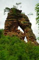
A magnificent hike to discover the rock formations of the Palatinate Forest. You will walk through breathtaking scenery and discover Neudahn Castle, destroyed during the Peasants' War in the 16th century, one of the best-preserved castles in the Palatinate Forest
Discovering the sandstone giants in Dahn
 5.73 mi
+883 ft
-863 ft
3h 25
Moderate
Departure from Dahn (Südwestpfalz)
5.73 mi
+883 ft
-863 ft
3h 25
Moderate
Departure from Dahn (Südwestpfalz)
The Dahner Felsenpfad (Dahn Rock Trail) is located in Rhineland-Palatinate. This circular route takes you into the forest to discover the giant pink sandstone rocks and the surrounding viewpoints.
Refreshments are also available along the route.
Cross-border trail from the Col du Litschhof to Nothweiler
 4.10 mi
+420 ft
-440 ft
2h 15
Moderate
Departure from Wingen (Bas-Rhin)
4.10 mi
+420 ft
-440 ft
2h 15
Moderate
Departure from Wingen (Bas-Rhin)
This pleasant cross-border walk near Nothweiler is ideal for a family outing. Views of the ruins of the fortified castles of Wegelnburg and Löwenstein provide a reward during the ascent. On the German side, the route takes walkers to the Eisenerzgrube Nothweiler iron ore mine. Nothweiler is a romantic village with numerous half-timbered houses.
Route discovery of the town of Wissembourg and its vineyards
 5.90 mi
+404 ft
-394 ft
3h 05
Moderate
Departure from Wissembourg (Bas-Rhin)
5.90 mi
+404 ft
-394 ft
3h 05
Moderate
Departure from Wissembourg (Bas-Rhin)
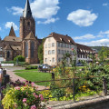
This walk along the ramparts, through the vineyards and around the neighbourhoods of Wissembourg will take you past more than 70 houses built before 1700 and the imposing St. Peter and St. Paul Church.
The town's origins date back to themid-7thcentury when Benedictine monks founded an abbey, St-Pierre-et-Paul, on an island in the Lauter. The town has miraculously emerged unscathed from a history punctuated by sieges, disasters and acts of war, with a battle in 1870 bearing its name.
Wissembourg Forest House on the Stiefelsberg
6.41 mi
+791 ft
-774 ft
3h 40
Moderate
Departure from Wissembourg (Bas-Rhin)
A route featuring numerous narrow paths that wind around the Col du Pigeonnier to the Col du Stiefelsberg, offering views over the Rhine plain, and back via the Chemin des Bornes, which passes through the Luchsenkopf and the Eslsberg.
Tour of the Scherhol from Wissembourg
 9.33 mi
+1,470 ft
-1,460 ft
5h 35
Moderate
Departure from Wissembourg (Bas-Rhin)
9.33 mi
+1,470 ft
-1,460 ft
5h 35
Moderate
Departure from Wissembourg (Bas-Rhin)
A magnificent route where hikers will follow a path that was iconic for the people of Wissembourg in the early 20th century to reach the old Scherhol Tower. Return by descending the slope towards the Lauter Valley and a visit to the town of Wissembourg.
For more walks, use our search engine .
The GPS track and description are the property of this route's author. Please do not copy them without permission.

