


 Country:
 City:


The circular walk begins at the Hexenplätzel car park on the north-eastern outskirts of Busenberg, above the sports ground (Waldstraße).
(S/E) From the car park, the route leads into the forest along a wide, gravelly path. At the first fork, keep to the right. Walk gently downhill for a while, then turn left at the next opportunity by the Kuhbach stream, immediately turn right again, and keep to the right at the fork.
(1) We follow a gentle, winding path to the right up the slope and then continue straight on. In the middle of the sparse woodland, the Langenwalder Felsen – the first red sandstone formation – comes into view. The massive rock formation seems to grow out of the broad mountain ridge like a row of teeth. The Holzschuhpfad now runs almost at ground level through the Langenwald. At the next junction, we keep to the right, and at the next fork, we also turn right. We reach a crossroads and follow the second path on the right. We ignore the next two turnings and keep right at the next fork. Then we turn sharply right.
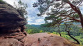
(2) The path now winds its way up in tight circular zigzag loops to a beautiful vantage point, the Löffelsberg, adorned with several massive cairns. From a bench, the view stretches out over the seemingly endless forests of the Wasgau.
(3) The route then leads across the rocky ridge of the Löffelsberg to another panoramic rock outcrop fitted with handrails. From the viewing platform, the view takes in the village of Busenberg. To the right, the Langenwalder Felsen rises high above the treetops. Below the exposed rocky spur of the Löffelsberg, the Holzschuhpfad winds its way through a narrow rocky gateway. The path now descends steeply into the valley in tight hairpin bends.
(4) At the next junction, at the bottom of the valley, we turn left onto a wide forest track. At the next junction, turn right, then take the third right and follow the path to the right.
(5) We then climb leftwards (second option) in switchbacks up to the Puhlsteinfelsen. From here, there is a fantastic view of the village of Busenberg, and the Drachenfels castle ruins can be seen in the distance. From the Puhlsteinfelsen, the path leads downhill again. After another stretch of switchbacks, we follow the path to the right and turn left at the second option. Turn left at the next junction and follow the path round the right-hand bend.
(6) Once in the valley, we cross the B 427, turn left and then walk along a wide meadow path into the wet meadows. We reach St Gertrude’s Chapel. It stands in the middle of a woodland meadow and was built around 1450 by Eckbrechten von Dürckheim. Until the mid-20th century, it was a destination for pilgrimages, including from neighbouring Alsace.
(7) As we continue, soft meadow paths now characterise the route. At the next fork, we keep to the left. At the crossroads, we go straight on and, at the fork, keep to the right, then take the next left.
(8) Eventually, the Holzschuhpfad climbs to the right up the flank of the Heidenberg. Halfway up the slope, a detour to a vantage point beckons. After about 200 metres, we come to a clearing in the woods offering outstanding views of Drachenfels Castle.
(9) Back on the main route, the Holzschuhpfad climbs once more and leads us up to the Schlüsselfelsen. From this massive rock outcrop, we enjoy fantastic panoramic views across the Wasgau. In the endless sea of woodland, Berwartstein Castle can be seen far in the distance.
(10) At the next junction behind the rocks, we keep to the right and then turn left at the next fork. The path leads downhill towards the Drachenfelshütte.
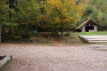
(11) On the road, we turn left and reach the Drachenfelshütte, run by the Pfälzer-Wald-Verein.
(12) At the next fork, we keep to the right and take a detour up to Drachenfels Castle. We return to the main route, turn right and then immediately left, into the woods. At the next junction, we turn right. We then take the third right, then the second left. Take a sharp right at the crossroads. The Busenberger Holzschuhpfad leads up the Jüngstberg along wide forest paths through the sparse woodland. At the next fork, we keep to the right and turn right again at the next one.
(13) We follow the path round a bend to the left, then round a bend to the right. The Geierstein is on our left. At the next fork, we keep to the right and then turn left.
(14) We cross the Geiersteinbach stream and turn left just beyond it. We pass the Wasgau sheep farm. The path climbs again. From the Geiersteinbach valley, the signposts lead us up to the Sprinzelfelsen. We walk straight ahead across the junction, turn right and then sharply left.
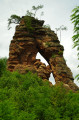
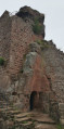
(15) Keep right at the fork; we reach the Sprinzelfelsen. The path leads past the sheer rock face via rocky paths and stone steps. Metal railings on the left protect walkers from falling into the abyss, before the route swings sharply to the right and emerges into the light on the other side of the Sprinzelfelsen through a natural rock arch.
(16) The path now winds its way up to the viewing platform, offering a bird’s-eye view of the village of Busenberg. Across the long, stretched-out rocky ridge of the Sprinzelfelsen, we follow narrow, root-covered paths past gigantic sandstone formations and protruding rock outcrops to further vantage points. At the junction, we turn left and then immediately right again.
(17) We cross the B 427 again, follow it a short way to the right and then immediately turn left. Take the next right and then left at the fork. The Holzschuhpfad leads around the Eichelberg in a circular pattern.
(18) We cross the K 85, follow it a short way to the left and then turn right, passing through a car park. The path curves sharply to the right, then we turn sharply right again, and take the next opportunity to turn left.
(19) Passing imposing rock formations, we follow a hillside path back to the walkers’ car park at Hexenplätzel (S/E).

 Visorando Member


 Moderate
 Easy

