


 Country:

 City:
City:


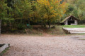
(Start/Finish) From the Col du Litschhof, take the path heading eastwards between the road and the hut (shelter available). The path runs alongside the road, slightly above it, through the woods. Join the road and, shortly afterwards, turn right onto an uphill forest track. At the exit of a right-hand bend, take a path down to the left. Join a road and follow it to the left for a few tens of metres.
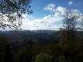
(1) At the junction, follow a gently ascending path to the right along the hillside. Ignore a path on the right and continue north. Clearing in the woods offer lovely views of Wegelnburg Castle. The path turns north-east and, further on, reaches a junction.
(2) Turn onto the path on the right and follow it to a mountain spur. When you reach it, take the path to the left, which descends steeply. At the bottom, join a track and follow it to the left to reach a sort of small pass (a hut with picnic tables).
(3) Take the first path on the right, which leads downhill. You’ll join a track; follow it to the right until you reach the Eisenerzgrube Nothweiler iron mine site. Pass through the first metal gate (buildings fitted out for visitors) and continue down a gentle slope to a second gate.
(4) Walk back to the small pass.
(3) Continue straight on (west; south-west) along a forest track. Immediately turn left onto this track and walk slightly downhill, along the mountainside, to a small car park. The track gives way to a small road which leads to Nothweiler after three hairpin bends. Come out onto the main road and follow it to the left for a few metres.
(5) Then turn left at the edge of a small clearing. Continue along a path to the right between two buildings. Join the road again and follow it to the left. Leave the village and continue along the road until you reach a large car park on the left-hand side (Wanderparkplatz; former customs post hut).
(6) The road makes a left turn: carry on straight ahead along a path. At the edge of the woods on your right, follow the valley floor, which is covered in grassland. At a fork in the road, take the left-hand path (the narrower one) and continue along the valley floor. Enter a woodland. At the junction further on, take a path on the left. You’ll come out onto a road; follow it carefully to the right (south).
(7) A little further up, at a bend to the left, take the path on the right running along the edge of the woodland. Walk alongside a meadow and, at the corner of the meadow, take the path on the left which leads away from it. Continue along the path which runs alongside the small road at some distance to your right. This will take you to the Col du Litschhof (S/E).
 Visorando Member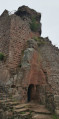
 Easy
Easy 
 Tourism professional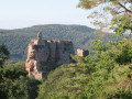
 Difficult
 Very difficult
