Refine your search for walks in Jupilles
Jupilles walks


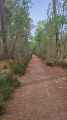
 The Forest School Trail and the Fontaine de la Coubre
 Visorando Member

 1.28 mi
 +95 ft
 -95 ft
 0h 40
 Easy
 Departure from Jupilles (Sarthe)
A fun and educational walk to enjoy with children. Throughout the route, information boards provide details about the surrounding flora and fauna and suggest games to play. Allow at least 2 hours for the walk to read the boards and take part in the activities.
Meet the woodland elves of the Bercé State Forest
3.70 mi
+194 ft
-194 ft
1h 50
Easy
Departure from Saint-Vincent-du-Lorouër (Sarthe)
Legend has it that the wood elves like to sleep at the bottom of the valleys and dance around the magnificent oak trees. Perhaps you’ll come across them?
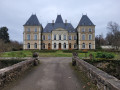
Segrais Castle route
 5.31 mi
+207 ft
-210 ft
2h 35
Easy
Departure from Saint-Mars-d'Outillé (Sarthe)
The route runs across agricultural land south of the Rhonne valley and ends by crossing an area of moorland adjacent to the Bercé Forest.
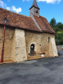
Courdemanche and its Saint-Fraimbault Chapel
 8.88 mi
+554 ft
-584 ft
4h 35
 Moderate
Departure from Courdemanche (Sarthe) (Sarthe)
A hike through two valleys. It passes through the hamlet of Saint-Fraimbault and its restored chapel.
Les Sapins des Pauvres
 Tourism professional
 11.37 mi
+302 ft
-289 ft
5h 30
Moderate
Departure from Saint-Mars-de-Locquenay (Sarthe)
The name adopted at the time of the merger refers to the location of the two villages situated in the valley at the confluence of the Arche and Hune streams. The area has been inhabited since ancient times, as evidenced by the dolmen on the border with Tresson, dating from the Neolithic period, and the ancient road – the Via Turniacensis – linking Le Mans to Blois; passing through Volnay and Saint-Mars-de-Locquenay before heading towards the Loir Valley. This facilitated the development of large agricultural estates, explaining the presence of numerous fiefdoms in medieval times, of which few traces remain (Champion, Pois, Le Grand Yvay, Mèleve, Sargilet), with the exception of La Chesnaye, which incorporated most of them during the Modern Era (16th–18th centuries).
On the edge of the woods from Volnay
 13.34 mi
+502 ft
-492 ft
6h 35
 Difficult
Departure from Volnay (Sarthe) (Sarthe)
The name Val-de-la-Hune, adopted at the time of the merger, refers to the location of the two villages situated in the valley at the confluence of the Ruisseau de l’Arche and the Hune. The area has been inhabited since ancient times, as evidenced by the dolmen on the border with Tresson, dating from the Neolithic period, and the ancient road, the Via Turniacensis, linking Le Mans to Blois; passing through Volnay and Saint-Mars-de-Locquenay before heading towards the Loir Valley. This facilitated the development of large agricultural estates, explaining the presence of numerous fiefdoms in medieval times, of which few remains are left (Champion, Pois, Le Grand Yvay, Mélève, Sargilet), with the exception of La Chesnaye, which incorporated most of them during the Modern Era (16th–18th centuries).
The Étangsort Valley towards Tresson
 8.68 mi
+348 ft
-351 ft
4h 20
Moderate
Departure from Tresson (Sarthe)
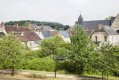
The origins of the settlement of Tresson are very ancient, as evidenced by a dolmen situated not far from Les Basses Poches. Furthermore, the territory of Tresson is crossed by the Via Turniacensis, near which a large agricultural estate is recorded in 572. This villa was donated by Bishop Domnole to Saint-Vincent Abbey, which established a priory in Tresson. This combination of factors led to the development of the present-day village in the Étangsort valley.
La Tussonne from Vancé
 4.15 mi
+318 ft
-295 ft
2h 10
Easy
Departure from Vancé (Sarthe)
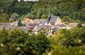
Situated in the south-west of the Calais plateau, which is cut by steep-sided valleys, the village is divided by watercourses belonging to the Braye basin; the two main ones are the Charmançon and the Tusson. Its origins may date back to the Gallo-Roman period, but its history becomes clearer in the Middle Ages thanks to the discovery of coins. In the early19th century, following significant population growth, Vancé became home to a large number of craftsmen. In 1810, the village was home to thirteen weavers and twelve building tradespeople: four stonemasons, one bricklayer, one carpenter, three joiners, three shingle cutters and numerous other craftsmen catering to everyday needs.
Between Tuffeau and Grès Roussard
 7.53 mi
+289 ft
-279 ft
3h 45
Moderate
Departure from Sainte-Osmane (Sarthe)
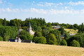
Val-d’Étangson is a new commune formed in 2019 from the merger of the communes of Évaillé and Sainte-Osmane. Dedicated to an Irish princess who became a hermit in Brittany in the7th century, the church, extensively remodelled around 1540, features a beautiful Renaissance porch with classical decorations. By undertaking the interior restoration of the building themselves, the residents have revived the tradition of the ‘fabrique’ – an assembly of parishioners responsible, under the Ancien Régime, for the building’s upkeep. In 1841, the local landscape was mainly characterised by small farmsteads, sometimes grouped into hamlets such as La Chauvière, and a few large estates, such as Rateau or a dairy farm.
The Holly Route in Mulsanne
4.09 mi
+39 ft
-39 ft
1h 55
Easy
Departure from Mulsanne (Sarthe)
At the foot of the famous 24 Hours of Le Mans route, a pleasant stroll beneath Scots pines and maritime pines where the squirrel reigns supreme.
Around the Boulevard Nature: Mulsanne, the ‘Petit Chien’ route
 10.28 mi
+102 ft
-98 ft
4h 50
Moderate
Departure from Mulsanne (Sarthe)
This walk takes you into the heart of the pine forests. It crosses several roads, so please take care throughout the walk.
The Orée de Bercé-Belinois Route
 6.22 mi
+66 ft
-66 ft
2h 55
Easy
Departure from Moncé-en-Belin (Sarthe)
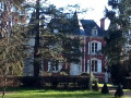
During this walk, you will encounter different periods of history, from the 12th century right up to the Second World War.
On the Via Turniacensis in Maisoncelles
 5.48 mi
+82 ft
-82 ft
2h 35
Easy
Departure from Maisoncelles (Sarthe) (Sarthe)
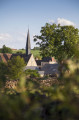
The village of Maisoncelles, described as a ‘street village’, has developed linearly along the road linking Bouloire to Tresson and Écorpain, running perpendicular to the Ruisseau de l’Étangsort. Although difficult to date precisely, the imposing Church of Notre-Dame, possibly dating back to the Romanesque period, is undoubtedly the oldest building in the village. You can, however, see typical rural features from theThird Republic, such as the public pump at the foot of the church. Heading towards the cemetery, you will see on the right the old communal washhouse, recently converted to welcome walkers, and further up, a former school recognisable by its two-storey structure and brick window frames.
Along the banks of the Tusson towards Val-d'Etangson
 7.85 mi
+308 ft
-315 ft
3h 55
Moderate
Departure from Évaillé (Sarthe)
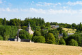
Val-d’Étangson is a new commune formed in 2019 from the merger of the communes of Évaillé and Sainte-Osmane. Possibly first mentioned as early as the9th century, the village on the banks of the Tusson consisted in 1829 of nothing more than the church, the18th-century presbytery with its courtyard and garden, and around fifteen houses. It expanded after 1840, no doubt linked to the opening of the road connecting the two sub-prefectures of La Flèche and Saint-Calais (now the D13).
Around Boulevard Nature: Ruaudin, amidst the pine trees
 5.61 mi
+16 ft
-13 ft
2h 35
Easy
Departure from Ruaudin (Sarthe)
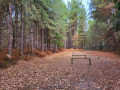
Set off on a walk through the heart of Ruaudin’s countryside! From the town centre, discover the area’s heritage through the church, the wash house and the old tram bridge. You’ll then follow the course of the ‘Le Roule-Crottes’ stream to the beautiful pine forest that gives the town its charm. Along the way, make the most of the facilities: picnic areas, a playground, a fitness trail and benches.
The Sourice Valley
 6.31 mi
+203 ft
-190 ft
3h 05
Moderate
Departure from Surfonds (Sarthe)
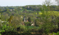
The parish underwent a re-demarcation in 1836: certain farms such as La Bardouillère and houses in the village were part of Volnay. Since then, the south-eastern boundary has been formed by the Ruisseau la Sourice. Under the Ancien Régime, the parish seigneury was annexed to the Château du Coudray, which you will see to the right of the hill as you head towards La Bardouillère. The village still has traditional houses near the church; it has gradually expanded towards the crossing point over the Sourice, where the roads from Surfonds to Bouloire and from Le Breil to Volnay used to meet, later transformed inthe 19th century into the main road from Tuffé to Le Grand-Lucé.
Loudon Ponds and Wood
2.56 mi
+177 ft
-171 ft
1h 20
Easy
Departure from Parigné-l'Évêque (Sarthe)
This circular walk allows you to discover a site not far from Le Mans that is rich in natural beauty. Ponds, peat bogs, wet and dry heathland, and marshy woods... all form a mosaic of landscapes that are home to species rare in the region: harriers, hobby falcons, goshawks, purple herons (among the birds); and royal ferns, marsh marigolds and sundews (among the plants).
Discovering the woods and ponds of Loudon
 4.85 mi
+36 ft
-36 ft
2h 15
Easy
Departure from Saint-Mars-la-Brière (Sarthe)
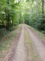
Parigné-Lévêque is a very large and heavily wooded commune: northern pines with sand dunes, and southern chestnut and birch trees. The route allows you to discover the charm of numerous woodlands, vast moors and ponds. The Loudon Stream is crossed in several places.
In the footsteps of Gohan in Bouloire
 10.05 mi
+486 ft
-509 ft
5h 05
Moderate
Departure from Bouloire (Sarthe)
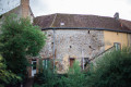
Bouloire is nestled in the heart of a vast, hilly agricultural region crossed by the Dué and Tortue rivers. Human presence along the ancient road between Le Mans and Orléans is attested to by a coin dating back to the Merovingian period. Its name comes either from a Celtic place name meaning "fortification" or from an etymology meaning "between two coasts ". The town centre is rich in ancient architectural heritage. The Church of Saint-Georges, destroyed by a fire that ravaged the village in 1680, bears the coat of arms of Marshal Guillaume Testu de Balincourt, who enabled its reconstruction. The town's coat of arms is also linked to this figure.
Around the Boulevard Nature: Arnage, the witch’s curse
 3.79 mi
+10 ft
-10 ft
1h 45
Easy
Departure from Arnage (Sarthe)
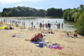
This walk, along the banks of the Sarthe, follows a section of the Boulevard Nature. It starts at Arnage harbour, goes to the Gémerie lake and circles it before returning to Arnage harbour. If you wish to extend your walk, you can continue past Arnage harbour by following the signs for the Boulevard Nature.It is accessible to people with reduced mobility as well as to three-wheeled pushchairs (also suitable for three-wheeled wheelchairs).
La Mare aux Poissons Rouges and the Arche de la Nature
 2.04 mi
+92 ft
-92 ft
1h 00
Easy
Departure from Changé (Sarthe) (Sarthe)
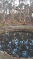
The Mare aux Poissons Rouges is an artificial pond which hosted a procession from the early 20th century until the Second World War.
The procession set off from the church at Yvré-l’Évêque and passed through the grounds of the Château de l’Arche.
Today, the pond has been cleaned up and is home to many protected amphibians, such as the marbled newt.
Around Boulevard Nature: Arche de la Nature, the Prairie House
 2.23 mi
+30 ft
-30 ft
1h 05
Easy
Departure from Yvré-l'Évêque (Sarthe)
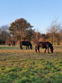
This walk is accessible to people with disabilities using a three-wheeled wheelchair and to families with pushchairs, provided they are using a three-wheeled pushchair.
This forest walk takes you past the Maison de la Prairie, where you can see animals in their enclosures.
Around the Boulevard Nature: Arche de la Nature, amidst heathland and chestnut trees
 7.72 mi
+138 ft
-138 ft
3h 40
Moderate
Departure from Yvré-l'Évêque (Sarthe)
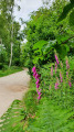
This forest walk from the Arche de la Nature takes you past a variety of tree species.It allows you to explore much of the site, walking along both wide paths and narrow tracks.