Country:
 City:


From Le Mans, take the D338 and drive to Mulsane. At the roundabout at the entrance to the town, turn left onto Avenue de Ronen. Park near Square Bentley and the shopping centre.
(S/E) With your back to the shopping centre, follow the signs to the left of the information board to cross the whole of Square Bentley and exit onto Rue des Pins. Turn left onto this street and continue straight on until you reach the church.
(1) Walk down Rue de l’Église, passing the Pontvillain terraces. Do feel free to stop off at the old wash house. Take Route de la Chesnaie on the right until you reach the D338. You’ll pass the old La Madeleine wash house. Follow the D338 to the right, then cross it carefully at the first track on the left.
(2) This is called Chemin de la Fuie. Cross a stream, then cut across Rue des Coccinelles and then Rue des Libellules. You’ll come to a junction.
(3) Then follow the path to the left. Ignore Rue des Grillons and then Rue des Criquets. At the first junction, turn right onto the small lane leading to Rue des Papillons. Continue straight on along the street, then straight across to Boulevard de Bellevue. You’ll reach the roundabout at Rue du Stade. Take the Chemin de l’ACO, which runs alongside the sports grounds, to the ACO car park for the 24 Hours race. Carry on straight ahead until you reach the old water tower.
(4) Turn left, then follow the signposted path, continuing straight ahead at first until this is no longer possible. Then, keep to the left until you reach the bridle path and follow it to the right. Pass under the power lines until you reach a junction.
(5) Turn right, passing under the high-voltage power lines again. Continue to the D140 (24 Hours route). Cross with care; after about 500 m, turn left into the woods onto the first path. You’ll come to a crossroads at a bend.
(6) Follow the road on the right (the ‘S’ bend at Arnage, also known as the ‘Indianapolis bend’); atthe second bend, leave the road towards La Lande du Tertre onto a small tarmac road, then take the path on the right to reach a T-junction.
(7) Keep left at the junction until you reach La Pincenardière, situated just as you emerge from the forest (Le Mans FC training ground).
(8) Leave theGR®36to the right towards Le Petit Midi. Follow the main avenue. Carry on straight ahead until you have passed a clearing, its football pitch and the tennis court at Les Petites Ganières. Carry on straight ahead until you reach a crossroads.
(9) Turn left, staying behind the safety barrier, towards Le Mans for 200 m. Cross the D338 (with care) and head left before taking the first right to follow the Route de la Closerie as far as the D140ter.
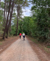
(10) Cross it to reach Boulevard des Grands Rôtis. Continue for 400 m, then turn left along the edge of the woodland. Keep going straight on until you reach the next major track, also known as a bridle path.
(11) Turn left onto it. Follow it for about 1 km, ignoring three junctions coming from the right. At the fourth junction, turn right onto another wide track; leave this after 200 m and turn right. Continue straight on until the end of the track, then turn left. Turn right again, then left onto a track to reach the Route de la Megrière and Brette-les-Pins.
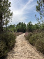
(12) Turn right and follow the road for about 350 m. Take care – this is a dangerous road. After passing the track on the right, leave the road and turn right into the woodland onto the first path. Keep left at the first junction, then continue straight on through the small chestnut grove.
(13) Cross the woodland then head straight on towards the road. Continue straight on until you reach the second path (Rue Émile Zola): exit the woodland to the right, cross at the pedestrian crossing and take the pavement. Turn right into the first small chestnut grove, where you’ll find a chestnut tree estimated to be around 550 years old.
(14) Walk past the Édith Piaf Hall until you are opposite the sports halls. Follow Avenue de Nettleham to the right via the pedestrian path. Go round the roundabout towards the shopping centre, turning left onto Avenue de Rouen. You will then reach Square Bentley (S/E).


 Visorando Member
 Easy

 Tourism professional