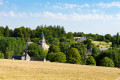
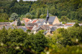
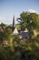
Meet the woodland elves of the Bercé State Forest

Legend has it that the wood elves like to sleep at the bottom of the valleys and dance around the magnificent oak trees. Perhaps you’ll come across them?

Details

22339056
Creation:
Last update:
Last review:
  • Walking
    Activity: Walking
  • ↔
    Distance: 3.70 mi
  • ◔
    Average duration: 1h 50 
  • ▲
    Difficulty: Easy

  • ⚐
    Back to start: Yes
  • ↗
    Ascent: + 194 ft
  • ↘
    Descent: - 194 ft

  • ▲
    Highest point: 518 ft
  • ▼
    Lowest point: 400 ft

Description of the walk

To reach the start from Jupilles, follow the D13 towards Pruillé-l’Éguillé. Pass through La Chauvinière, go past the Rond Jousset junction and continue to the next one, Rond de l’Embranchement. Turn right at the Rond du Chêne Désiré, carry on straight ahead and take the first track on the right at the Carrefour des Vieux Fours.

(S/E) Continue along the tarmac for a few metres, heading east, until you reach a forest track on your left.

(1) Take this track and, after about 200 m, you’ll see a magnificent oak tree (Chêne Sermaise). Carry on straight ahead.

(2) At the junction with the road, turn right.

(3) At the four-way junction, turn right onto the road and carry on straight ahead to the starting point.

(S/E) Take the forest track on the left.

(4) At the three-way junction, follow the path that branches off to the right and head down into the valley.

(5) At the end of the forest track, turn left onto the footpath and return to the junction you took earlier.

(4) Carry on straight ahead, following the route in the opposite direction to the outward journey, until you reach the Carrefour des Vieux Fours (S/E).

Waypoints

  1. S/E : mi 0 - alt. 518 ft - Carrefour des Vieux Fours
  2. 1 : mi 0.06 - alt. 515 ft - Forest track
  3. 2 : mi 0.57 - alt. 446 ft - Forest track
  4. 3 : mi 0.98 - alt. 446 ft - The wine press
  5. 4 : mi 2.31 - alt. 466 ft - Junction encountered twice
  6. 5 : mi 2.81 - alt. 472 ft - Valley
  7. S/E : mi 3.7 - alt. 518 ft - Carrefour des Vieux Fours

Worth a visit

Reviews and comments

4.5 / 5
Based on 2 reviews

Reliability of the description
4.5 / 5
Ease of following the route
5 / 5
Route interest
4 / 5
Denis26
Denis26 ★

Thank you, jfgbenner, for pointing that out; I’ve just added a few details on how to get to the start of the walk.

Machine-translated

jfgbenner
jfgbenner

Overall rating : 4.3 / 5

Date of your route : Jul 23, 2026
Reliability of the description : ★★★★☆ Good
Ease of following the route : ★★★★★ Very good
Route interest : ★★★★☆ Good
Very busy route : No

A very pleasant route through the cool forest, despite the sweltering heat and the prefectural restrictions banning access from midday onwards. The only thing is that the access point is a bit tricky to find if you don’t have a way of using the GPS coordinates provided; perhaps a description of how to get there by car from the main road network could be added. But apart from that minor detail, thanks to the author – this route offers views of magnificent, centuries-old oak trees that we hope to be able to preserve for as long as possible.

Machine-translated

jjdolo
jjdolo
• Edited:

Overall rating : 4.7 / 5

Date of your route : Jun 05, 2023
Reliability of the description : ★★★★★ Very good
Ease of following the route : ★★★★★ Very good
Route interest : ★★★★☆ Good
Very busy route : No

Hello,

A lovely little walk in the Bercé Forest.

Please note: I clicked on ‘Go to start’ so that my sat-nav would take me to the right place, but the finish point is incorrect. The sat-nav takes me to the centre of the village of Saint Vincent du Lorouër, which is 5 km from the actual starting point.

Here are the GPS coordinates for the starting point: 47.827200, 0.490159

Thank you and enjoy the walk :-)

Machine-translated

Other walks in the area

For more walks, use our search engine .

The GPS track and description are the property of this route's author. Please do not copy them without permission.