The Forest School Trail and the Fontaine de la Coubre

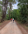
A fun and educational walk to enjoy with children. Throughout the route, information boards provide details about the surrounding flora and fauna and suggest games to play. Allow at least 2 hours for the walk to read the boards and take part in the activities.

Details

n°16755157
Creation:
Last update:
Last review:
  • Walking
    Activity: Walking
  • ↔
    Distance: 1.28 mi
  • ◔
    Average duration: 0h 40 
  • ▲
    Difficulty: Easy

  • ⚐
    Back to start: Yes
  • ↗
    Ascent: + 95 ft
  • ↘
    Descent: - 95 ft

  • ▲
    Highest point: 528 ft
  • ▼
    Lowest point: 423 ft
  • ⚐ Country: France
  • ⚐ City: Jupilles (72500)
  • ⚑
    Start/End: N 47.794224° / E 0.372064°
  • ❏
    IGN map(s): Ref. 1720SB, 1820SB
  • Hour-by-hour weather

Photos

Description of the walk

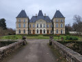
Park at the Fontaine de la Coubre car park on the edge of the Route Forestière des Trembles.

(S/E) Cross the bridge over Le Dinan, then turn right at the information sign showing the route of the walk. Take the path on the right which follows the stream to reach the edge of the forest.

(1) Turn left, follow the path along the edge of the forest, and a few hundred metres further on you’ll come to another junction.

(2) Turn slightly left and walk past a small pond. A viewing platform allows you to get closer to it and look out over it. Continue along the path and cross the Route Forestière des Trembles. Then turn left to join theGR®36at the next junction.

(3) Turn left onto it to easily return to the Fontaine de la Coubre car park (S/E).

Waypoints

  1. S/E : mi 0 - alt. 433 ft - Car park at the - Fontaine de la Coudre
  2. 1 : mi 0.19 - alt. 423 ft - Edge of the woodland
  3. 2 : mi 0.46 - alt. 502 ft - Junction
  4. 3 : mi 1 - alt. 456 ft - GR36
  5. S/E : mi 1.28 - alt. 433 ft - Car park at the - Fontaine de la Coudre

Notes

Please note: The route of the path does not appear on the IGN map; to view it, use the OSM base map.

The path is signposted with yellow arrows.

Please ensure you wear suitable footwear or boots for children.

There is a picnic area with tables near the car park.

Always be cautious and plan ahead when you're outdoors. Visorando and the author of this route cannot be held responsible for any accidents occurring on this route.

The GR® and PR® markings are the intellectual property of the Fédération Française de Randonnée Pédestre.

Reviews and comments

5 / 5
Based on 1 review

Reliability of the description
5 / 5
Ease of following the route
5 / 5
Route interest
5 / 5
Anne PINEAU
Anne PINEAU

Overall rating : 5 / 5

Date of your route : Oct 09, 2023
Reliability of the description : ★★★★★ Very good
Ease of following the route : ★★★★★ Very good
Route interest : ★★★★★ Very good
Very busy route : Yes

A lovely walk through a rolling woodland with beautiful winding paths and a wide variety of tree species. We particularly enjoyed the sections through the beech woods, even though the trees hadn’t yet taken on their autumn colours.
We went on this walk with a 6-year-old child who was delighted with the walk.

Machine-translated

Other walks in the area

For more walks, use our search engine .

The GPS track and description are the property of this route's author. Please do not copy them without permission.