


Refine your search for walks in Hotton
Hotton walks


 Hotton, a typical village in La Famenne
 Visorando Member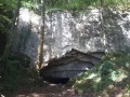
 9.38 mi
 +1,040 ft
 -1,033 ft
 5h 15
5h 15
 Moderate
 Departure from Hotton (Province de Luxembourg)
Limestone and blue stones make up a significant part of the habitat. Rue Haute is a fine example of this. Several limestone houses dating from the 18th century stand side by side. Among these are two listed buildings, the Moulin Faber and the Maison Godenir, which houses the Royal Tourist Office.The Aïve Cave/Neolithic cave, Ti Château/Roman camp, Trou Fré Djame... are other places you will encounter along this route.
The wooded heights of the Ourthe river at the start of Hotton
 10.42 mi
+1,155 ft
-1,152 ft
5h 50
Moderate
Departure from Hotton (Province de Luxembourg)
10.42 mi
+1,155 ft
-1,152 ft
5h 50
Moderate
Departure from Hotton (Province de Luxembourg)
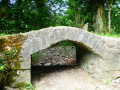
This walk begins by following one of Wallonia's iconic rivers, with some beautiful rocks as a bonus, before offering a pleasant loop through the forests and countryside south of the tourist town.
Broom walk from Waharday
 9.93 mi
+965 ft
-981 ft
5h 25
Moderate
Departure from Rendeux (Province de Luxembourg)
9.93 mi
+965 ft
-981 ft
5h 25
Moderate
Departure from Rendeux (Province de Luxembourg)
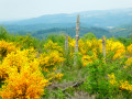
The deforested hillsides in the Waharday, Chéoux and Hodister area have been repopulated with various species of shrubs, notably broom, which has taken root there in their thousands.When they flower in May, they light up the whole area with their characteristic magnificent yellow colour.The icing on the cake is that the numerous meadows are also illuminated in yellow by buttercups.A real feast for the eyes.
In search of a lost cross in Rendeux
 9.44 mi
+1,155 ft
-1,142 ft
5h 20
Moderate
Departure from Rendeux (Province de Luxembourg)
9.44 mi
+1,155 ft
-1,142 ft
5h 20
Moderate
Departure from Rendeux (Province de Luxembourg)
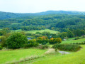
We went in search of the Croix Monseur-Kinet located near the Chapelle Saint-Thibaut. We didn't find it! But we found others. A mainly forestroute offering panoramic views of the Ourthe valley and its tributaries here and there.
Around Rendeux
11.20 mi
+1,112 ft
-1,119 ft
6h 05
Moderate
Departure from Rendeux (Province de Luxembourg)
Start at Robert Lenoir Park in Rendeux and head towards Bois d'Arlogne. Once there, the hike passes through Marcouray. Then, from the village, head towards Cielle and descend towards La Boverie to finally follow the Ourthe to Rendeux via Jupille and Marcourt. A beautiful circular route to discover the villages of our municipality!
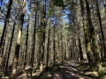
The Hermitage of St-Thibaut
 4.94 mi
+607 ft
-600 ft
2h 50
Moderate
Departure from Rendeux (Province de Luxembourg)
4.94 mi
+607 ft
-600 ft
2h 50
Moderate
Departure from Rendeux (Province de Luxembourg)
The hike starts at the end of Rue du Belvédère and crosses the woods to reach the village of Hodister. It then heads towards the site of St-Thibaut. Be sure to admire the view halfway along the route before returning to the starting point.
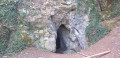
Geological trail in the Fond des Vaulx nature reserve
 2.48 mi
+151 ft
-151 ft
1h 15
2.48 mi
+151 ft
-151 ft
1h 15
 Easy
Departure from Marche-en-Famenne (Province de Luxembourg)
Easy
Departure from Marche-en-Famenne (Province de Luxembourg)
The Fond des Vaulx is part of the Famenne-Ardenne Geopark, the first UNESCO Global Geopark in Belgium.
A stone's throw from the town centre, this small, steep-sided valley offers a landscape that contrasts with the expanse of the Marche plain. It is home to several caves, chantoirs and holes, including the Trotti-aux-Fosses chasm, which is unique in Belgium and remarkable for its collapse chasm morphology.
Countryside between Marche-en-Famenne and Verdenne
 5.15 mi
+289 ft
-292 ft
2h 35
Easy
Departure from Marche-en-Famenne (Province de Luxembourg)
5.15 mi
+289 ft
-292 ft
2h 35
Easy
Departure from Marche-en-Famenne (Province de Luxembourg)
This route takes you to the village of Verdenne, on the plateau to the east of Marche-en-Famenne.
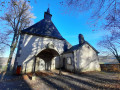
Saint-Thibaut Hermitage
 3.63 mi
+607 ft
-604 ft
2h 10
Easy
Departure from Rendeux (Province de Luxembourg)
3.63 mi
+607 ft
-604 ft
2h 10
Easy
Departure from Rendeux (Province de Luxembourg)
The Saint-Thibaut Hermitage trail and its panoramic view of the valley and the River Ourthe
From the Petit-Han Woods to the N833
2.28 mi
+72 ft
-52 ft
1h 05
Easy
Departure from Durbuy (Province de Luxembourg)
Hike starting from the Petit-Han municipal school. There is a football pitch (easy and free parking, Rue des Pinèdes), a playground and picnic benches.Fully paved round trip, ideal for a stroll with a pushchair
Walk in Famenne-Ardenne from Petit-Han
 10.95 mi
+397 ft
-410 ft
5h 25
Moderate
Departure from Durbuy (Province de Luxembourg)
10.95 mi
+397 ft
-410 ft
5h 25
Moderate
Departure from Durbuy (Province de Luxembourg)
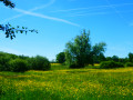
Located mainly in Famenne, on the border with the Ardennes, this circular route alternates between woodland and countryside, with a short section along the River Ourthe.With very little elevation gain and plenty of hard-surfaced paths (cycle paths, local roads or access roads to residential estates), it presents no difficulty other than the odd slightly muddy footpath or forest track. Lovely views over the northern part of the Famenne and the Ourthe valley between the residential area of Plain de Holset (Monteuville) and Melreux.
Circular in the Petit-Han Woods
4.23 mi
+131 ft
-118 ft
2h 05
Easy
Departure from Durbuy (Province de Luxembourg)
This is a walk starting from the Petit-Han community school and the football pitch (easy and free parking). Playground and picnic benches available on site.Part of the route is paved, the other part is accessible with a sturdy pushchair.
Walk to the sources of the Hédrée from Lignières
 8.98 mi
+830 ft
-843 ft
4h 50
Moderate
Departure from Marche-en-Famenne (Province de Luxembourg)
8.98 mi
+830 ft
-843 ft
4h 50
Moderate
Departure from Marche-en-Famenne (Province de Luxembourg)
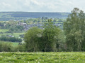
The Hédrée river forms in the marshy area of the forest on the outskirts of Marche-en-Famenne between the villages of Gênes (Rendeux) and Bande (Nassogne).The route crosses this rushing stream at the ford on the path shortly after kilometre 2 and then follows one of its tributaries, whose bed runs alongside the path for just under the next kilometre.This is not the only wet spot on the walk: you often have to take a path through the undergrowth instead of the road until you reach the junction with Rue des Fagnes at kilometre 4.4.After a well-deserved break, it's back to the same thing for about 2 kilometres after crossing the national road.The last 4 kilometres are much drier.A short stop on the bridge at the bottom of Grimbièmont allows you to see how much the waters of the Hédrée have swollen over the first few kilometres of its course.In autumn, the circular offers not only the beautiful colours of nature but also an incredible diversity of mushrooms.
From La Passerelle to Durbuy
8.48 mi
+492 ft
-489 ft
4h 20
Moderate
Departure from Durbuy (Province de Luxembourg)
Hike starting from the La Passerelle hotel-restaurant (free parking on site).
For a day's walk that includes the town of Durbuy, stop off to visit the old town.
At Petit-Han, you must cross the Adventure Valley barrier to reach Durbuy.
From La Passerelle to the Petit-Han woods
5.42 mi
+243 ft
-243 ft
2h 40
Moderate
Departure from Durbuy (Province de Luxembourg)
Hike starting from the La Passerelle hotel-restaurant (free parking on site). Round trip walk in the village of Grand-Han (along the village road) and in the Petit-Han woods. The hike is accessible to pushchairs.
Dolmens, menhirs and the Aisne Tourist Tramway
 13.38 mi
+1,480 ft
-1,480 ft
7h 25
13.38 mi
+1,480 ft
-1,480 ft
7h 25
 Difficult
Departure from Erezée (Province de Luxembourg)
Difficult
Departure from Erezée (Province de Luxembourg)
Megaliths – whether dolmens (covered passageways) or menhirs (standing stones) – are abundant in this region, where one comes across boulders that could well have been added to the collection at any bend in the forest path. One question remains: how on earth did our Neolithic ancestors manage to move, erect or stack these enormous boulders, some weighing up to 10 tonnes?The Aisne Tourist Tram, on the other hand, is much more recent, dating from the 1960s, following the permanent closure of the local railway line from the first half ofthe 20th century, which linked the stations at Comblain-la-Tour and Melreux via Manhay.
Towards La Hédrée and La Wamme, setting off from Waha
 11.45 mi
+1,112 ft
-1,086 ft
6h 15
Moderate
Departure from Marche-en-Famenne (Province de Luxembourg)
11.45 mi
+1,112 ft
-1,086 ft
6h 15
Moderate
Departure from Marche-en-Famenne (Province de Luxembourg)
From Waha church, the walk begins by heading due east before climbing up through the countryside and then into woodland. After passing through the very pretty Bois de Waha, the route returns to open countryside as far as Harsin, offering beautiful panoramic views over the Hédrée and Wamme valleys. The walk then takes you to explore the Prés de la Wamme and the splendid Château Jemeppe in Hargimont, before gently winding its way back up to the hills of Waha.
Discover Wéris and its megaliths
3.68 mi
+400 ft
-387 ft
2h 05
Moderate
Departure from Durbuy (Province de Luxembourg)
With a stated length of 6 km and an elevation gain of 125 m in a rural setting, we discovered a very pretty village with interesting architectural heritage and beautiful restorations. This hunt took us along streets and roads, country lanes and forest paths. There is a significant elevation gain, which is not mandatory, to find the Pierre de Haina.
Around Heyd and Morville
 10.44 mi
+1,194 ft
-1,198 ft
5h 50
Moderate
Departure from Durbuy (Province de Luxembourg)
10.44 mi
+1,194 ft
-1,198 ft
5h 50
Moderate
Departure from Durbuy (Province de Luxembourg)
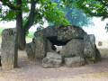
A walk offering varied scenery, alternating between countryside and woodland, paths, tracks, village streets, short stretches of country roads and cycle paths, starting from Wéris, one of Wallonia’s most beautiful villages, well known for its megaliths and its museum.
Along the Ourthe between Bohon and Bomal
 11.31 mi
+1,289 ft
-1,266 ft
6h 20
Difficult
Departure from Durbuy (Province de Luxembourg)
11.31 mi
+1,289 ft
-1,266 ft
6h 20
Difficult
Departure from Durbuy (Province de Luxembourg)
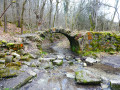
No, the walk doesn’t follow the banks of the Ourthe for 18 km… that would probably be very pretty but too monotonous over such a distance.Starting from the centre of Barvaux, the route begins by climbing the hill on the western side towards Durbuy (which you can visit off the trail) and reaches the Ourthe at the new relief car park.From there, the walk follows the river for just over 3 km before leaving it to reach the plateau between Tohogne and Herbet.After descending to the Ourthe and passing through Bomal, the walk climbs up the other side of the Ourthe and follows the lovely ridge path through the Mont des Pins and Mont Pelé Nature Reserve.