Country:
 City:
City:


Car park or bus stop: Ruttermarkt, in Rutten (Tongres/Tongeren).
(S/E) From the square, head north-west along Wilstraat and join the main road (N614) after 500 m. Cross the road and follow it to the left for 200 m.
(1) Turn right down towards a fenced-off property entrance, then immediately left, go through a wooden gate and, a few metres further on, keep left to join a path winding between two fences.
This path leads onto a village road near a house; take this road to the right.
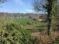
(2) At the junction, take the concrete land consolidation track on the left. This bends to the right and runs parallel to the valley for about one kilometre.
(3) At the junction, turn right into Rue Kraaibroek towards the centre of the village of Lauw. Follow it for 300 m (ignore the first street on the right) and turn right into Rue Bosstraat (opposite a brick-built electricity substation). Cross the Geer and then turn immediately left into Rue Sint-Luciastraat.
(4) Then turn left into Rue Nullenaren. Follow it to the end, go through the barrier and take the path that runs alongside the Geer.
(5) After following the Geer for one kilometre (ignore the first footbridge halfway along), the path joins a concrete track. Turn left, cross the Geer and turn left again onto the land consolidation track leading back towards Lauw, running parallel to the stream. Halfway along, the concrete track gives way to a grassy section in the middle.
(6) Once you reach the village, take the road on the right (Klerestraat), then at the end of this, turn left into Lauwerlinde. At the bottom of this, turn right into the village road (Bosstraat), which joins the main road (N614).
(7) Once you reach the main road, cross it and continue straight on towards the village of Herstappe. Opposite the police station, turn left into Rue de l’Église, then 200 metres further on, as you leave the village, turn right onto a concrete path (Luykerweg) leading through the fields.
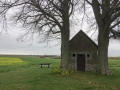
(8) After 500 m, the path narrows and leads off to the left to a small 15th-century chapel with a lovely view of the surrounding countryside and a picnic table.
Return to the concrete path and continue downhill. Turn left onto the concrete path running alongside a copse and a small stream (Ezelsbeek).
(9) Picnic table. Follow this country lane to the entrance to the village of Rutten. It joins a wider path, then runs alongside a sports ground (lighting masts).
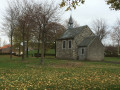
(10) At the crossroads, turn right, then right again (ignore the pedestrian street on the left), and head towards the sports facilities. Before reaching them, pass through a gate leading to a large, tree-lined area with a chapel at its centre: Sint-Evermarus.
(11) Exit through the gate opposite, turn right and follow the road, which soon bends to the left, to reach a large square farmhouse.
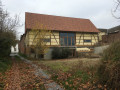
(12) After the farm, turn left into Toppetstraat, then straight on along the grassy path which passes some beautifully restored cottages before emerging onto the village’s main street (Rechtstraat). Turn left here, then immediately left again, and walk behind the church, going round it to return to the starting point at Ruttermarkt, Rutten (S/E).

 Visorando Member

 Easy
Easy