


 Country:
 City:
City:


The walk starts at Saint-Clément Church in Oreye, where you can park easily (except perhaps on days when services are held).
The walk is not suitable for pushchairs as some sections follow fairly narrow dirt tracks.
Very accessible walk


A walk passing through the villages of Oreye, Otrange and Lauw (in Flanders). Half of the walk follows the River Geer through a lush, relaxing green setting. The other half winds through the villages and takes you up a slight incline.


The walk starts at Saint-Clément Church in Oreye, where you can park easily (except perhaps on days when services are held).
The walk is not suitable for pushchairs as some sections follow fairly narrow dirt tracks.
Very accessible walk
From castles to orchards in Sint-Pieters-Heurne  10.32 mi
+374 ft
-354 ft
5h 05
Moderate
10.32 mi
+374 ft
-354 ft
5h 05
Moderate
 Departure from Heers (Province de Limbourg)
Tongrian Hesbaye: Lauw – Hestappe
Departure from Heers (Province de Limbourg)
Tongrian Hesbaye: Lauw – Hestappe 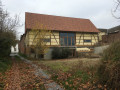 7.82 mi
+200 ft
-190 ft
3h 45
Moderate
Departure from Tongeren (Province de Limbourg)
Borgloon and its Transparent Chapel 3.43 mi
+174 ft
-167 ft
1h 45
7.82 mi
+200 ft
-190 ft
3h 45
Moderate
Departure from Tongeren (Province de Limbourg)
Borgloon and its Transparent Chapel 3.43 mi
+174 ft
-167 ft
1h 45
 Easy
Departure from Borgloon (Province de Limbourg)
Circular through the Limburg orchards starting from Helshoven
Easy
Departure from Borgloon (Province de Limbourg)
Circular through the Limburg orchards starting from Helshoven  8.11 mi
+213 ft
-220 ft
3h 55
Moderate
Departure from Borgloon (Province de Limbourg)
Route des Châteaux à Tongeren
8.11 mi
+213 ft
-220 ft
3h 55
Moderate
Departure from Borgloon (Province de Limbourg)
Route des Châteaux à Tongeren 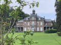 8.40 mi
+272 ft
-279 ft
4h 05
Moderate
Departure from Tongeren (Province de Limbourg)
Hanneffe – Avin – Hannut
8.40 mi
+272 ft
-279 ft
4h 05
Moderate
Departure from Tongeren (Province de Limbourg)
Hanneffe – Avin – Hannut  12.39 mi
+282 ft
-308 ft
5h 55
12.39 mi
+282 ft
-308 ft
5h 55
 Difficult
Departure from Donceel (Province de Liège)
Through the orchards around Hoepertingen
Difficult
Departure from Donceel (Province de Liège)
Through the orchards around Hoepertingen  11.38 mi
+266 ft
-246 ft
5h 30
Moderate
Departure from Sint-Truiden (Province de Limbourg)
The Geer Valley starting from Glons
11.38 mi
+266 ft
-246 ft
5h 30
Moderate
Departure from Sint-Truiden (Province de Limbourg)
The Geer Valley starting from Glons  7.78 mi
+246 ft
-233 ft
3h 50
Moderate
Departure from Bassenge (Province de Liège)
7.78 mi
+246 ft
-233 ft
3h 50
Moderate
Departure from Bassenge (Province de Liège)
For more walks, use our search engine .
The GPS track and description are the property of this route's author. Please do not copy them without permission.
Scan this QR code with your smartphone's camera.
To open this route on your smartphone, you must have the Visorando app installed. If not, got to the Apple Store (iPhone) or Google Play Store (Android) to download the app.
 Visorando Member
