Country:
 City:
City:


Parking near the Slins sports hall, Rue du Chainay 61, 4450 Juprelle
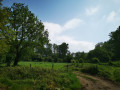
(S/E) Take the path opposite the sports hall, running alongside the fence (concrete posts), and join the dirt track, which you take to the right. Cross the concrete path and continue straight on until you reach the woods, where you head downhill to join a concrete land consolidation track further down.
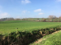
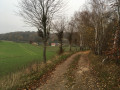
(1) Take this track to the right. It runs alongside the woodland (on the right) and farmland (on the left); follow it for approximately 1 km.
(2) At the end of the track, follow the dirt track to the left, which continues to run alongside the woodland. This track joins a railway line (single track); pass under it and continue to the left of the line until you reach Glons station.
(3) Once past the station, cross the tracks (level crossing) and take Rue de la Gare to the roundabout. At the roundabout, turn left, then immediately right before the railway bridge (two tracks), to follow a path leading up to a bridge over the tracks (Thier Saint-Laurent), which you cross to reach the junction with Rue Jonas.
(4) Turn right and continue to the end of Rue Jonas. Then turn right into Rue Saint-Pierre and follow it to the junction with Rue Bois Hamé. Turn right under the railway bridge.
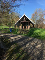
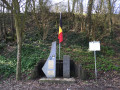
(5) As you emerge on the other side of the bridge (war memorial), turn onto the path that climbs to the right, passes in front of a chapel and then follows a narrow valley. Go up the two flights of steps and continue climbing to reach the plateau (fields).
(6) On the plateau, at the end of the path, turn left onto the concrete path, then, at the copse (ventilation shaft in the middle of the copse, military land), head down to the left into Rue du Chainay. Then join the road below (Provincial Road) and follow it down.
(7) After passing under the railway bridge again, turn right into Rue de Brus. As this street curves to the left (crucifix), turn right under the bridge (narrow tunnel).
(8) After the bridge, head up the path, keeping to the left. This path reaches the railway tracks before quickly moving away from them and gradually leading up to the plateau (cultivated fields). Take the concrete path on the left and follow it to the end. This path turns at a right angle to the right at the edge of the woods.
(9) At the end of the tarmac, take the hairpin bend left onto the path which heads back the way you came and descends to the E313 motorway. At the bottom of the path, take the dirt track to the right, behind a gate, which runs alongside the motorway, climbing slightly. This tree-lined path eventually runs alongside a copse and leads down to a motorway car park.
Go round the back of the car park and continue along the dirt track running parallel to the motorway. Carry on to the first junction.
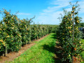
(10) Turn right onto the land consolidation track (Voie de Visée). At the end of the track, by an orchard of low-stemmed fruit trees, follow the concrete path to the left (Rue Eugène Vanal), which leads to the village of Slins.
(11) Once you reach the village street (Rue Provinciale), turn left onto it for 20 metres, cross it and turn into the alleyway on the right (after number 707, opposite the funeral parlour). This soon runs alongside a meadow (on the left), then widens near a school (on the right).
(12) Turn right into Rue de la Mer after the school, then right again into Rue de la Vaux. Next, turn left twice (Rue Montgorêt, then Rue du Tilleul) to reach Rue du Chainay. Turn right onto this street.
(13) Take the first path on the left, which runs diagonally, to reach the back of the housing estate, which leads directly to the sports centre, at the far end of the estate (S/E).


 Visorando Member


 Easy
Easy