Country:
 City:
City:


Starting point and car park: ‘De Velinx’ (free): Dijk 111, 3700 Tongeren-Borgloon, near the ‘De Motte’ playground and the sports ground.
(S/E) Head down towards the large pond and go round it on the right to reach the right bank of the Geer. Continue until you reach a low tower, visible on the other side of the stream (Tour des Drapiers).
(1) At the Tour des Drapiers, retrace your steps for about ten metres, cross the footbridge and take the ford on the left onto Kastaniewal. After 50 metres, turn right into the alleyway Onder de Linde, which is the entrance to the beguinage (alay religiouscommunity of beguines).
(2) Enter the beguinage, continue to the end of the street and turn right. Carry on straight ahead at the junction to reach the beguinage church. At the church, turn right into Brouwerstraat, then left at the end of the lane into Sint-Ursula-Straat. Turn left into the first street, then right into Sint-Rosastraat, heading towards the Moerenpoort Tower.
(3) Take the alleyway on the left before the Moerenpoort to enjoy the view of the old city walls.
(4) Walk along the ramparts and cross Leopoldwal Avenue a little further on at the pedestrian crossing, then turn back. Ignore the street (Sportpleinstraat) opposite the tower and, 50 metres further on, take the concrete footpath that winds along the stream (also ignore the straight path leading to the municipal gardens).
(5) This path soon crosses the Geer: carry on to the end and turn left into Oude Blaarstraat, which leads to the tunnel under the railway line; go through it.
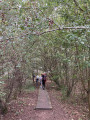
(6) Once you reach the Kevie nature reserve, after the tunnel, take the path on the right, which is protected by a gate. It runs alongside the railway line, below the embankment. At the end of the wooden walkway, carry on for a few metres and take the wooden and rope bridge to cross the stream (Oude Jeker). Then rejoin the path leading into the copse (do not cross the road!). This path runs alongside the stream at a distance and leads onto a concrete footpath (with a bridge and bench visible).
(7) Turn left onto the concrete path and, after 250 metres, turn right onto the straight, tree-lined path. At the end, turn right into the lane. Follow it for 200 metres and cross the stream to reach a track suitable for vehicles.
(8) After 75 metres, turn right onto the path crossing the secondary stream and follow the main stream along its left bank for a good kilometre. At the end, the path turns left and leads to a small bridge, which you cross to continue straight on. Shortly afterwards, the path turns left, passes a viewing point, and then joins a tarmac road (Oude Blaarstraat).
(9) Turn left onto the road. This passes a picnic area.
(10) Carry on along the path, then pass an old mill. Ignore the two streets on the right and continue along the stream. The tarmac road gives way to a gravel path.
After 500 metres, the track turns right: ignore the first bridge and take the second one.
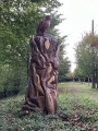
(11) After crossing the bridge, take the path on the right which leads to the track running alongside the stream. At the end, the track takes a sharp bend to the left before rejoining a lane shortly afterwards. Turn right onto this lane and follow it for 750 metres, then turn right onto the path running diagonally across, level with the totem pole visible on the other side of the lane (do not go back under the tunnel visible at the end of the lane).
(12) The path crosses the Geer and then leads into the residential areas: at the end, keep right into Beemdstraat, then turn left into the street of the same name. At the end of the street (church), turn left into Jamièstraat, go under the railway bridge and continue to Leopoldwal. Cross the boulevard (at the pedestrian crossing) and walk along its left-hand side for about fifty metres.
(13) Turn right into the shopping cul-de-sac. It leads to a square courtyard topped by a canopy. Cross the courtyard diagonally to exit on the right at the tourist information centre (which is housed in a former chapel).
(14) Head for the main street opposite (Masstrichterstraat) and turn right onto it until you reach the boulevard. Turn left.
(15) Then turn left onto Elfde Novemberwal (11 November Wall). You can choose to take either the lower path or the upper road to walk along these ancient ramparts. At the end, continue on to Vermeulenstraat and turn left. After 50 metres (opposite the entrance to a car park), turn right to go round the Administrative Centre and you’ll then come out onto Maastrichterstraat. Turn left onto this street and follow it for 150 metres, then turn right into Kielenstraat. After about 20 metres, turn right into the alleyway (signposted ‘Gallo-Roman Museum’).
(16) Walk past the Gallo-Roman Museum, then keep to the right to walk alongside the basilica (Evermaruspad).
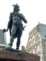
(17) With your back to the main entrance of the basilica, head towards the statue of Ambiorix and walk along Grote Markt Plein. Continue straight on along Sint-Jansstraat. At the bottom, first turn left then right to reach the banks of the Geer on Kastanjewal. Cross the road at number 42 and head to the car park opposite (S/E).
 Visorando Member


 Easy
Easy