


Refine your search for walks in Grésy-sur-Isère
Grésy-sur-Isère walks


 Mont de Grésy via Montailloset
 Visorando Member
 3.82 mi
 +2,136 ft
 -2,126 ft
 3h 35
 Moderate
 Departure from Grésy-sur-Isère (Savoie)
The ascent via Montailloset follows a steep path that no longer appears on IGN maps. It passes above the Gorges des Lavanches.
Grand Roc Circular Trail
 9.86 mi
+4,439 ft
-4,429 ft
8h 25
 Difficult
Departure from Cléry (Savoie) (Savoie)
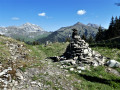
The Grand Roc, situated in the Bauges Massif Nature Reserve, boasts a wealth of wildflowers that are particularly striking in May: daffodils and narcissi in abundance all along the path. A steady path leads to the Col de la Fougère after a long climb.
You reach the Col du Haut du Four via a narrow path, then follow the ridge path with its breathtaking views over the Albertville valley, before finally reaching the Grand Roc with its splendid views of the surrounding peaks.
The Col d'Orgeval
 6.19 mi
+2,448 ft
-2,448 ft
5h 00
Moderate
Departure from École (Savoie)
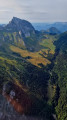
The Col d'Orgeval is located on theGRP® trail in the Massif des Bauges. More than the pass or the chalets, it is the superb Orgeval valley with its gentle slopes that will remain in hikers' memories.
The mountain pasture is owned by the same family, who graze a pretty herd of heifers there.
Pointe d'Arcalod via the Chalets d'Orgeval
 7.21 mi
+3,999 ft
-3,999 ft
6 hrs
 Very difficult
Departure from École (Savoie)
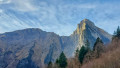
A beautiful, aerial and technical hike to climb to the highest point of the Bauges Massif (2,217 m).
Magnificent 360° panorama of the entire Bauges Massif and Mont Blanc.
Note on difficulty: following feedback from hikers, this hike has been classified as Very Difficult because the ascent and descent of the peak are quite technical.
Tour de l’Arcalod
18.64 mi
+6,283 ft
-6,293 ft
2 days
Difficult
Departure from École (Savoie)
A two-day route around the Pointe d’Arcalod, the highest point in the Bauges, passing through unspoilt wilderness, valleys and rivers. The suggested route mainly follows the GR® de Pays Tour de l’Arcalod, marked in yellow and red. Spectacular views of the mountains and Lake Annecy. This wild and little-used route is mainly situated within a Regulated Sensitive Area.
Nant Fourchu stream car park – Chalets de l’Eau Froide
8.13 mi
+4,140 ft
-2,103 ft
7h 20
Very difficult
Departure from École (Savoie)
First day of a two-day route around the Pointe d’Arcalod, the highest point in the Bauges, crossing wild areas, valleys and rivers. The proposed route mainly follows the eastern section of the GR® de Pays Tour de l’Arcalod, marked in yellow and red. Spectacular views of the mountains and Lake Annecy. This wild and little-used route is situated mainly within a sensitive, regulated area.The terrain is good and presents no particular difficulties.
Pointe de Chaurionde
 8.83 mi
+4,094 ft
-4,072 ft
7h 35
Difficult
Departure from École (Savoie)
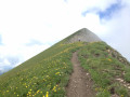
This hike will take you to the Pointe de Chaurionde via the Col du Haut du Four and the south-west ridge. Don't miss the chamois that inhabit the slopes. At the summit, you can admire Lake Annecy and Mont Blanc. You will cross the Vallon d'Orgeval (the valley of bears), which has now become a peaceful valley home to Tarine and Abondance cows and marmots.In June, the flora is magnificent and varied.
Chaurionde means "round summit".
(6) Access to the summit (or descent) via the Chalet de Coutarse is now prohibited (ZR zone of the PNR).
Pointe de la Fougère
 6.37 mi
+3,248 ft
-3,248 ft
5h 45
Moderate
Departure from École (Savoie)
Pointe de la Fougère is not the most popular of the Beaujus peaks. This hike retains a wild character; it is not uncommon to see animals on the ascent. Beautiful panoramic views of the nearby peaks and beyond.
Mont de la Coche and Tré le Mollard
 7.17 mi
+3,409 ft
-3,389 ft
6h 15
Difficult
Departure from École (Savoie)
This beautiful, wild circular hike starting from the Nant du Fourchu car park takes you to two peaks over 2,000 m in the Bauges massif in just a few kilometres, and can be completed with a climb to Pointe d'Arcalod. You may even see some marmots!
Combe Fort and Pointe de la Fougère
 5.96 mi
+2,838 ft
-2,841 ft
5h 15
Moderate
Departure from Jarsy (Savoie)
A hike through a wild area in the heart of the Bauges Massif, offering magnificent views of Pécloz, Arcalod and Orgeval. From Pointe de la Fougère, you can see the Isère Valley, the Beaufortain and Mont Blanc. Chamois and mouflons are abundant in this area.
Arcalod-Mont de la Coche circular from Bellevaux
 10.29 mi
+5,381 ft
-5,364 ft
8 hrs
Very difficult
Departure from École (Savoie)
This is a beautiful circular that allows you to see three sides of Arcalod, climb to the summit via Orgeval and descend via a wilder route. It is a demanding but magnificent hike in good weather.
Please note that access to the Pointe d'Arcalod is not recommended with children or in wet weather.
The Col d'Arclusaz
 9.19 mi
+3,035 ft
-3,035 ft
6h 50
Moderate
Departure from École (Savoie)
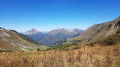
A lovely walk in the Arclusaz valley, dominated by some of the beautiful peaks of the Bauges.The colours of autumn are beginning to set the landscape ablaze.
Route de l'Armène
8.26 mi
+4,186 ft
-4,186 ft
7h 25
Difficult
Departure from École (Savoie)
A hike in the heart of the Bauges Massif towards one of its most beautiful peaks.
The ascent to the Col de l'Armène offers opportunities to spot chamois and enjoy varied panoramic views of the Northern Alps.
On the descent, be sure to visit the ruined village of La Chapelle and the Notre-Dame de Bellevaux Chapel.
Mont Pécloz and Mont d'Arménaz loop
 8.24 mi
+4,944 ft
-4,928 ft
8h 05
Difficult
Departure from École (Savoie)
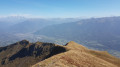
The most beautiful of the Baujus peaks! Loop hike Mont Pecloz 2197m and Mont d'Armenaz 2158m.
Please note: The descent from Mont Pécloz is rather tricky (exposure to rockfalls + some passages requiring the use of your hands).
Circular route via Mont Pécloz, Mont d'Arménaz and Pointe de la Fougère
 9.19 mi
+5,118 ft
-5,098 ft
7 hrs
Very difficult
Departure from École (Savoie)
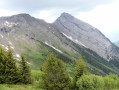
I recommend a lovely circular hike via Mont Pécloz, Mont d’Arménaz and Pointe de la Fougère.
Warning! Some sections are tricky, particularly the descent from Mont Pécloz towards Col d'Armène and the ridge between Mont d'Armenaz and Pointe de la Fougère
See the practical information section.
The Pecloz and Armenaz mountains
 7.96 mi
+4,951 ft
-4,948 ft
8h 00
Moderate
Departure from École (Savoie)
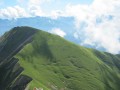
A beautiful, challenging circular route that takes you to two of the 14 2,000-metre peaks in the Bauges massif, Mont Pécloz and Mont d'Armenaz. The climb up to the pass separating the two peaks is quite steep, but you'll be accompanied by chamois. Once you reach the summit, Mont Pécloz offers a 360° view of the Alps. The descent is popular with ski tourers in winter.