Grande Lauzière and Tête Noire

A magnificent circular route starting from the Chamrousse resort, taking you to the summits of two peaks well known to hikers in the Belledonne range.
The route presents no particular technical difficulties or vertiginous sections, but the total distance and the cumulative elevation gain should satisfy even the most demanding hikers.

Details

n°15961060
Creation:
Last update:
Last review:
  • Walking
    Activity: Walking
  • ↔
    Distance: 13.30 mi
  • ◔
    Duration according to the author: 8 hrs 
  • ▲
    Difficulty: Very difficult

  • ⚐
    Back to start: Yes
  • ↗
    Ascent: + 5,233 ft
  • ↘
    Descent: - 5,213 ft

  • ▲
    Highest point: 8,921 ft
  • ▼
    Lowest point: 5,495 ft

Description of the walk

The route starts from the Chamrousse 1450 Le Recoin car park.

(S/E) Head towards the Aiguille ski lift, which you’ll pass very quickly. Then continue to the right at the next junction, heading towards the Col de la Balme, located above the top station of the Marmottes ski lift.

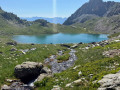
(1) Continue along the access track to the chairlift’s arrival building for a good hundred metres, then turn onto the marked path on the left. Join the Casse Rousse couloir which, via the southern Robert Pass, leads straight to the Robert Lakes.
Some sections, whether ascending or descending, require you to use your hands, but there is absolutely nothing insurmountable.

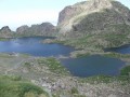
(2) Go round the lakes on the right, then head off along the path on the left to pass in front of a small shelter.

(3) At the fork, turn right, pass the last lake and continue along the main path (uneven but descending) for a good kilometre; ignore a path branching off to the left and you’ll soon reach a junction with a path branching off to the right.

(4) Leave theGR® route by taking the path on the right, where a steep climb lies ahead. Near the Combe de la Jasse Bralard, cross the stream and continue climbing towards Lac David; you will then find, on the plateau (around 2,400 m), a path on your right well before reaching the lake.

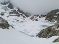
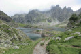
(5) Turn right and follow the path which runs along the summit ridge of this small shoulder. You’ll be walking through a completely rocky landscape where, in the distance, only the path marked by numerous cairns winds its way; follow this until you reach the foot of the Grande Lauzière (visible to the left of the path).

(6) When you reach the junction, there are two options:

(7) Reach the summit of the Grande Lauzière via the path leading uphill to the left
or
(8) Take the path on the right to go round the Tête Noire.
At this stage, you’ll have covered 11 km and climbed 1,400 m.
Once you’ve visited both summits, head back down to the junction leading to Lac David.

(5) Continue to the right and reach the junction leading to Lac David.

(9) Turn right, heading towards the Refuge de la Pra (in sight).

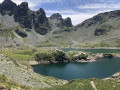
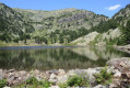
(10) With your back to the refuge, head back down to the lakes plateau, skirting Lake Claret on the right.

(11) Carry on and pass between Lac Longet and Lac Bernard to reach, much further down, Lac Léama. Cross the footbridge and continue along theGR®738, which will take you straight back to the Robert Lakes.

(3) Leave the route you took on the way up and follow theGR®738to the right, towards Brèche Robert Nord. Enjoy the view of the lakes before descending to the other side into a much more wooded landscape.

(12) At Lac des Pourettes, carry on along theGR®738and ignore the paths branching off on either side. Reach the ski area and, once the resort comes into view, let yourself glide down to Chamrousse 1450 (S/E).

Waypoints

  1. S/E : mi 0 - alt. 5,499 ft - Chamrousse le Recoin
  2. 1 : mi 0.65 - alt. 5,988 ft - Col de la Balme (1825m)
  3. 2 : mi 1.89 - alt. 6,572 ft - Lacs Robert
  4. 3 : mi 2.38 - alt. 6,578 ft - A/R junction
  5. 4 : mi 2.88 - alt. 6,302 ft - GR junction
  6. 5 : mi 4.51 - alt. 7,657 ft - Lac David junction
  7. 6 : mi 5.5 - alt. 8,858 ft - Grande Lauzière – Tête Noire junction
  8. 7 : mi 5.61 - alt. 8,921 ft - La Grande Lauzière (2741m)
  9. 8 : mi 6.03 - alt. 8,921 ft - Tête Noire (2727m)
  10. 9 : mi 7.31 - alt. 7,579 ft - Lac David
  11. 10 : mi 8.28 - alt. 6,909 ft - Refuge de la Pra
  12. 11 : mi 8.67 - alt. 6,726 ft - Lac Claret
  13. 12 : mi 11.78 - alt. 5,906 ft - Lac des Pourettes
  14. S/E : mi 13.3 - alt. 5,502 ft - Chamrousse le Recoin

Notes

There are no water sources along the route, apart from the numerous lakes you’ll pass and at the Refuge de la Pra.
You’ll spend very little time in the forest, so a hat and sun cream are essential.
At 2,800 m, the weather changes very quickly, so bring a change of clothes, a warm jacket, gloves and a hat, whatever the season (in October 2021, it was 10°C at the Lacs Robert at 9.30 am but 0°C with a wind at the summit of the Grande Lauzière...).

Worth a visit

As a general rule, you’ll never be on your own until you reach the Robert Lakes and as long as you’re following theGR®738.

Remember to look up between (4) and (5) as there are plenty of ibex all along the peaks of the Jasse Bralard (on your right), on the right-hand flank of the Grande Lauzière (so on your left) and on the small plateau (5) once you reach the junction with the Tête Noire

Finally, how could we fail to mention the Pra mountain refuge, with its beautiful surroundings and friendly wardens? A restorative stop-off here is almost a must....

Always be cautious and plan ahead when you're outdoors. Visorando and the author of this route cannot be held responsible for any accidents occurring on this route.

The GR® and PR® markings are the intellectual property of the Fédération Française de Randonnée Pédestre.

Reviews and comments

5 / 5
Based on 1 review

Reliability of the description
5 / 5
Ease of following the route
5 / 5
Route interest
5 / 5
User 9253834

Overall rating : 5 / 5

Date of your route : Sep 29, 2025
Reliability of the description : ★★★★★ Very good
Ease of following the route : ★★★★★ Very good
Route interest : ★★★★★ Very good
Very busy route : No

Very beautiful hikes, magnificent landscapes. Completed on Saturday, 20 September 2025 in strong winds. I hesitated to finish the summit section, having never been there before. But in reality, it's easy to do without any real effort.
Highly recommended

Machine-translated

Other walks in the area

For more walks, use our search engine .

The GPS track and description are the property of this route's author. Please do not copy them without permission.