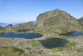
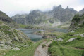
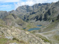
Lake Achard and the Arselle Plateau from La Croisette

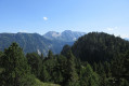
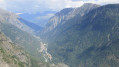
An enjoyable walk through the Swiss stone pines to explore the unspoilt setting of Lac Achard, then the magnificent Arselle Plateau and its peat bog, before returning to the Roche Béranger resort via the Prémol Forest.

Details

n°13071727
Creation:
Last update:
Last review:
  • Walking
    Activity: Walking
  • ↔
    Distance: 7.83 mi
  • ◔
    Average duration: 4h 40 
  • ▲
    Difficulty: Moderate

  • ⚐
    Back to start: Yes
  • ↗
    Ascent: + 1,257 ft
  • ↘
    Descent: - 1,273 ft

  • ▲
    Highest point: 6,375 ft
  • ▼
    Lowest point: 5,226 ft

Photos

Description of the walk

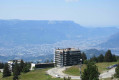
At Roche Béranger, park on the Route de la Croisette, near the residential complex of the same name. The start of the walks is marked by signposts next to the Croisette chairlift.

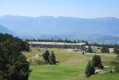
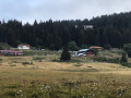
(S/E) Head east along the track that passes a bar-restaurant and leads to an artificial lake recently constructed in 2020: Lac de la Lauze (de Roche).

(1) Go round the lake on the left and take in the panoramic views. Turn back at the barrier preventing further access.

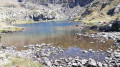
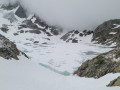
(1) Turn right onto the wide ski run that passes under a chairlift line. Pass the picnic tables on your right, then head into the Swiss stone pine forest. Stay on the main, signposted path, which climbs steadily before becoming increasingly stony, alternating between ascents and descents, until you reach Lac Achard.

(2) Walk round the lake (the route is clockwise). The walk follows a clearly visible track, with occasional rocks at the water’s edge, which can be crossed without difficulty.

(2) Head left (south then south-west) towards L’Arselle. Take care: the descent is very stony, with exposed tree roots. At the junction (elevation 1717), turn left onto the Astragale track on the L’Arselle estate.

(3) Turn right at the cairn and head down towards the Ruisseau de Salinière. Cross two footbridges. The path then moves away from the stream.

(4) Take the hairpin bend to the left onto the track. Cross the Salinière bridge, then look out for the Arselle plateau on your right. Keep to the left and follow the edge of the plateau.

(5) Keep to the left and head towards the barriers, following the track through the middle of the peat bog. Behind the barriers, there is a magnificent view. Caution: cliffs. You will reach the Brimbelles Bridge.

NB. If the middle section is too wet, take the path on the right via the boardwalk, which joins the rest of the route.

(6) Turn left onto the small path that runs alongside the stream below. You’ll reach a junction of tracks and paths.

(7) Carry on straight ahead along the stony track as it climbs.

(8) Turn left at the next junction. The track climbs, then descends to reach a clearing. The track then becomes a tarmac road.

(9) About a hundred metres past the clearing, turn right and head into the forest. At a Fork in the road, keep to the left. You’ll reach a junction with the track leading to the Pony Club.

(10) Turn left onto this track. Join the D111 and follow it to the left, downhill. After about 150 m, cross the road.

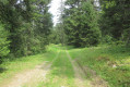
(11) Turn right onto the forest track leading into the Prémol Forest, signposted. Keep to the right and follow the signs for Roche Béranger.

(12) Take the hairpin bend to the right and follow the path uphill, signposted towards Roche Béranger.

(13) Cross the road at the fire station, then head right towards the large iron steps leading up to the resort. Cross the road, passing between the shopping centre and the Chalet des Moniteurs. Then climb the path until, at a bend, you rejoin the Route de la Croisette (S/E).

Waypoints

  1. S/E : mi 0 - alt. 5,846 ft - La Croisette
  2. 1 : mi 0.31 - alt. 6,001 ft - Lac de la Lauze (de Roche)
  3. 2 : mi 2.05 - alt. 6,293 ft - Lac Achard (Belledonne)
  4. 3 : mi 2.98 - alt. 5,538 ft - Cairn
  5. 4 : mi 3.37 - alt. 5,404 ft - La Salinière track
  6. 5 : mi 4.03 - alt. 5,279 ft - Barriers
  7. 6 : mi 4.18 - alt. 5,253 ft - Junction – Stream
  8. 7 : mi 4.39 - alt. 5,243 ft - Stony track
  9. 8 : mi 4.55 - alt. 5,305 ft - Junction
  10. 9 : mi 4.8 - alt. 5,256 ft - Junction
  11. 10 : mi 5.38 - alt. 5,299 ft - Junction – Track
  12. 11 : mi 5.7 - alt. 5,266 ft - Prémol forest track
  13. 12 : mi 7.1 - alt. 5,449 ft - Pin to the right
  14. 13 : mi 7.45 - alt. 5,614 ft - Crossing the D111
  15. S/E : mi 7.83 - alt. 5,846 ft - La Croisette

Notes

Wear sturdy walking boots to navigate the stony sections leading to Lac Achard. Take care in the damp areas of the Plateau de l’Arselle peat bog.

Lake Achard and the Plateau de l’Arselle

Walking off the paths and boardwalks is strictly prohibited within the Sensitive Natural Area (ENS) of the Arselle peat bog and Lake Achard (APPB No. 2003-09182 and municipal decree on the ENS)
Arselle peat bog: APPB, Natura 2000, listed site and ENS (sensitive natural area)
Dogs must be kept on a lead / fishing is prohibited on the bodies of water / camping, lighting fires, felling trees and picking plants are prohibited / Bivouacking is prohibited from 1 May to 30 October
There are wintering grounds for the Black Grouse in the area.

This route passes through a protected area, which may be subject to special regulations:

Reviews and comments

4 / 5
Based on 2 reviews

Reliability of the description
4 / 5
Ease of following the route
3.5 / 5
Route interest
4.5 / 5
User 17956527
• Edited:

Overall rating : 4.3 / 5

Date of your route : Jun 20, 2025
Reliability of the description : ★★★★☆ Good
Ease of following the route : ★★★★☆ Good
Route interest : ★★★★★ Very good
Very busy route : Yes

I left the Arcelle plateau at 8:30 a.m., which was ideal because there was no one around until I reached Lac Achard. Then, between 11 a.m. and 12 p.m. at Lac Robert, there were a few small groups, but nothing too bad. I'd recommend doing this during the week if possible, as it's much less crowded than on weekends.However, I found the return trip a bit complicated in terms of signage (Le Recoin, Roc Béranger), but not L'Arcelle for those who don't know it (like me), which isn't necessarily obvious. I could have cut across before ending up in Chamrousse 1650, but I got back anyway.

Machine-translated

nelisa2669
nelisa2669

Overall rating : 3.7 / 5

Date of your route : Jun 26, 2023
Reliability of the description : ★★★★☆ Good
Ease of following the route : ★★★☆☆ Average
Route interest : ★★★★☆ Good
Very busy route : No

Some of the directions for the junctions were vague, and I only managed to find my way using the altitude readings (once I’d passed the Arcelles plateau and before joining the departmental road).
It was also just as well that I knew the turn-off for Roche Béranger, where I ended up at Chamrousse 1650.

Machine-translated

Other walks in the area

For more walks, use our search engine .

The GPS track and description are the property of this route's author. Please do not copy them without permission.