


 Country:

 City:
City:


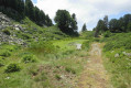
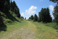
At Roche Béranger, park on the Route de la Croisette near the residential complex of the same name. The start of the walks is marked by signposts next to the Croisette chairlift.
(S/E) Turn left, heading due north, onto the path that runs alongside the road towards Lac des Vallons. At the end of the path, turn right onto the track and follow the signposts towards Lac des Vallons. On the left, there are lovely views of Le Recoin and the Grenoble valley. Follow the path which turns left, then right, and leads to Lac des Vallons. Go round the lake on the right. You’ll reach the signpost for Lac des Vallons 1,790 m.
(1) Turn right onto the track which climbs steeply towards the Lacs Robert. Pass beneath the Croix de Chamrousse cable car. After a short descent, you’ll reach the Col de la Balme (signpost).
(2) Keep to the left, heading north. The track descends and reaches a livestock fence. Follow the fence to the right, following the red Casserousse ski run. Look out for a cave on the left. You’ll reach an X-shaped junction (signpost for L’Aiguille).
(3) Continue to get as close as possible to the cave, then resume the route across the fields to rejoin the path heading east, marked with yellow and white-and-red markings. Follow this path as it enters the forest – theGR®738. You’ll reach a small lake, then a Y-junction with a signpost.
(4) Turn right, towards Lac des Pourettes. After a short descent followed by a steep, rocky climb, you’ll come to Lac des Pourettes; walk along its right-hand side.
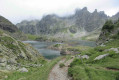
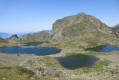
(5) From this point (alt. 1,850 m), the going gets tougher with steep climbs and rocks to negotiate (a cable is fixed into the rock). Near the Lacs Robert, the path levels out as it runs alongside scree. You’ll catch sight of the lakes; keep to the left as you descend the mountainside towards the Brèche Nord (2,008 m) (signpost).
(6) Turn right at the signpost and walk round the lakes on the left-hand side. Pass a mountain hut and then the Lacs Robert chairlift. Continue to the Brèche Sud (2,020 m) (signpost).
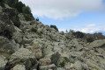
(7) Head towards Le Recoin, heading west. The path climbs and soon reaches a large scree slope. Follow the yellow markings and the numerous cairns. Take great care (cable in place). The path gradually levels out and reaches a signpost. Follow the signs for Le Recoin. Further on, you’ll reach asecond signpost for the Couloir de la Casse Rousse (1,960 m) and an X-shaped junction.
(8) Keep left onto the wide grassy path (blue ski run). Pass a small marshy pond and then keep to the right. You’ll reach a Y-junction.
(9) Turn right and head down the steep, stony path. Then cross a meadow and return to the Col de la Balme, which you passed on the way out.
(2) Turn left and, following the route in reverse to the outward journey, head for Lac des Vallons.
(1) Go round it on the right and, following the route in the opposite direction to the outward journey, return to the (S/E).
 Regulations at Lac Robert


 Visorando Member

 Difficult
 Easy
Easy 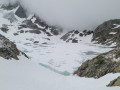
 Very difficult
