


Refine your search for walks in Gîte de Molliessoulaz
Gîte de Molliessoulaz walks


 Tour du Beaufortain
 Visorando Member
 57.03 mi
 +18,586 ft
 -18,638 ft
 7 days
 Moderate
 Departure from Hauteluce (Savoie)
The Beaufortain, between Albertville and Bourg-Saint-Maurice, offers a 7-day tour that will take you on a journey through a landscape reminiscent of Switzerland.
Walks near Gîte de Molliessoulaz
From Albertville station to the Refuge du Soplat des Streams
 7.03 mi
+4,177 ft
-604 ft
6h 50
7.03 mi
+4,177 ft
-604 ft
6h 50
 Difficult
Departure from Albertville (Savoie)
Difficult
Departure from Albertville (Savoie)
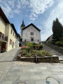
A lovely climb starting from Albertville, passing through the medieval town of Conflans and pretty mountain hamlets with views of the Tarentaise Valley, before reaching the Refuge du Soplat des Stream. The refuge is ideally located near the Tour du Beaufortain with a beautiful view of Albertville and the Olympic Park. Hike to be done from May to November: avalanche risk in winter above 1,100 metres.
Les Saisies - Roselette Chalet
10.55 mi
+2,303 ft
-1,647 ft
6h 50
Moderate
Departure from Hauteluce (Savoie)
Stage 1 of the Tour du Beaufortain, connecting Les Saisies resort to the Roselette chalet.
Lac Tournant
 7.86 mi
+2,064 ft
-4,298 ft
5h 25
Moderate
Departure from Beaufort (Savoie) (Savoie)
7.86 mi
+2,064 ft
-4,298 ft
5h 25
Moderate
Departure from Beaufort (Savoie) (Savoie)
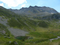
This is a circular walk based on trail 5 as promoted by the Arêches tourist board. It is well marked with yellow signs and paint flashes or markers for trail 5. There are good views over to Mont Blanc, the Beaufortain Mountains and the lake, although small, is a nice place to eat your sandwiches.
The Curé passage
10.65 mi
+2,900 ft
-4,199 ft
7h 25
Difficult
Departure from Beaufort (Savoie) (Savoie)
Lake Gittaz and the Curé passage.
Chalet de l'Econdu - Chalet des Arolles
8.95 mi
+2,503 ft
-2,470 ft
6h 20
Difficult
Departure from Granier (Savoie)
Another long stage offering the chance to discover Lake Saint-Guérin.
Refuge de la Thuile – Col de l’Arc
9.24 mi
+4,009 ft
-3,770 ft
7h 45
 Very difficult
Departure from Sainte-Hélène-sur-Isère (Savoie)
Very difficult
Departure from Sainte-Hélène-sur-Isère (Savoie)
A change of scenery: the view opens out towards the Beaufortain, the Tarentaise, the Aravis and then the Vanoise. You pass beneath the Grand Arc, descend towards the Vallon de Bayet, cross the Col Basmont, then spend the night at the Col de l’Arc in the unmanned hut
Plan de la Lai refuge - Chalet de l'Écondu
10.07 mi
+3,274 ft
-3,081 ft
7h 30
Difficult
Departure from Beaufort (Savoie) (Savoie)
This is a long stage between La Lai and L'Écondu, offering superb views of Lac de Roselend at the start.
From the Baraque de l'Abbaye to the Chalet de l'Alpettaz
 9.20 mi
+3,583 ft
-2,201 ft
7h 20
Difficult
Departure from Seythenex (Haute-Savoie)
9.20 mi
+3,583 ft
-2,201 ft
7h 20
Difficult
Departure from Seythenex (Haute-Savoie)
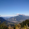
This hike takes you to the heart of the Faverges-Seythenex valley, following the Lac d'Annecy with the Torrent de Saint-Ruph, which is the lake's main source of water, ending with a view of Albertville and Mont Blanc at the Col de l'Alpettaz (alt. 1,580 m).
Chalets de l’Eau Froide – Stream Fourchu car park
10.52 mi
+2,142 ft
-4,190 ft
6h 40
Difficult
Departure from Giez (Haute-Savoie)
The second day of a two-day route around the Pointe d’Arcalod, the highest point in the Bauges, passing through wild areas, valleys and along rivers. The proposed route mainly follows the western section of the GR® de Pays Tour de l’Arcalod, marked in yellow and red. Spectacular views of the mountains and Lake Annecy. This wild and little-used route is situated mainly within a sensitive, regulated area. The terrain is good and presents no particular difficulties.
Col de l’Arc – Refuge du Logis des Fées
8.91 mi
+3,353 ft
-3,406 ft
7h 00
Difficult
Departure from La Léchère (Savoie)
It’s hard to say much about this section, as we completed the whole of it in driving rain and cloud. The route is challenging and stony, with numerous herds of livestock and detours… But it remains so beautiful despite everything. The climb up the Bellachat is less difficult than it looks. The landscape is actually very varied: there’s a lot of rocky terrain on the ascent of the Bellachat, with steep cirques all the way to the Lacs du Loup, where the mountain pastures take over before giving way to the Cirque du Colomban, only to return near the Refuge du Logis des Fées.