Country:

 City:
City:


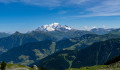
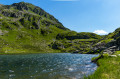
(S) From the refuge, head up through the Rognoux mountain pastures to the top of the Col de la Forclaz ski lift
(1) Continue on to reach the Col de la Forclaz quickly.
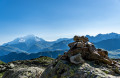
(2) Follow the yellow-marked path (also marked by numerous cairns) which climbs along the ridge, through a very rocky landscape. Leave the path leading up to the Col de la Louze on your left and continue the ascent straight ahead. Take care here: there may be one or two snowfields even late in the season. Reach the Y-junction below the summit of the Grand Mont.
(3) Head right to reach the summit of the Grand Mont, with its cross and aerial.
(4) Return to the previous junction.
(3) Take an unmarked path on the right – marked by cairns – to a small clearing near the ruins of a shelter (a clearly visible circle of stones).
Begin the (very steep) descent towards the Sept Lacs: the path is unmarked, but the numerous cairns make it easy to find your way between the rocky outcrops. The view of the Tempête lakes accompanies you throughout the long descent. After a final tricky section over scree, you’ll reach the Sept Lacs valley.
(5) Continue to the right, heading downstream, whilst staying slightly higher up as the ground at the bottom is very wet. Cross numerous streams and arrive above Lac Vert, which is theseventh and final lake.
(6) Descend to the valley floor towards the ruins of the Chizeraz chalets and cross the Bénétant torrent – this may be more or less difficult depending on the water level.
(7) Pass close to the ruins, then a first descent leads to a small plateau near the ruins of the Dard chalets.
(8) From here, begin the descent alongside the Dard waterfall. This descent is very steep and exposed but well-equipped with metal steps and cables at the trickiest sections. However, some sections can be slippery in wet conditions, so take care!
At the bottom of the slope, you’ll reach the Bénétant valley and come to a dirt track. Take this to the right until you reach a wide ford.
(9) Cross it and join the road leading uphill towards La Ravoire. At the junction with the path leading down to the Pont de Cavet, continue to the right. After a series of hairpin bends, you’ll reach the houses in the hamlet known as Le Châtelard.
(10) Carry on to the right; at the next crossroads, leave the Chemin des Ardoisières on your right and continue along the flat dirt track. Finish with a few hairpin bends downhill to return to the La Ravoire car park above La Bâthie (E)
 Visorando Member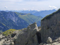
 Moderate
 Easy
Easy