Country:
 City:
City:


Starting point: Quai Paul Boudet, at the Boudet bus stop – line D. For those arriving by car, please use the designated parking spaces on Rue de la Cale.
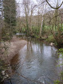
(S/E) Set off along Quai Paul Boudet with the River Mayenne on your right, cross the Avesnières Bridge and join the towpath.
(1) Walk along this path, with the River Mayenne on your left, past the water treatment plant until you reach the D1.
(2) Continue along the towpath, which runs as close as possible to the departmental road. Walk as far as the entrance to the hamlet of Saint-Pierre.
(3) Walk past the houses on your left, rejoin the D1 (coach stop) and take the first turn left then right to join the Chemin de Sainte-Croix.
(4) At the first junction, turn right up towards Chemin de la Lande and follow it, turning left. At the crossroads, carry straight on to reach the roundabout on the D112.
(5) Go round the roundabout on the right, cross the departmental road carefully to join the parallel greenway. Turn right, cut across a forest track and continue to the next one.
(6) Turn left, then right at a 90° angle at the first junction. Carry on straight ahead, passing a large car park on your right – which could serve as another starting point for this walk – and go round the back of a detached house. Then turn right to join the D112.
(7) Cross the road carefully and take the path immediately on the left. Walk past the working dog training centre and join a small road. Follow it in the same direction, passing close to a reservoir; ignore a path on the left and carry on to the next junction.
(8) Turn right and follow the small road called Chemin de la Gommetière to the entrance to Laval, ignoring any turn-offs on the right.
(9) Turn left to take the underpass beneath Boulevard des Trappistines, then turn right immediately. Turn left to follow Rue de l’Huisserie for about a hundred metres, then turn right into Rue de l’École. Continue to Place d’Avesnières, cross it, then walk along the left-hand side of the basilica to rejoin the towpath.
(10) Turn left, first following the Quai d’Avesnières and then the Quai Albert Goupil to reach the Pont Vieux.
(11) Cross the Mayenne via this bridge, then turn right to follow Quai Paul Boudet as far as the Boudet bus stop (S/E).

 Visorando Member

 Easy
Easy