


 Country:
 City:
City:


The start is from the Espace du Maine car park, behind the town hall.
(S/E) With your back to the town hall, take the Chemin de la Peignerie (on your left when facing the theatre) and follow it as far as the schools.
(1) At the state school, cross the road towards the sports halls and leave them on your right to take the road leading towards Le Fougeray. After the housing estate, at the 10 o’clock position, you’ll see the hangars at Laval Aerodrome.
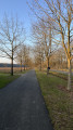
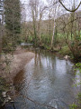
(2) At Le Fougeray, follow the sign for the towpath and head down the path, which can be muddy in winter and lined with flowers in fine weather. When you reach the river, take the towpath on your left for 2 km until you reach the hamlet of Saint-Pierre-le-Potier on the opposite bank.
(3) Continue along the towpath alongside the D1 and pass the Cumont Lock.
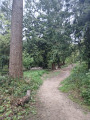
(4) After the lock, cross the road to enter the woods (a walking sign points towards Ahuillé). Follow the path uphill for about 200 metres.
(5) At a junction marked with mountain bike signposts, take the path leading uphill to the right. If you can see the orange 255 marker at the top on the right, you’re on the right track. Continue along this path on the cliff-top (with a view of Laval through the trees) until you reach a wider track, the old D1.
(6) Take this old main road on the right. At a large junction, you’ll be tempted to carry on straight ahead down this main road. Ignore it and take the path on the left under the fir trees. Carry on straight for 1 km until you reach a tarmac road (dog training centre).
(7) Cross the road and head back into the woods, continuing straight on. You’ll soon reach another tarmac road. Take the Allée de la Croix du Breton. After the large crossroads, walk a further 100 m and follow the fitness trail in the opposite direction.
(8) After the ‘sauts de puces’, turn right, then take the first path on the left which leads uphill. At the three-way junction, keep to the right and follow this path straight on until you come out of the woods.
(9) As you emerge from the woods, you can see Laval Racecourse on your right. Follow this path to the road and turn left. The road winds round a few bends.
(10) When you reach a property with a large gate and stone walls (No. 750), take the path on the left. Keep the houses on your left and the fields on your right.
(11) At a small roundabout, go straight across to take the path slightly to the right. Walk past the car garages via the footpath alongside the road
(12) At a large roundabout, turn right and continue along Rue du Bois.
(13) At the “Villa”, carry on straight towards the village centre, using the church as a landmark. Walk past the bakery and round the church to reach the car park behind the town hall (S/E).

 Visorando Member
 Easy
Easy 
 Tourist office
