Blaches Forest, Combe de Vau and the old hamlet of Pinet

This is a varied hike that crosses the Blaches Forest via a wide track before descending to the Combe de Vau nature reserve with its beautiful rolling hills.
The return journey takes you through the old hamlet of Pinet, where you can discover some historical curiosities.
This hike is also suitable for mountain bikes.

Details

4384991
Creation:
Last update:
Last review:
  • Walking
    Activity: Walking
  • ↔
    Distance: 6.20 mi
  • ◔
    Average duration: 3h 05 
  • ▲
    Difficulty: Moderate

  • ⚐
    Back to start: Yes
  • ↗
    Ascent: + 308 ft
  • ↘
    Descent: - 312 ft

  • ▲
    Highest point: 1,493 ft
  • ▼
    Lowest point: 1,194 ft

Photos

Description of the walk

To get to the start of the hike:
From Eyzin-Pinet, take the D38 towards Cours-et-Buis. Pass the hamlet of Pinet and, at the top of the hill, take the only small road on the left called Chemin des Blaches. At the end of this small road, there are a few places to park. (See below in the practical information section for the possibility of shifting the starting point slightly).

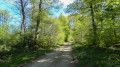
(S/E) At the end of the tarmac road, take the wide, fairly straight track on the right (les combes), which is rather stony. After a little over 600 m, at the fork in the track, take the left fork. After 2.3 km of track through the forest, you will see a clearing on the right with two houses and a wide path coming in from the right. Continue along the track, keeping slightly to the left.

(1) 300 m further on, 100 m after a third house, the track splits in two; take the left fork.
Continue along the track until you reach the yellowPR® signpost marked La Piencière.

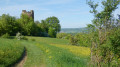
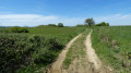
(2) At this sign, turn left onto Chemin de la Piencière, a wide grassy path with large ruts at the beginning, towards the Pinet tower and Le Paviot. After 500 m on this grassy and often wet path, offering a very clear view, you will arrive at the yellow Le Paviot sign. Continue straight ahead towards the Pinet tower.

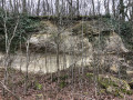
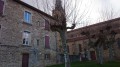
(3) The path becomes a small tarmac road that descends straight ahead. Towards the end of this descent, you will see tuff and moraine outcrops on the left (photo 2).
After a little over 500 m of descent, the road makes a hairpin bend to the left.

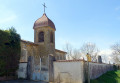
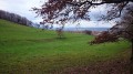
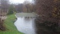
(4) 150 m after this hairpin bend, you will arrive in front of a large renovated house. This is the start of the Combe de Vau nature reserve. Take the very small road, Chemin de Charpenet, which is marked in yellow (sign prohibiting vehicles over 19 tonnes) and continues straight ahead, passing to the left of the house. At the start of this small road, you will see a small spring on the left (photo 3), then the chapel (photo 4) in the grounds of the large house.

Continue along this small road, passing in front of the goat farm, where you can see the beautiful rolling meadows of Combe de Vaux on the right.

Continue along the poorly maintained small road until you pass a first house, then 120 m further on, a second house. At the second house, the small road turns into a wide stony path; follow it. The path remains on the edge of the forest for a long time and offers beautiful views of the pastures of the combe.
Then the path enters the forest. After a small water source on the left, you will reach a third house. Continue along the same path, almost straight ahead.

About 50 metres after the third house, you will see a somewhat naive art brut wall on the left (photo 5), with an explanatory panel. The path returns to the edge of the forest, with a meadow on the right. There is an unobstructed view of the Gère plain.

(5) Just before the end of the meadow on the right, when the path begins to descend, at a crossroads, leave the main path (marked with a yellow cross) and take the wide stony path slightly to the left (Chemin de Saint-Marcel).

This path climbs, then turns left and offers a view of the village of Eyzin on the right. At the top, at the crossroads, continue almost straight ahead. You will then leave the sensitive natural area of the Combe de Vaux. Continue along the main path for about a kilometre until you reach a small tarmac road.

(6) Follow this tarmac road for almost 400 metres. During these 400 metres, you will walk alongside a forest on your left.

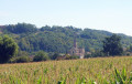
(7) When the forest ends and a field appears (about 60 metres before a house with a round tower), turn right at a right angle onto a wide grassy path that runs alongside the forest. This path turns into a trail that crosses wetlands, then later becomes a wide gravel path again. You will have a view of the rear of Pinet Castle (photo 6) and the Pinet tower. The path climbs to reach the road (D 38).

(8) When you reach the D 38 in the hamlet of Pinet, turn left onto the road that climbs for about 100 metres, running alongside the rocky wall of Pinet Castle. Be careful of traffic on this road.

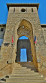
(9) At the end of the castle wall, turn left onto Impasse de la Tour. You will see some beautifully renovated houses on your left, then take the path on the right that climbs uphill. After 150 metres, you will see the Pinet tower (photo 7) on your right, covered with bricks.

(10) At the crossroads called La Tour de Pinet, take the path on the left towards the Forêt des Blaches and Meyssiez. At the next crossroads called Les Crêtes, continue straight on towards the Forêt des Blaches. After about 20 metres, you will return to the starting point (S/E).


Waypoints

  1. S/E : mi 0 - alt. 1,407 ft - End of the small road
  2. 1 : mi 1.65 - alt. 1,467 ft - Exit from the main track
  3. 2 : mi 1.9 - alt. 1,480 ft - PR La Piencière sign
  4. 3 : mi 2.39 - alt. 1,447 ft - Road junction
  5. 4 : mi 2.84 - alt. 1,211 ft - Maison Bovier - Start of the Chemin de Charepenet
  6. 5 : mi 4.37 - alt. 1,207 ft - Exit to the left of the main path.
  7. 6 : mi 5.01 - alt. 1,220 ft - Road junction
  8. 7 : mi 5.25 - alt. 1,204 ft - Fork in the road before the hamlet of Pérouse.
  9. 8 : mi 5.67 - alt. 1,280 ft - Route D38
  10. 9 : mi 5.74 - alt. 1,306 ft - Impasse de la Tour fork
  11. 10 : mi 5.95 - alt. 1,388 ft - PR La tour de Pinet junction
  12. S/E : mi 6.2 - alt. 1,411 ft - End of the small road

Notes

You can also start after 300 m of track, which is accessible by car. There are places to park on the side of the road, a turning area and a picnic table, which can be nice at the end of the hike.
There is no drinking water along the route, but there are water points for animals.
No special equipment is required.
Some sections are muddy during heavy rain.

Worth a visit

At the point (4), you can go down a little to the right on the road (about 80 m) to admire the restored house, the park and the chapel.
At the point (8), you can take the time to discover the 19th-century castle a little further down, which was built on the ruins of an old convent.
You can also take the opportunity to discover the fountain of 10,000 martyrs by following the path under the old houses of Pinet.

For more details on the history, see the website:
https://www.eyzin-pinet.fr/historique/

Always be cautious and plan ahead when you're outdoors. Visorando and the author of this route cannot be held responsible for any accidents occurring on this route.

The GR® and PR® markings are the intellectual property of the Fédération Française de Randonnée Pédestre.

Reviews and comments

4.7 / 5
Based on 14 reviews

Reliability of the description
4.9 / 5
Ease of following the route
4.7 / 5
Route interest
4.4 / 5
dougere
dougere
• Edited:

Overall rating : 4.7 / 5

Date of your route : Apr 18, 2026
Reliability of the description : ★★★★★ Very good
Ease of following the route : ★★★★★ Very good
Route interest : ★★★★☆ Good
Very busy route : No

A lovely, varied walk through woodland, countryside, pastures with goats and sheep, and ending with a historic tower.
The very muddy section just after point 7 isn’t insurmountable; you can get around it.

Machine-translated

MJC Bellegarde Poussieu

Overall rating : 4.7 / 5

Date of your route : Mar 23, 2026
Reliability of the description : ★★★★★ Very good
Ease of following the route : ★★★★★ Very good
Route interest : ★★★★☆ Good
Very busy route : Yes

A pleasant walk through the Blaches Forest, with lovely views all the way.

Machine-translated

Phil69
Phil69

Overall rating : 5 / 5

Date of your route : Nov 17, 2025
Reliability of the description : ★★★★★ Very good
Ease of following the route : ★★★★★ Very good
Route interest : ★★★★★ Very good
Very busy route : No

A good idea, transformed by us into an enjoyable moment, with the icing on the cake being the astonishing work of art by snake hunter Maurice Lombart.

Machine-translated

User 4186781

Overall rating : 4.3 / 5

Date of your route : Aug 19, 2025
Reliability of the description : ★★★★★ Very good
Ease of following the route : ★★★★☆ Good
Route interest : ★★★★☆ Good
Very busy route : No

Machine-translated

TineDo
TineDo
• Edited:

Overall rating : 5 / 5

Date of your route : Feb 20, 2024
Reliability of the description : ★★★★★ Very good
Ease of following the route : ★★★★★ Very good
Route interest : ★★★★★ Very good
Very busy route : No

A pleasant and varied hike on easy trails. Moraines, an impressive brick tower, two fountains, valleys, goats, a pink castle, forests, pastures, small streams, and, the highlight of the route, an unusual wall of art brut.
At point 7, be careful not to miss the path on the left, in front of a field where there is sometimes a truck converted into a mobile home.
However, avoid walking this route the day after rain, as the paths may be wet and muddy.
The GPS app complements the paper description well.
I would gladly do this again.

Machine-translated

Noëlle Eymin
Noëlle Eymin

Overall rating : 5 / 5

Date of your route : Aug 02, 2023
Reliability of the description : ★★★★★ Very good
Ease of following the route : ★★★★★ Very good
Route interest : ★★★★★ Very good
Very busy route : No

The route is perfectly described, but be careful at level 7: the path is narrow and somewhat overgrown, and we got distracted by a refrigerated lorry converted into a mobile home on the right, opposite the entrance to this small path.

Machine-translated

Klaudius33
Klaudius33

Thank you for your feedback. Your comments are also useful for correcting any errors.

Machine-translated

Karamazow
Karamazow

Overall rating : 4.3 / 5

Date of your route : Jul 24, 2023
Reliability of the description : ★★★★★ Very good
Ease of following the route : ★★★★☆ Good
Route interest : ★★★★☆ Good
Very busy route : No

A very pleasant walk in the forest during a heatwave!

Machine-translated

Toumpy
Toumpy

Overall rating : 4.3 / 5

Date of your route : Aug 21, 2022
Reliability of the description : ★★★★★ Very good
Ease of following the route : ★★★★☆ Good
Route interest : ★★★★☆ Good
Very busy route : No

A beautiful hike in the woods, which is usually very much appreciated in the summer heat.
Beautiful views
Very little elevation gain, so really accessible
Note that the grassy path at the end of the route, just before the house with the round tower, is a little difficult to find as it is rarely used, so the grass is tall and the path is almost invisible: it is best to follow the woods on your left.

Machine-translated

patball
patball

Overall rating : 4.3 / 5

Date of your route : Jul 03, 2022
Reliability of the description : ★★★★★ Very good
Ease of following the route : ★★★★☆ Good
Route interest : ★★★★☆ Good
Very busy route : No

A pleasant walk, mostly in the shade. Varied landscapes. A few wet areas, but no difficulty, especially in summer.
Please note that the yellow markings can sometimes be confusing. However, with the description and GPX track, there is no problem.
From the outset, we used the forest paths rather than the stony track, which was quite busy with vehicles.
Thanks to the author for this hike.

Machine-translated

Gerard.REYNAUD
Gerard.REYNAUD

Overall rating : 5 / 5

Date of your route : Nov 11, 2021
Reliability of the description : ★★★★★ Very good
Ease of following the route : Not used / Not applicable
Route interest : ★★★★★ Very good
Very busy route : No

Pleasant, varied walk, with a few muddy sections between 7 and 8, which can be avoided in rainy weather by returning directly to the starting point (see map).

Machine-translated

Klaudius33
Klaudius33

Overall rating : 4.7 / 5

Date of your route : Sep 30, 2021
Reliability of the description : ★★★★☆ Good
Ease of following the route : ★★★★★ Very good
Route interest : ★★★★★ Very good
Very busy route : No

Hiking, with beautiful views. Unfortunately, between points 7 and 8, we had to go down into the field and then back onto the trail because there was a lot of water running down from the woods.
Apart from this minor issue, the road after point 8 is very dangerous for about 150 metres because there is a lot of traffic.
Otherwise, no problems. An interesting hike to discover.

Machine-translated

Françoise escoffier
Françoise escoffier

Overall rating : 4.7 / 5

Date of your route : Mar 29, 2021
Reliability of the description : ★★★★★ Very good
Ease of following the route : ★★★★★ Very good
Route interest : ★★★★☆ Good
Very busy route : No

Beautiful, easy hike, lovely ponds, perfect route.

Machine-translated

Viennois63
Viennois63

Overall rating : 4.7 / 5

Date of your route : Mar 10, 2021
Reliability of the description : ★★★★★ Very good
Ease of following the route : ★★★★★ Very good
Route interest : ★★★★☆ Good
Very busy route : No

Easy route, mostly through woodland.

Machine-translated

Other walks in the area

For more walks, use our search engine .

The GPS track and description are the property of this route's author. Please do not copy them without permission.