Variation of route No. 2 around Eyzin-Pinet

When the weather is too wet, this variation allows you to avoid the muddy clay section between the hamlet of Le Salin and the village of Pinet. It also offers a view of part of Montfort Castle.

Details

93865
Creation:
Last update:
Last review:
  • Walking
    Activity: Walking
  • ↔
    Distance: 4.50 mi
  • ◔
    Average duration: 2h 35 
  • ▲
    Difficulty: Easy

  • ⚐
    Back to start: Yes
  • ↗
    Ascent: + 571 ft
  • ↘
    Descent: - 568 ft

  • ▲
    Highest point: 1,430 ft
  • ▼
    Lowest point: 873 ft

Photos

Description of the walk

Park in the main square of the village of Eyzin-Pinet, opposite the town hall and the swimming pool.

(S/E) Set off along the narrow lane between the pharmacy and a beautiful Dauphiné-style house. At the end, turn right onto Rue du Salin. Then, at the end of Rue du Salin, head down the path on the far left and take the small lane on the right before the main street. You will emerge at the foot of the church.

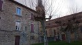
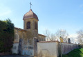
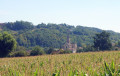
(1) Follow the tarmac path on the right (below the church) (photo 1), join the Montée de l’Église and continue along it.
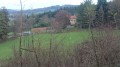
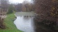
The road turns into a track; continue straight on, cross the D38, then take Chemin des Parents opposite; you will see the lower part of Montfort Castle on your left (photo 2). Join the D38.

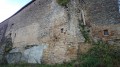
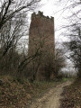
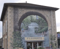
(2) Turn left onto it and follow it to the hamlet of Pinet. Continue up the road (D38) and after a few dozen metres, turn right onto Impasse des 10000 martyrs for about twenty metres (you can continue as far as the Source des Dix Mille Martyrs, where salamanders breed in some years). Turn left into a narrow lane between two houses and climb a few steps. Return to the road (D38) and take it to the right. Walk along the ramparts of the old fortified castle of Pinet (photo 4). At the end of the ramparts, turn left onto Impasse de la Tour and continue to a crossroads.

(3) Follow the path that climbs to the right. Continue along the path to the hamlet of La Tour de Pinet. Carry on straight ahead towards Meyssiez and the Blaches forest. At the next junction, turn right towards Meyssiez and the Blaches forest; 20 metres further on, take the road on the right. You will reach the D38 again.

(4) First turn left then right and take the path almost directly opposite. If the path becomes muddy, go round it on the left along a field. To get round the second muddy section, take the small path in the woods on the right which runs alongside the main path. At the crossroads, take the path marked in yellow on the right then continue straight on along a wide track.
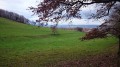
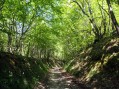
At a junction where three paths branch off, take the middle one. At the next junction, continue straight ahead. The path descends into the forest, then through meadows (photo 7). At the bottom, at the junction, take the path on the right. You can see the old village of Pinet in the distance (photo 8). Reach the next junction at thePR® Chez David signpost.

(5) Turn left towards Estrablin, Moidieu and La Garde. When you reach the Impasse du David road, take the path almost opposite, slightly to the right (this path runs alongside the hedge of the David property), then turn onto the path on the left. From this path, there are beautiful views stretching from the Pilat massif to the Monts du Lyonnais, the Monts d’Or and all the surrounding hills.
At the road, turn right. At the junction with Route du Rieu, continue straight on, passing the “Cartalet” farm. Continue along the road, passing through the hamlet of Le Colas. You will come to a Stop sign.

(6) Turn right onto the D41c, then about ten metres further on, turn right again onto the path which is the old road. At the bottom of the road (D41), turn right and continue for about a hundred metres. You will find the car park on the right in the centre of the village (S/E).

Waypoints

  1. S/E : mi 0 - alt. 879 ft - Car park in the village of Eyzin-Pinet
  2. 1 : mi 0.29 - alt. 906 ft - Climb to the church
  3. 2 : mi 0.66 - alt. 1,129 ft - D38
  4. 3 : mi 1.14 - alt. 1,325 ft - The Pinet Tower
  5. 4 : mi 1.86 - alt. 1,424 ft - D38
  6. 5 : mi 2.92 - alt. 1,171 ft - Le David (yellow PR signpost)
  7. 6 : mi 3.89 - alt. 942 ft - D41c
  8. S/E : mi 4.5 - alt. 879 ft - Car park in the village of Eyzin-Pinet

Notes

A water point (closed in winter) at the top of the sports complex, near the tennis courts (on the corner).
A shelter on Place d’Eyzin, near the pharmacy.
Hiking boots recommended, but not essential.
A short walk best undertaken in dry weather due to a section of clay soil that is muddy almost all year round, followed by a wet area, between the hamlet known as ‘Le Salin’ and the village of Pinet (between the first and second kilometres).

This variation of route No. 2 can be added to route No. 1 for a longer walk. As the junction point (6) on route No. 1 is the same as the junction point (1) on route No. 2, these two routes can be joined at this junction.

Worth a visit

To find out more about Eyzin-Pinet’s heritage, visit the town’s official website.

Always be cautious and plan ahead when you're outdoors. Visorando and the author of this route cannot be held responsible for any accidents occurring on this route.

The GR® and PR® markings are the intellectual property of the Fédération Française de Randonnée Pédestre.

Reviews and comments

4.2 / 5
Based on 6 reviews

Reliability of the description
4.2 / 5
Ease of following the route
4.5 / 5
Route interest
3.8 / 5
User 26292680

Overall rating : 4.7 / 5

Date of your route : Dec 16, 2025
Reliability of the description : ★★★★☆ Good
Ease of following the route : ★★★★★ Very good
Route interest : ★★★★★ Very good
Very busy route : Yes

Hello, route featuring historical points of interest
If possible, avoid this route in winter or after recent rainfall... best to do it in dry weather.

Machine-translated

cortovaldes
cortovaldes

Overall rating : 3 / 5

Date of your route : Jul 14, 2021
Reliability of the description : Not used / Not applicable
Ease of following the route : ★★★★★ Very good
Route interest : ★☆☆☆☆ Very disappointing
Very busy route : No

I wanted to do route no. 2, but once I got there I took a wrong turn and ended up doing this rather uninteresting route instead. What’s more, a long stretch along the D38 is far too dangerous and not at all pleasant. I realise that the actual circular route no. 2 must be more enjoyable when I look at the map of it. But I’m noting down the alternative route I took today.
As well as the long stretch on the D38, this route doesn’t let you see the tower in its entirety (you pass right by the foot of it but can’t see the whole thing from a distance).

The return to Maison David (at least on the final descent) resembles a riverbed with large, round pebbles that constantly test your sense of balance.

A panorama that is all too rare presents itself to our gaze.

Machine-translated

la toupie
la toupie

Overall rating : 4.7 / 5

Date of your route : Feb 17, 2020
Reliability of the description : ★★★★★ Very good
Ease of following the route : ★★★★★ Very good
Route interest : ★★★★☆ Good

A splendid view to enjoy in fine weather.
A bit too much tarmac on the way back,

Machine-translated

ChristianeG
ChristianeG

Overall rating : 5 / 5

Date of your route : Jan 26, 2019
Reliability of the description : ★★★★★ Very good
Ease of following the route : ★★★★★ Very good
Route interest : ★★★★★ Very good

A lovely walk. The description was spot on!

Machine-translated

dioude3971
dioude3971

Overall rating : 4.3 / 5

Date of your route : Feb 18, 2018
Reliability of the description : ★★★★★ Very good
Ease of following the route : ★★★★☆ Good
Route interest : ★★★★☆ Good

A very pleasant walk, apart from the section of the D38 you have to take to reach the hamlet of Pinet (a wide road with heavy traffic and verges that aren’t always usable). Thanks to the author of this walk.

Machine-translated

eneumann
eneumann

Hello,
I created this route and would like to know where exactly you got lost, so that I can perhaps provide some further details.
The GPX file that accompanies all my walks always helps you find your way back; I recommend you use it, whichever app you’re using.
Thank you in advance for your reply and any details you can provide.
eneumann

Machine-translated

bibi
bibi ★

Please do let us know if there are any improvements to be made to the description so that future visitors don’t get lost. Thank you.

Machine-translated

jeanpierre38
jeanpierre38

Overall rating : 3 / 5

Date of your route : Nov 27, 2015
Reliability of the description : ★★☆☆☆ Disappointing
Ease of following the route : ★★★☆☆ Average
Route interest : ★★★★☆ Good

I got lost in the woods
I’ll go for that pleasant walk again as soon as I can
jp 38

Machine-translated

Other walks in the area

For more walks, use our search engine .

The GPS track and description are the property of this route's author. Please do not copy them without permission.