Country:

 City:
City:


The route starts in the centre of Cour-et-Buis, a small village between Beaurepaire and Vienne. The central square, which is the starting point, is surrounded by the church, the town hall and the school.
The route is mainly marked in yellow. Apart from the forest track, it mainly follows very small, quiet tarmac roads.
(S/E) Leave the car park via the lane between the school and the town hall (Rue de l'Égalité). It turns left and passes in front of the cemetery. Very soon, at a fork near a bridge, turn right (Chemin de Bois Dinoud). At first, you will have a stream on your left, then your path turns left and crosses the stream to move away from it.
You will come out onto a small road.
(1) Take it on the left to pass in front of a car cemetery. Shortly afterwards, the yellow markings invite you to turn right. Follow them to take Chemin des Terres Blanches.
A little further on, leave the yellow markings and continue left along the small road, which leads to a T-junction (signposted "Route du Buron"). Turn left and very quickly turn right (signposted "Voie sans issue"). Pass a first, faintly marked path on the left, then another more obvious one, before taking the path that descends towards the railway line. You will come to a small road, which you take on the right. You will arrive at the tunnel under the railway line.
(2) Go under it. You will come to a T-junction and turn left (signposted "Route de Primarette"), then very quickly left again (Chemin Virguilloud). This will take you over a small stream (you will find the yellow markings again). At a fork, go up to the right. Your road climbs steeply and turns right before the hamlet of Petit-Feu.
(3) It makes two sharp bends. On the plateau, at a T-junction, turn right (yellow markings).
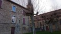
(4) When you reach a wood, take the path on the left that runs alongside it (signposted Maison Piolat - 452m, towards Chapelle de Buis). When you reach Maison Piolat, continue straight ahead, along the hedge. Descend to a T-junction. Turn right (signposted "Chemin du Raclet"). You will arrive at an imposing building (the former school of Buis).
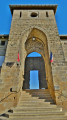
(5) You will see a sign for "Buis - 390m". Turn right and walk to the pretty Buis Chapel (about 200m away).
(6) As a reward, there is a water tap at the gate of the cemetery surrounding the building (the water is turned off during periods of frost).
(5) Back at the old school, head opposite towards the Blaches forest. Cross the district road, then cross a stream and climb steadily up the hillside. Once you enter the woods, cross the first crossroads (yellow markings). You will come out onto a wide, flat forest track (signposted "Forêt des Blaches - 450m").
(7) Take it to the left towards "Tour de Pinet/Les Crêtes". Follow it for about 2.5km (about 45 minutes at a normal walking pace). Ignore any paths leading off to the right or left; the yellow markings will guide you in the right direction.
(8) You will see a table and benches on your left, under a beautiful tree. Continue on.
(9) Shortly afterwards, you will come out of the woods. You will see some houses; take the small road on the left (house No. 432). This will take you away from the yellow markings.
(10) You come out onto the D38 departmental road. Turn left. Be careful, traffic moves fast here. Stay on the left side of the road, facing oncoming traffic. About 100 metres further on, take the path down to the left. It continues onto a small road, which you also take on the left. You arrive at a roundabout.
(11) Turn left (there is a pavement). At the traffic lights, turn left to return to your car park (E).




 Visorando Member

 Easy
Easy