Refine your search for walks in Farnay
Farnay walks
The Col de Trente Sous from Saint-Paul-en-Jarez
An easy hike (reasonable distance and elevation gain) offering views of the northern slope of the Pilat Regional Nature Park, the hillsides of Jarez and the Monts du Lyonnais. Alternating meadows and groves, with a few sections on very quiet roads.
Tour of Crêt de Montieux
This hike around Crêt de Montieux offers beautiful views of Mont Pilat, the Couzon dam and the Col de Pavezin.
The Chartreuse de Sainte-Croix-en-Jarez
Hike in the Pilat Massif with views of the Rhône Valley.
From the Couzon Dam to Sainte-Croix-en-Jarez
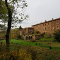
Discover Sainte-Croix-en-Jarez and its Chartreuse in the Pilat region, starting from the dam on the Couzon.
Couzon Dam, Les Roches de Marlin, Sainte-Croix-en-Jarez
Walk to the Roches de Marlin and return along the Lac du Couzon. On the way, you can visit the former Chartreuse de Sainte-Croix-en-Jarez.
Couzon dam
This is a beautiful hike that allows you to see different landscapes: lake, forest, path and, finally, the river bed as you pass over a pretty aqueduct. This hike is a shorter variation in the opposite direction to the hike I found on this website, called 'Around the Couzon Dam'.
Around the Couzon Dam
Walk in the Pilat, 6 km from Rive de Gier, around the beautiful Lake Barrage du Couzon.
Pilat - From Sainte-Croix-en-Jarez to Longes
This hike takes us to Les Roches de Marlin, which is somewhat overgrown with broom and other vegetation, and the beautiful flower-filled village of Longes. Don't forget to enjoy the beautiful views of the Gier valley and the crosses at almost every crossroads.
Around Chagnon
A beautiful hike through orchards and forests in the hills above Rive de Gier. The very hilly area offers beautiful panoramic views. Chagnon and Saint-Romain-en-Jarez are interesting for those who love old buildings.
Le Crêt de Marcoux
A walk to discover beautiful views of the Dorlay valley, an opportunity to explore an old Roman road and an old railway line.
Trail around Saint-Martin-la-Plaine Zoo
On the heights of Saint-Martin-la-Plaine, a lovely walk through the fields. The last part takes you past a zoo where you can see a few animals (ostriches, wolves, goats).
Discover the beech forests in the municipality of Pavezin
Most of this hike takes place in beech forests. It is perfect on sunny or windy days. It overlooks the village of Pavezin.
Bélize Castle and Crêt de Baronnette Tower
An easy route to discover the Crêt de Baronnette and the Celtic site of the Château de Bélize, in the Pilat Regional Nature Park. A half-day walk, perfect before or after lunch.
The Way of the Cross in Pavezin
More than fourteen crosses to discover on this hike around Pavezin.
Between the Rhône and Loire rivers in Saint-Joseph
Straddling the Loire and Rhône rivers, near Rive de Gier, Saint-Joseph and Saint-Maurice-sur-Dargoire, this is a very pleasant walk along the river.
Circulars in the Pilat from the Col du Pavezin
In the footsteps of Jean-Jacques Rousseau and Doctor Odouard, a circular eight between the Cols de Pavezin and Doizieu.
The first part leads to the Croix de Montvieux via the ruins of the Château de Bélize and the Crêts des Quatregrains, with a beautiful view of the Pîlât mountains. The second part goes to the Collet de Doizieux via pleasant forest tracks and views of Pélusin and the Rhône valley. The return route passes through the Neufond woods with two beautiful screes and the Baronnette trails.
From Col de Pavezin to Col de Grenouze via Mont Ministre
Hike through the forest from one pass to another via Mont Ministre, alternating between panoramic views of the Pilat massif and the Rhône valley. Along the way, there are a few remarkable sites: Grotte des Fées (Fairy Cave) and the Old Chapel.
There are places to eat at both passes, or you can stop for a picnic at Col de Grenouze.
Take care on the descent from the forest track to the Vieille Chapelle: it is a narrow, fairly steep path that can be slippery in wet weather.
Trek around Saint-Joseph - Le Mas
This hike is primarily along clear paths with views over le Pilat and Sainte-Catherine. An easy trek with some slight up and downhill slopes. Be careful, as non-stone tracks can get muddy in the rainy season.
The Mont Pilat loop from Doizieux
A long route along the panoramic ridges of Mont Pilat.
From La Roussillière to Les Bozançons
A wild walk, often along the Bozançon, with the option to visit special sites (Roman aqueduct).
Panoramic view of Mont Monnet from the Col de Grenouze
Magnificent panoramic view of the Alps on a clear day. Partially shaded return route through the woods. Somewhat strenuous climb but no technical difficulty.
Tour of Mont Ministre and Mont Monnet
The hike combines the Odouard and Jean-Jacques Rousseau trails, starting from Chuyer. The first part, to the south-east, on the Odouard trail, offers beautiful views of the Rhône valley. At the Col de Grenouze, the small loop takes you up to Mont Monnet: orientation table, beautiful view in good weather over the valley, the Vercors and the Alps (Mont Blanc). Forest paths then follow the Jean-Jacques Rousseau trail to the Col de Pavezin, and return via the Odouard trail.
Loop between Valfleury and Chavanne
This circuit starts in Valfleury, a charming village nestled at the bottom of a valley, and mainly follows ridges offering numerous views towards Saint-Chamond, Saint-Étienne, Pilat and, further afield, Forez and Auvergne. Don't miss a visit to Valfleury church.
The Valfleury Aqueduct
A very varied hike in the Loire, alternating between open landscapes with meadows, valleys, deciduous forests and numerous apple and cherry orchards. The walk also allows you to discover a curious underground aqueduct. In good weather, you can enjoy a breathtaking view of Mont Blanc and the entire Alpine range.
This hike can be enjoyed in all seasons, but it must be magnificent in spring when the fruit trees are in bloom.
Le Crêt de la Magdeleine in Longes
Walk in the hills above Longes with magnificent panoramic views of the Alps, the Pilat massif and the Monts du Lyonnais. Car park with a beautiful table and two magnificent wooden deckchairs from which to admire the Rhône valley and the Alps.
The Saut du Gier from the Col de la Croix du Planil
This is a fairly strenuous hike with beautiful views. If you wish, between (1) and (2), you can take a slightly easier route. The waterfall is worth the detour.
Around the Bozançon
Walk around the Bozançon valley (and even the Bozançon rivers) with remains of Roman aqueducts, water mills, old railway tracks and old gold mines.
At Les Piles, you can continue up the Bozançon to the viaduct and return to Jurieux via the old railway line (an extra 2 hours).
Going up the Bozançons
This varied circuit runs through the upper catchment area of the Grand and Petit Bozançon rivers, taking you along the banks of streams, up hillsides through orchards and, at times, offering unobstructed views of the Pilat mountain range.
Old wall circuit
This is a beautiful, easy walk along both sides of the Bozançon River, where this section of the valley is a succession of ancient terraces structured by low stone walls. A taste of Provence..
Old description, see reviews if you are not using the app
De Saint-Maurice-sur-Dargoire, boucle des ruisseaux Bezançon
This circular hike in the Monts du Lyonnais between the Rhône and Loire rivers takes place in a little-visited and rather secret area around the Bezançon valleys and its tributaries, including the Grand Bezançon and Petit Bezançon, passing through a few isolated hamlets. It allows you to discover three arches, remnants of the Roman aqueduct of the Gier, and a high bridge pier of a railway line, intended to connect Rive-de-Gier to Mornant, whose construction was halted by the war of 1914. This route can be shortened to 23 km with an 800 m elevation gain by taking a shortcut (see practical information).
Around Saint-Christo-en-Jarez on the Sabot Bleu circuit
The route passes through different areas in the countryside around Saint-Christo-en-Jarez (wetlands, forest and meadows). Along the way, themed information boards provide details about the local wildlife. On a clear day, two-thirds of the way along the route, you will be treated to a magnificent view of the Alps.
Saint-Christo-en-Jarez - Marcenod - L'Hôpital
A circuit primarily on small paved and sunny roads.
The Chemin du Tacot to the east of Pélussin
At the start and end of the route, this circuit follows the Tacot, a local railway line that connected the two sides of the Pilat Massif, the Loire and the Rhône, until 1930. Magnificent views of the Pilat Massif, but above all of the Rhône Valley and the Alps, with Mont Blanc visible on the left when the sky is clear. Most of the circuit is in the forest.
The Dentillon hut from Pelussin
This walk starts in Pelussin (in the heart of Pilat) and offers a gentle climb (just under 600m) to keep you in shape, rising steadily throughout. You will arrive at the Dentillon hut, with its arboretum and orientation table. You can then continue on to the 3 dents, which takes an additional 45 minutes and 250m of elevation gain.
Historic Pélussin and the Scie valley
This easy walk allows you to stroll around the beautiful village of Pélussin before heading into the wooded valley of the Scie stream.
It partly follows the Priel trail (Pelussin 1, yellow/white markings).
From La-Valla-en-Gier, circular through the discreet Ban valley and Le Bessat
Most of the hike is in the woods, which is very pleasant in summer. From La Valla-en-Gier, a pretty village that has retained its authentic character, take a small road and then a footpath to reach the Ruisseau du Ban stream, nestled at the bottom of a bucolic valley. The path runs alongside this stream for almost 3 km before climbing up to the Bessat plateau. TheGR®®42 trailtakes you to Le Bessat, a tourist village with low, squat houses reminiscent of the nearby Massif Central. The return journey is a descent through the woods.