


Refine your search for walks in Étang de Pédourés
Étang de Pédourés walks


 Pédourès Pond and Siscar Pond loop.
 Visorando Member
 8.80 mi
 +3,310 ft
 -3,304 ft
 6h 55
6h 55
 Difficult
 Departure from L'Hospitalet-près-l'Andorre (Ariège)
A beautiful hike in Haute Ariège, at the gateway to Andorra. The route includes five lakes and small lakes in a high mountain landscape dotted with streams.
Pic de Nérassol via the Étang du Siscar and the Étang de Pédourrés
10.81 mi
+3,950 ft
-3,940 ft
8h 25
Difficult
Departure from L'Hospitalet-près-l'Andorre (Ariège)
Ascent to the Pic de Nérassol via the Ruisseau du Siscar valley and the lake of the same name. Descent to the Étang de Pédourrés and return via the Jasse de Brounic. A day trip is possible, with a return journey from Toulouse by train.
Walks near Étang de Pédourés
From L’Hospitalet-près-l’Andore to Mérens-les-Vals via Porteille des Bésines
 10.31 mi
+3,353 ft
-4,577 ft
7h 40
Difficult
Departure from L'Hospitalet-près-l'Andorre (Ariège)
10.31 mi
+3,353 ft
-4,577 ft
7h 40
Difficult
Departure from L'Hospitalet-près-l'Andorre (Ariège)
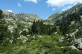
A hike from station to station with 900 m of ascent and nearly 1,300 m of descent, passing through the Refuge des Bésines and the eponymous Porteille, and following theGR®107CandGR®10trails.
L'Hospitalet near Andorra - Refuge des Bésines
 4.50 mi
+2,359 ft
-180 ft
4h 10
4.50 mi
+2,359 ft
-180 ft
4h 10
 Moderate
Departure from L'Hospitalet-près-l'Andorre (Ariège)
Moderate
Departure from L'Hospitalet-près-l'Andorre (Ariège)
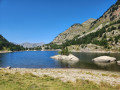
Part of the long route (9 stages) around Carlit, hiking from refuge to refuge, based on the Tour des Pérics and using various marked trails,GRP® andGR® in the area.
Initial stage designed to ease you gently into the hike.
From the Pra Redoun Refuge to the Juclar Refuge
 5.47 mi
+2,884 ft
-1,168 ft
5h 00
Moderate
Departure from Savignac-les-Ormeaux (Ariège)
5.47 mi
+2,884 ft
-1,168 ft
5h 00
Moderate
Departure from Savignac-les-Ormeaux (Ariège)
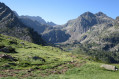
The second stage of the “Ax-les-Thermes to Latour-de-Carol” route; this is a beautiful high-mountain stage with magnificent scenery. Favourable weather is recommended.
This route follows a path which is initially very poorly signposted, climbing steeply towards the first pass, the Col de Behl, before reaching the Refuge de Ruhle, then the beautiful ascent to the Col de Juclar and finally the descent into Andorra towards the manned refuge of the same name.
From the Juclar Refuge to Pas de la Case
 9.19 mi
+1,762 ft
-2,421 ft
5h 45
Moderate
Departure from Canillo (Andorra)
9.19 mi
+1,762 ft
-2,421 ft
5h 45
Moderate
Departure from Canillo (Andorra)
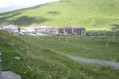
This third stage of the route linking Ax-les-Thermes to Latour de Carol takes you to Pas de la Case… and its hotels and refreshment stops; it is an easy, somewhat long stage that takes place at altitude, mainly along the gentle, grassy ridges of Andorra, but without any difficulty. It is best to tackle this stage in good weather, as landmarks can be misleading, especially if fog sets in.
Ruhle Mountain Hut – Mérens-les-Vals
 7.75 mi
+1,339 ft
-5,069 ft
4h 45
Moderate
Departure from Ariège
7.75 mi
+1,339 ft
-5,069 ft
4h 45
Moderate
Departure from Ariège
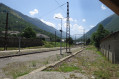
The final stage of the journey. We set off from the refuge to descend back into the valley, passing through spectacular high-mountain scenery whilst following the well-markedGR®10. There are no particular difficulties apart from a few rather tricky scree slopes.
Refuge du Rulhe - Castelet
11.00 mi
+958 ft
-5,958 ft
5h 55
Difficult
Departure from Ariège
This second day is exceptional. Most of it takes place on ridges from which you can see the Ax 3 Domaines resort on one side and the Plateau de Beille on the other. And everywhere, there are lakes and breathtaking landscapes. This stage is long (nearly 18 km), but you'll never want it to end before you descend into the valley through the forest. It's best to have someone waiting for you in the valley, or else you can reach Ax-les-Thermes on foot or by bus. Be aware that as you will be taking photos and spending time admiring the landscape, you should allow 6½ to 7 hours for the whole trip.
Refuge du Ruhle - Col de Belh - de la Didorte - Cabane Rieutort - Laparan
 5.31 mi
+1,198 ft
-3,297 ft
3h 30
Moderate
Departure from Ariège
5.31 mi
+1,198 ft
-3,297 ft
3h 30
Moderate
Departure from Ariège
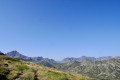
From the start of the hike, pay attention to the common white and red GR® T66 and GR®10 markings, as there are several crossroads and forks in the trail. Please note: the hike is in open terrain until the descent into the forest, well after the Rieutort hut.From the refuge, via the Crête des Isards and up to the Col de la Didorte, what a view! Of course, you need to be very careful on this ridge, which is often steep and jagged. But as soon as you stop, you can enjoy a 360° panorama.The steep descent to the Rieutort hut is on a narrow but safe path, offering beautiful views. The return to the road is not easy, but the path (GR®T66), although steep in places, is well marked throughout the descent.
Ascent to the Refuge du Rulhe from the Cascade des Escaliers (Mérens)
 6.01 mi
+3,727 ft
-1,260 ft
6h 00
Difficult
Departure from Mérens-les-Vals (Ariège)
6.01 mi
+3,727 ft
-1,260 ft
6h 00
Difficult
Departure from Mérens-les-Vals (Ariège)
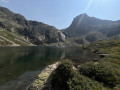
First day’s hike to the Refuge du Rulhe.With a 1,000 m elevation gain over 5.5 km, the average gradient of the climb to the Pyramide de Lherbés is 18%. IBP difficulty rating = 105 (“very difficult” for a hiker of average fitness).Allow 6½ hours with a light rucksack.This day takes place in the high mountains, far from any roads, tracks, etc.The landscapes and environments you’ll pass through are majestic.
From Mérens-les-Vals to Étang de Pédourrés via Étang de Couard
 6.55 mi
+4,052 ft
-400 ft
6h 35
Difficult
Departure from Mérens-les-Vals (Ariège)
6.55 mi
+4,052 ft
-400 ft
6h 35
Difficult
Departure from Mérens-les-Vals (Ariège)
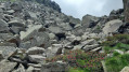
The first stage of the journey! We leave the village of Mérens-les-Vals to reach Étang de Pédourès via the rugged slopes of the Ariège mountains; the scenery is magnificent and very wild. The main difficulty lies between the Étang de Comte and the Étang de Couard, where the well-marked path follows a very long and at times arduous scree slope; once you reach the Étang de Couard, the beauty of the scenery makes up for the hard work.
Ax 3 Domaines Plateau du Saquet - Rulhe Refuge
6.69 mi
+2,293 ft
-1,677 ft
5h 05
Difficult
Departure from Ax-les-Thermes (Ariège)
This is a magnificent hike that starts from the Plateau du Saquet, and therefore the Ax 3 Domaines ski slopes, and ends at the Refuge de Rulhe, where a good local rataf will do you good. Once you reach the top of the resort, long desert plateaus await you before you descend into the austere scree slopes at the foot of Rulhe and finish sliding down to the Refuge de Rulhe. This first stage is wild and challenging, in the scree slopes. Be careful on the descent from the Col de Lhasse, which is very steep (but the GR® is well marked).