Vignory Castle

A walk that allows you to explore Vignory, one of the “small towns of character”, with its Romanesque church and the remains of its feudal castle, as well as the forests and woods surrounding the village.

Details

3724115
Creation:
Last update:
Last review:
  • Walking
    Activity: Walking
  • ↔
    Distance: 6.59 mi
  • ◔
    Average duration: 3h 40 
  • ▲
    Difficulty: Moderate

  • ⚐
    Back to start: Yes
  • ↗
    Ascent: + 735 ft
  • ↘
    Descent: - 709 ft

  • ▲
    Highest point: 1,142 ft
  • ▼
    Lowest point: 784 ft
  • ⚐ Country: France
  • ⚐ City: Vignory (52320)
  • ⚑
    Start/End: N 48.278373° / E 5.10135°
  • Accessible from the train station Gare de Vignory Centre.
  • ❏
    IGN map(s): Ref. 3117SB
  • Hour-by-hour weather

Photos

Description of the walk

The tour starts from the car park at Vignory Town Hall.

(S/E) At the car park, turn left to continue through the village towards the church until you reach the wash house, then go round it on the right via the narrow street, Rue de la Fontaine.

(1) Take the steps and follow the path leading to the castle. You will arrive at the upper courtyard. On your right you will see the keep and on your left the Tour du Puits, both of which have been restored.

(2) Opposite, take the path that descends along the restored ramparts to the medieval garden.

(3) Turn right and follow the Route du Val-Noise uphill until you come to a fork on the left.

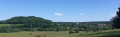
(4) Take the path on the left to climb up to the plateau, following the path through the fields. On the plateau, turn left to stay on the path that leads back down towards the Combe de Ribévaux.

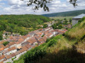
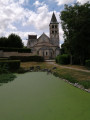
(5) Once you reach the village, turn right onto the Route du Val-Noise, then opposite onto Rue du Général Leclerc and finally right towards the church. Walk round the church on the right, making sure to admire it from the small pond at the end of the chancel. From this pond, turn right to follow the path running behind the village; here you can compare the current view of the village with that from 1669, shown on a panoramic display. Continue along the county road under the chestnut trees for about 300 metres.

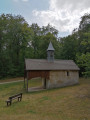
(6) Turn right onto the path at the first house – formerly the Chapel of Saint Joachim – and follow it uphill towards the Forest of Boué. This path shares its route with theGR® de Pays Marie Calvès. At the top of the climb, take the path on the left leading to one of the last remaining lime kilns, then take the first path on the left and then on the right to emerge onto the local road on the plateau, with the village of Cerisières in the background.

(7) Turn left, following the local road, and pass the junction with the road leading to Cerisières until you reach the district road.

(8) Cross the departmental road and follow the path. At the end, turn left onto the path that descends towards the Notre-Dame du Val Chapel.

(9) Leave theGRP® trail. Turn left and follow the Chemin du Vieux Val, which descends to the departmental road.

(10) Turn right onto the departmental road, taking care to head back towards the village of Vignory

(6) Opposite Saint-Joachim, take the path on the right, then turn left to return to the starting point (S/E).

Waypoints

  1. S/E : mi 0 - alt. 804 ft - Town hall car park
  2. 1 : mi 0.13 - alt. 814 ft - Stairs leading up to the castle
  3. 2 : mi 0.37 - alt. 974 ft - Along the ramparts
  4. 3 : mi 0.44 - alt. 840 ft - Medieval garden
  5. 4 : mi 0.92 - alt. 988 ft - Turn-off towards the plateau
  6. 5 : mi 2.04 - alt. 823 ft - Vignory
  7. 6 : mi 2.63 - alt. 833 ft - Saint-Joachim
  8. 7 : mi 3.95 - alt. 1,129 ft - Route Forestière
  9. 8 : mi 4.82 - alt. 1,093 ft - Departmental Road
  10. 9 : mi 5.21 - alt. 1,047 ft - Notre-Dame du Val Chapel
  11. 10 : mi 6.06 - alt. 869 ft - Departmental Road
  12. S/E : mi 6.59 - alt. 804 ft - Town hall car park

Notes

This walk follows the blue-and-yellow markings of the shortPR® walk no. 109, which are signposted throughout the route.

Places to visit:
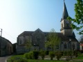
- Saint-Étienne Church, built in the 11th century in the pre-Romanesque architectural style of eastern France and first mentioned as early as 1034;
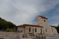
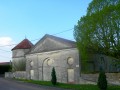
- the restored remains of the feudal castle, built between the 11th and 15th centuries, notably its keep with its fine timber framework, the Well Tower with its partially reconstructed stone vault, and the ramparts. The first written records of the castle date back to 1050.
- the 17th-century house and the museum

You can contact the Vignory Tourist Office (03 25 03 80 80) for information on guided tours available all year round, by booking in advance for groups of at least 10 people, organised by the Histoire Association.

Worth a visit

On your way back via Saint-Joachim, you can head up the Blaise valley; you might stop off at the Château de Cirey-sur-Blaise, just as Voltaire did in his day at the invitation of Madame du Châtelet, or carry on to Colombey-les-Deux-Églises, the final resting place and memorial to General de Gaulle.

If you head in the opposite direction towards Chaumont, you can stop off at Vouécourt, a pretty village on the banks of the Marne and the canal between Champagne and Burgundy.

Always be cautious and plan ahead when you're outdoors. Visorando and the author of this route cannot be held responsible for any accidents occurring on this route.

The GR® and PR® markings are the intellectual property of the Fédération Française de Randonnée Pédestre.

Reviews and comments

4 / 5
Based on 3 reviews

Reliability of the description
3.7 / 5
Ease of following the route
4 / 5
Route interest
4.3 / 5
Lyndi
Lyndi

Overall rating : 5 / 5

Date of your route : Apr 26, 2026
Reliability of the description : ★★★★★ Very good
Ease of following the route : ★★★★★ Very good
Route interest : ★★★★★ Very good
Very busy route : No

A lovely route for exploring Vignory and its castle. The first part is quite sunny, but the second half is more shaded.

Machine-translated

Lindoun
Lindoun
• Edited:

Overall rating : 2.7 / 5

Date of your route : Dec 24, 2024
Reliability of the description : ★★☆☆☆ Disappointing
Ease of following the route : ★★★☆☆ Average
Route interest : ★★★☆☆ Average
Very busy route : Yes

The village of Vignory is lovely, but the walking route leaves something to be desired. There are very few forest paths. It’s a star-shaped route that winds its way around the village. Some of the paths are impossible to find. There are a lot of roads and fields.

Machine-translated

Floyd17230
Floyd17230
• Edited:

Overall rating : 4.3 / 5

Date of your route : Jul 23, 2023
Reliability of the description : ★★★★☆ Good
Ease of following the route : ★★★★☆ Good
Route interest : ★★★★★ Very good
Very busy route : No

A lovely walk; the church at Vignory is remarkable, with its chapels bathed in natural light and featuring very simple ornamentation, which lends this architectural gem a majestic air …
I then made my way up to the castle; the slope is a bit steep, but a bench halfway up is a welcome respite and offers a chance to admire the superb scenery… At the castle, a sign explains in detail the layout of the site since the 12th century
The walk continues through a medieval garden – unfortunately overgrown – and a fairly long stretch across fields where hemp was growing; I even thought it might be cannabis. Then the path winds back down through the woods towards the village, where a glance at the old wash house reveals figurines depicting the work of the washerwomen and the knife-grinder.
I was on my own and I really enjoyed this walk… it’s surprising that, for a Sunday afternoon, there weren’t more people about.

Machine-translated

Other walks in the area

For more walks, use our search engine .

The GPS track and description are the property of this route's author. Please do not copy them without permission.