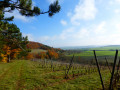
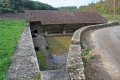
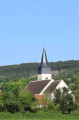
Wash houses and views over Rix

A lovely discovery trail that can be enjoyed with the family or in a group.

Details

2008179
Creation:
Last update:
Last review:
  • Walking
    Activity: Walking
  • ↔
    Distance: 3.85 mi
  • ◔
    Average duration: 2h 00 
  • ▲
    Difficulty: Easy

  • ⚐
    Back to start: Yes
  • ↗
    Ascent: + 246 ft
  • ↘
    Descent: - 220 ft

  • ▲
    Highest point: 669 ft
  • ▼
    Lowest point: 518 ft

Photos

Description of the walk

The route starts in the village of Rix from the car park on Place des Tilleuls.

(S/E) Walk down Rue de la Liberté, then turn left onto Rue de l’Église. At the junction, turn left, then right onto Rue des Ormes. When you reach Route de Brinon, cross it carefully, turn left, then take the first street on the right, Route du Lavoir.

(1) Turn left for a return trip to the wash house. On the way back, turn left for about 50 metres and then left again onto a footpath. At the three-way junction, keep to the right.

(2) Cross Route de Breugnon (D143), take the path to reach the first cross-path.

(3) Turn left. At the next cross-path, turn left again, then right onto the tarmac road to cross Champmoreau. After the last houses, turn left to reach the D23 road.

(4) Cross the road with care. Continue straight ahead onto the Route du Puits.

(5) Carry on straight ahead, leaving the road on your right and then the next one on your left. Rue des Montis ends in a track running almost parallel to the road below. When you reach the hamlet of Les Meulots, rejoin a tarmac road and carry on straight ahead along Rue de la Montagne.

(6) Opposite the cemetery, turn left, then immediately take the first right onto Rue de l’Europe. At the end of this street, turn left onto Rue de la Verdrelle and head for the car park (S/E).

Waypoints

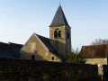
  1. S/E : mi 0 - alt. 604 ft - Car park at Place des Tilleuls. Near the - Église Saint-Pierre-aux-Liens (Rix)
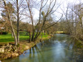
  2. 1 : mi 0.24 - alt. 522 ft - Return trip to the wash house - Beuvron (rivière) - Affluent de l'Yonne
  3. 2 : mi 1.32 - alt. 607 ft - Cross the road (D143)
  4. 3 : mi 1.82 - alt. 669 ft - Crossroads with a side road
  5. 4 : mi 2.39 - alt. 541 ft - Cross-country road (D23)
  6. 5 : mi 2.63 - alt. 600 ft - Road junction
  7. 6 : mi 3.47 - alt. 620 ft - Crossroads with a side road
  8. S/E : mi 3.85 - alt. 604 ft - Car park: Place des Tilleuls

Worth a visit

Châteauvert is a lodge (the château is private).
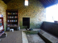
(4) After crossing the bridge and before reaching the road, you can visit the wash house further down.

Reviews and comments

4.7 / 5
Based on 2 reviews

Reliability of the description
5 / 5
Ease of following the route
5 / 5
Route interest
4 / 5
Stéphanie R.
Stéphanie R.

Overall rating : 4.7 / 5

Date of your route : Dec 19, 2022
Reliability of the description : ★★★★★ Very good
Ease of following the route : ★★★★★ Very good
Route interest : ★★★★☆ Good
Very busy route : No

A short, unpretentious walk, but a very pleasant one nonetheless. We discovered it on a lovely sunny day in mid-December, at a time of year when you don’t necessarily fancy setting off on a long hike. This walk is therefore ideal – just the thing for getting a breath of fresh air and enjoying the beautiful colours. It’s really very easy to follow and allows you to explore the lovely countryside. A special mention goes to the Plessis wash house, which has been turned into a ‘book wash house’ and even has a table and chairs. What a lovely idea! It really invites you to take your time...

Machine-translated

andreb42
andreb42

Overall rating : 4.7 / 5

Date of your route : Jan 22, 2020
Reliability of the description : ★★★★★ Very good
Ease of following the route : ★★★★★ Very good
Route interest : ★★★★☆ Good

Hello, walk completed on the afternoon of 21 January 2020

An easy walk with a well-marked route and unobstructed views. However, point 4 – the return trip to Chateauvert – is of no interest, as we have no view of the castle since its entrance is on private property.
Kind regards

Machine-translated

Other walks in the area

For more walks, use our search engine .

The GPS track and description are the property of this route's author. Please do not copy them without permission.