Between Jouhé Castle and the murals in Pioussay Church

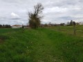
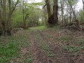
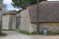
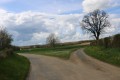
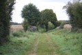
A pleasant walk through a bocage landscape of open fields and woods. There are some wonderful discoveries to be made, both in terms of the scenery and the heritage of the Poitou region, including, amongst others, the magnificent Château de Jouhé and the church at Pioussay with its wall frescoes. In the villages along the route, there are beautiful traditional houses, some of which have been restored and others currently undergoing restoration.

Details

1001122
Creation:
Last update:
Last review:
  • Walking
    Activity: Walking
  • ↔
    Distance: 7.28 mi
  • ◔
    Average duration: 3h 30 
  • ▲
    Difficulty: Moderate

  • ⚐
    Back to start: Yes
  • ↗
    Ascent: + 131 ft
  • ↘
    Descent: - 135 ft

  • ▲
    Highest point: 548 ft
  • ▼
    Lowest point: 453 ft
  • ⚐ Country: France
  • ⚐ City: Pioussay (79110)
  • ⚑
    Start/End: N 46.086764° / E 0.044984°
  • ❏
    IGN map(s): Ref. 1629SB, 1729SB, 1730SB
  • Hour-by-hour weather

Photos

Description of the walk

The car park is situated at the junction of Rue du Château and Rue du Peintre, a few metres from the D112 road. You can park on the hard shoulder of the road, which is wide at this point.

(S/E) Take the small road towards Château de Jouhé (heading east). At the first junction, turn left onto Rue des Maronniers (D112). After about fifty metres, turn right onto Rue du Tilleul. Pass the hamlet of Chez Damy, then ignore a turn-off on the left (elevation 147).

(1) Turn sharply right towards La Garenne, on the edge of a small wood on your left. At the hamlet of La Garenne, turn left and follow the small road to the next junction.

(2) Turn left onto the D304 (Rue des Ormeaux). Pass through the hamlet of l’Houmelée and continue to the next junction in open countryside.

(3) Turn left onto the D312. Follow this road carefully for about a hundred metres. Then take the first track on the right.

(4) At the next junction, carry on straight ahead. Ignore a track branching off to the left; you’ll come out onto a small road and follow it to the right for about a hundred metres.

(5) At the junction, turn right. Ignore a path branching off to the right and cross the hamlet until you reach the water tower. Then turn right twice and head towards the hamlet known as La Ville or Bas Lugée. When you reach some large farm buildings on the right, turn left into Rue de la Ville.

(6) When you reach the last house on the left, take the path on the right which runs alongside a small wood on your left. At the next junction, continue along the path opposite. Shortly afterwards, with a wood on your left, take the first path on the left (west). At the end, turn left onto Rue des Écoles. Pass between the cemetery and the church.

(7) At the crossroads, turn right onto Rue de l’Église. At the T-junction, turn left twice. Almost immediately, take a path on the right (west).

(8) At the crossroads, turn sharply right. At the next crossroads, carry on straight ahead and walk alongside a small wood on your left. Ignore a path branching off to the left, then walk alongside the Bois Barret on your right. Join a small road and follow it to the left.

(9) At the Grand Bois crossroads, follow the small road to the right towards the hamlet of La Rogneuse. On arrival, the road is called Rue du Relais: pass through the hamlet and, at the junction, carefully cross Rue des Jardins and take the small road almost directly opposite.

(10) At the T-junction, turn left towards the hamlet of La Place. Continue straight on and take Rue du Four. Then turn left onto Rue du Puits. At the end, first turn left then right to join an unnamed lane. At the end, turn right and do the same at the next junction to take Rue de l’Ancienne Mare.

(11) After passing Rue du Palet on your right, turn left onto Rue de la Châtaigneraie (a cul-de-sac). After the last houses, the road gives way to a track. Take the first track on the right. When you reach a small road, make the first turn right then left and follow a track that crosses the Châtaigneraie de la Place woodland. Further on, the track leaves the woodland and runs along its edge on the right-hand side.

(12) At the junction, turn left onto a track which eventually leads to a small road at the corner of a farm. First turn left then right and follow Rue du Peintre. Next, turn right into Rue Neuve and then left into Rue du Château. You will soon reach the car park (S/E).


Waypoints

  1. S/E : mi 0 - alt. 489 ft - Y-junction
  2. 1 : mi 0.6 - alt. 482 ft - Sharp right-hand bend
  3. 2 : mi 0.89 - alt. 479 ft - Junction of Rue de la Garenne and the D304
  4. 3 : mi 1.25 - alt. 476 ft - Junction of the D304 and D312
  5. 4 : mi 1.59 - alt. 492 ft - Crossroads
  6. 5 : mi 2.19 - alt. 535 ft - Lugée
  7. 6 : mi 2.73 - alt. 502 ft - Crossroads including Rue de la Ville
  8. 7 : mi 3.58 - alt. 518 ft - Junction of Rue des Écoles and Rue de l’Église
  9. 8 : mi 4.19 - alt. 476 ft - Crossroads
  10. 9 : mi 5.16 - alt. 535 ft - Grand Bois crossroads
  11. 10 : mi 5.8 - alt. 502 ft - T-junction, turn left
  12. 11 : mi 6.29 - alt. 489 ft - Rue de la Châtaigneraie
  13. 12 : mi 6.92 - alt. 492 ft - Junction
  14. S/E : mi 7.28 - alt. 489 ft - Y-junction

Notes

This walk takes place over varied terrain and requires suitable footwear.

This route is marked in blue and corresponds to the ‘Entre château et fresques’ route published by the Deux-Sèvres Department and the Syndicat du Pays Mellois. A white pictogram depicting the fairy Mélusine on a blue background can be seen throughout the walk. In addition, it is advisable to follow the instructions in the description and on the map, whilst also taking in the surrounding landscape.

Walk completed by the author on 13 April 2018.

Worth a visit

Jouhé Castle
The village of Jouhé is situated in the commune of Pioussay. Raymond Proust, an archaeologist from Chef-Bouton, speculated that a motte-and-bailey castle had preceded the present-day residence, at least in the immediate vicinity.

The Jouhé motte
A locality recorded in the original land register but not in subsequent ones, situated 300 metres north-north-west of Jouhé Castle, in an area known as the Plaine de Jouhé, where no natural features would have justified the place name ‘motte’ until, whilst ploughing, an underground passage was discovered in the spring of 1967. It has not been studied in detail, but the newspaper *Le Courrier de l’Ouest* of 9 August 1967, in its Deux-Sèvres edition, provided a good description of it.
This cavity may have been an annex to the lost structure that gave the place its name, ‘motte’.
Source: Raymond Proust, Bulletin of the Société des antiquaires de l’Ouest et des musées de Poitiers, 2nd quarter 1978, 4th series, volume XIV, page 450

The castle
Visible from all around the surrounding area due to its immense and magnificent keep with a spiral staircase (listed as a historic monument by decree of 18 November 1999).
Some sources state that the first mention of the fief appears in 1124 in the cartulary of Saint-Maixent under the name of Johec. However, Jean-François Comte, a historian from Ruffec, points out that Jouhé (like Tourteron and Tessé) was part of the possessions of Hilduin, Lord of Ruffec, as early as the 10th century.

“The land of Jouhé was sold to Guillaume Turpin, Lord of La Place, in 1236 by the Lord of Ruffec, with the right to exercise low and middle justice...”
The archives of La Barre mention that in 1439, Micheau Turpin was referred to as Lord of Jouhé.

This castle, now privately owned, was built on the site of an older, 15th-century residence during the first half of the 17th century.
“The main house (the logis) was reduced by one storey following a fire and completely rebuilt in 1636.” It is situated between the round tower and the keep, also known as the pavilion
At the rear of the main building stands a circular tower with a conical roof covered in slate (similar to that of Le Melzéar).

The church of Pioussay
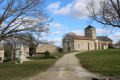
A Romanesque and Gothic church, Saint-Martin de Pioussay is situated in the diocese of Poitiers.
It was attached to an abbey, namely that of the Canons Regular of Saint Augustine at Saint-Séverin, in the former diocese of Poitiers (near Aulnay-de-Saintonge), now in Charente-Maritime. A building of major importance in the religious heritage of the Poitou region.

Description of the building, listed as an ISMH in 1990
“The church at Pioussay consists of a Romanesque nave complemented by a Gothic chancel and chapel.
The west façade features two bells and is topped by a gable surmounted by a cross. It is therefore a vertical, flat bell gable, situated at the top of the building to house the bells.
To the left, it is flanked by the stair turret providing access to the bells, and to the right by the imposing first buttress of the nave. The portal, a three-linteled pointed arch, appears offset to the left. The capitals and friezes are decorated with oak or chestnut leaves.
Running along the north wall of the nave is a band at the level of two small windows, and four buttresses reinforce this wall.
Leaning against the south wall, three buttresses support the nave to prevent it from spreading further apart at the top.

The nave can be entered through a doorway in this south wall, which features two small windows, but of particular note are the slate roof tiles (and the lignolet), which have fortunately been preserved. In the chancel, restoration work has uncovered magnificent 15th-century murals depicting the Passion and Resurrection of Christ."
Source: Nuits Romanes en Poitou-Charentes website.

Restoration work in 1999 uncovered a vast collection of wall paintings dating from the late Middle Ages, making the church a leading example of Poitou’s religious heritage."

Further information:

Reviews and comments

4.3 / 5
Based on 3 reviews

Reliability of the description
4.3 / 5
Ease of following the route
4.3 / 5
Route interest
4.3 / 5
MARTDomi
MARTDomi

Overall rating : 4.3 / 5

Date of your route : Jul 13, 2024
Reliability of the description : ★★★★☆ Good
Ease of following the route : ★★★★☆ Good
Route interest : ★★★★★ Very good
Very busy route : No

A lovely circular route through the countryside. The route winds its way along numerous tiny roads and tracks suitable for vehicles, and passes through many hamlets with traditional buildings.
Jouhe Castle is very beautiful and rather unusual. The frescoes in Pioussay Church are quite remarkable.
It’s worth noting that the route is, as of now, clearly signposted in blue.

Machine-translated

pgetrochon
pgetrochon

Thank you for your message.
Enjoy your walks once the lockdown is over.

Machine-translated

gwenva17
gwenva17
• Edited:

Overall rating : 4 / 5

Date of your route : Mar 15, 2020
Reliability of the description : ★★★★☆ Good
Ease of following the route : ★★★★☆ Good
Route interest : ★★★★☆ Good

A very rural walk, passing through several charming little villages, with a wide variety of scenery, far removed from the hustle and bustle; to be enjoyed to your heart’s content

Machine-translated

JgParis
JgParis

Overall rating : 4.7 / 5

Date of your route : Aug 27, 2018
Reliability of the description : ★★★★★ Very good
Ease of following the route : ★★★★★ Very good
Route interest : ★★★★☆ Good

A fairly varied walk, though unfortunately with too much tarmac: the old paths leading to the fields have gradually been covered with tarmac by the DDE to make it easier for machinery to get through and… to speed up water runoff. A daft policy, but thankfully one that has been abandoned.

Machine-translated

Other walks in the area

For more walks, use our search engine .

The GPS track and description are the property of this route's author. Please do not copy them without permission.