Fontenille and Saint-Martin-d’Entraigues
The village of Fontenille owes its name to the small fountains situated around the village centre. It came under the jurisdiction of the seneschalship of Civray and the election of Saint-Maixent. Feudally, it fell under the authority of Parsay, whilst judicially it was part of the castellany of Tillou. Two noble families lived in the parish. There was also a bourgeois, a notary, a sergeant, a clerk, three millers, thirteen labourers, seven craftsmen, nineteen day labourers and twenty servants. In the early 18th century, taxes in Fontenille were crushing and harvests meagre. Fontenille had a population of 354 in 1821 and 283 in 1968.
Built on the site of an ancient Gallo-Roman settlement, the village of Saint-Martin-d’Entraigues was first known as Inter-Aqua around 1300 and took its current name in 1648. The name derives from a tribute to Saint Martin, whilst ‘Entraigues’ – meaning ‘between the waters’ – refers to the River Boutonne and the surrounding rivers. The parish was formerly part of that of Loizé. The castle of Saint-Martin-d’Entraigues, partly rebuilt in the 16th century, has long since disappeared. In 1855, glazed earthenware tiles dating from the Renaissance were discovered on the site; these are now housed in the Archaeological Museum of Niort. In the early 18th century, Saint-Martin had six dairy farms and two watermills. In 1804, the land produced wheat, barley, mixed grain, oats, hemp, flax and potatoes, though in small quantities. Part of the land was planted with vines. Trade centred on wheat, wine, sheep and pigs, which were fattened on potatoes. Trade was not as flourishing as it might have been, as transport links were poor, the roads were impassable and stone was in very short supply for their upkeep. It was not until 1946 that agriculture underwent significant modernisation with the creation of a threshing co-operative called ‘La Paysanne’. Saint-Martin-d’Entraigues had a population of 401 in 1821 and 174 in 1975.
The commune is home to 24 businesses, representing a total of 15 trades and providing a livelihood for more than 130 people. With 6 agricultural businesses, 1 retail outlet, 5 industrial establishments and 9 craftspeople, economic activity is very satisfactory for this small commune.
Agriculture is the commune’s main economic activity. In total, the six agricultural businesses cultivate 850 hectares and produce 600,000 litres of goat’s milk and 600,000 litres of cow’s milk per year.
Places and Monuments
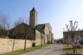
The church of Saint-Martin-d’Entraigues: built in the 12th century, and surprisingly large for such a small village, this Romanesque church dedicated to Saint Martin was destroyed and then rebuilt in the 15th century. A fire led to the church being remodelled in the 17th and 18th centuries. Despite obvious reductions in size, the building still conveys a strong sense of space that surprises visitors and raises questions about its original volume. Today, only three bays remain (one of which serves as the chancel), characterised by Gothic architecture that is rare in the churches of the Mellois region. Between 2002 and 2004, the church underwent an initial restoration programme (roofing, wall rendering, removal of the false ceiling, restoration of the arcades, interior lighting), which enabled it to continue hosting worship services and cultural events in suitable conditions. As each century has left its own mark, the idea of a contemporary design was chosen for the stained-glass windows so that the present day might, in turn, find its place within this space. The installation of the stained-glass windows was completed in 2009. Finally, in early 2010, roadworks on the town’s main thoroughfare, particularly around the church, further enhanced the building’s appeal.
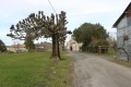
The church at Fontenille dates from 1870, replacing the former, spacious church of Saint-Médard, which was sold as national property during the Revolution and half-demolished in 1818. In 2004, the local council decided to install a clock and to illuminate the interior of the bell tower.
The church at Fontenille dates from 1870, replacing the former, spacious church of Saint-Médard, which was sold as national property during the Revolution and half-demolished in 1818. In 2004, the local council decided to install a clock and to illuminate the interior of the bell tower.
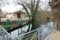
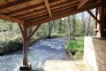
The covered washhouse at Couturette
Couturette Castle (11th century),the seat of a seigneury, is an old manor house flanked by two corner towers and formerly surrounded by a moat.
The Rhy Fountain
The Trembles Fountain
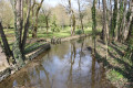
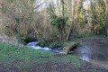
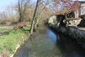
The spillways in the bed of the River Rhy were once used to flood the fields for the cultivation of hemp.
The pine wood and the Chaumes Pelées pond is a nature reserve home to a diverse range of wildlife and several species of orchid.
The Mare des Chétifs Prés is home to a wide variety of wildlife, some of which is rare.
The Fontenille meadows form an ecosystem that is ideal for many species of orchids and butterflies.
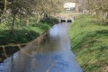
The Boutonne
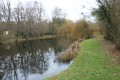
The Boutonne, which is nearly 100 kilometres long, rises in the south of the Deux-Sèvres department, enters Charente-Maritime at Saint-Séverin and Dampierre-sur-Boutonne, before flowing into the Charente to the west of the Vals de Saintonge. Twenty-five communes in the Vals de Saintonge are traversed by the Boutonne.
An essential feature of the landscape and a true green corridor amidst the plains of northern Saintonge, the Boutonne has carved out, along its course, meanders, islands, marshes and floodplains that are inundated in winter. Its banks attracted human settlement very early on, as evidenced by the Mesolithic necropolis (dating from between 8500 and 8000 BC) discovered at La Vergne.
From the Middle Ages onwards, water power was used to drive the wheels of numerous mills. Navigable as far as Saint-Jean-d’Angély, the Boutonne made this town a prosperous centre thanks to its river port, which remained in operation until the end of the 19th century. Today, locks such as the one at L’Houmée, in Torxé, bear witness to the river’s development to facilitate navigation.
Artificial poplar plantations
But the human activity linked to the Boutonne that still shapes the landscape is the cultivation, from the early 20th century onwards, of artificial poplar groves. Poplars, which thrive on alluvial soils that are well-aerated, moist and even temporarily flooded, have found the ideal conditions here for their growth. As a fast-growing species, poplars are planted in rows to make efficient use of space and maximise production.
Poplar wood is a versatile material used in various sectors, but the main market in Poitou-Charentes and the Vals de Saintonge is for veneer production. This industry requires high-quality wood, which in turn demands careful maintenance of the poplar plantations.
Major factories, established during the 20th century not far from the Boutonne (Malvaux in Loulay, Lécuiller in Tonnay-Boutonne, BDR in Poursay-Garnaud, Joubert in Saint-Jean-d’Angély, etc.), as well as small-scale sawmills, have utilised this resource. Following a shift towards the use of exotic woods in the second half of the 20th century, a trend towards a return to poplar from the banks of the Boutonne has been observed in recent years.
Article published in Sud-Ouest on 29 August 2017 at 3.40 am. Updated at 9.00 am by Philippe Brégowy.



 Country:
 City:
City:



 Visorando Member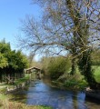

 Moderate