Country:
 City:
City:


Starting point: the Saint-Macoux leisure centre.
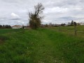
(S/E) Set off to the left onto the road, then turn right onto thefirst track and follow the hedge on your left, ignoring the track that branches off to the right. Turn right just before the small bridge.
(1) Turn left immediately afterwards and climb the slope in front of you until you reach the hamlet known as Les Quatre Vents.
(2) Turn left onto the small road. Pass the Berin well, the only pulley well on the route. Take thefirst road on the right, turn right asecond time, then head for the railway bridge on the right and cross it.
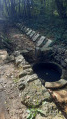
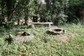
(3) After the bridge, turn left immediately and take thefirst forest track on the right. Walk past the Cousine well. It has a ‘timbre’ (a drinking trough in French). The roof protecting the mechanism is gabled and made of sheet metal. The Chez Cheveau and Petit Champmagnan wells are identical to this one in every respect. Continue straight on until you reach the road.
(4) Turn left onto the road, then right, and head towards La Maingotière. The well is directly opposite; its drum has two cranks (the water is 15 metres deep) and its roof is covered with tiles. Turn round and take thefirst road on the left.
(5) Turn right and walk through the hamlet of Chez Périllon. You’ll see the Chez Cheveau well on your right.
(6) Turn right into the hamlet and walk through the small wood. Turn left after the Petit Champmagnan well, heading towards Champmagnan.
(7) Veer slightly to the right. You’ll pass the Champmagnan well on your left. Its mechanism is driven by a wheel. Asecond wheel powers a tap. The roof protecting the mechanism is rounded and made of sheet metal. Turn right onto the Chemin du Gros Chêne and continue until you reach a crossroads.
(8) Turn left towards the village of Puypousin. Its well is on the right; it has a rounded, sheet-metal roof and is fitted with two water gauges.
(9) Turn right, then left (ignore the road branching off to the right) and go under the railway bridge. Keep to the left. You’ll pass the Fayolle well (a hamlet in the commune of Saint-Saviol). It has a drum with two cranks and a gabled tin roof. This hamlet has a dwelling built between the15th and 17th centuries.
(10) Take the hairpin bend to the right, ignore the two roads branching off to the left and take thesecond dirt track on the right. Carry on straight ahead until you reach the end. Turn right onto the limestone track and rejoin the fork from the outward journey.
(1) Carry on straight ahead and turn right onto the Chemin de la Vallée des Buis. Cross a road and turn right onto the street to reach the war memorial on the left.
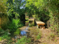
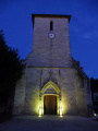
(11) Follow the Route du Moulin de Roche and turn right towards Les coteaux de Saint-Macoux. Go down the path on the left to reach the Fontenelle fountain. This fountain supplied drinking water to the village school until the 1930s. Turn round and turn right to head down into the village towards the church.
(12) Head back up to the road and take thesecond street on the left. At the top, on the road, turn right and carry on straight ahead, taking the path that continues from there to return to the starting point (S/E).

 Visorando Member

 Easy
Easy