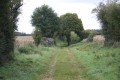
Montalembert
The commune of Montalembert belongs to the canton of Sauzé-Vaussais, in the district of Niort (in the Deux-Sèvres department). It covers an area of 11.80 km²; its minimum altitude is 118 m and its maximum 187 m. It borders the department of Vienne to the east and the department of Charente to the south. It gave its name to the Montalembert horst (1).
In ancient texts, references can be found to Mons Arambert (1228) – Montralembert (1275) – Mons Eremberti Seu Heremberti (1300) – Montarembert (1405)…
Since 1962, the village has been losing its population. It fell from 400 inhabitants in 1962 to 268 in 2007. The inhabitants are known as Montalembertiens, Motalembertiennes… or Montalemberois, Montalemberoises
Source: Wikipedia
A bit of history and economics
The following text was provided by the Sauzé-Vaussais Tourist Office in 2005, based on an interview between Mrs Jacqueline Ajer, mayor of Montalembert, and Nicolas Chambard:
The commune extends largely over a wooded hill in the far south-east of the Sauzéen region. Montalembert is linked to the family of the same name who, until the end of the 15th century, occupied the castle situated in the heart of the village. The present-day château is not the original structure: the original building, which featured towers and a keep, was demolished over the centuries and replaced at the end of the 19th century by a building characteristic of that era. Some members of the Montalembert family left their mark on French history. For example, Jean de Montalembert served as Governor, under Charles V, of the Château de Cognac, and later as an adviser to Jean, Duke of Berry, the king’s brother and Count of Poitou. André de Montalembert, for his part, was one of the most valiant captains under François I.
The geographical location of this commune is rather unusual, as it lies at the junction of the Deux-Sèvres, Vienne and Charente departments. A boundary marker, erected in 1995, marks this junction. Until 1790, Montalembert formed part of the diocese of Ruffec: it was only then that it was incorporated into the Deux-Sèvres department and the canton of Sauzé-Vaussais, despite strong protests from the inhabitants. At the time, they justified their opposition to this reorganisation by explaining to the authorities that, since time immemorial, they had, on the one hand, been subject to the jurisdiction of Ruffec and, on the other, had always bought their goods there and sold their produce there. Despite this, their case was not upheld.
“The Deux-Sèvres residents in spite of themselves”, as Mr Poignat calls them (in *L’Histoire des communes des Deux-Sèvres*), now number 301 (compared with 800 in 1789, 984 in 1821 and 400 in 1962).They are spread across numerous small hamlets, such as Le Pigeon Blanc, Négreveau, La Verrie, La Souris Chauve and Champmagnan, the latter being the only one situated to the east of the N10. Montalembert is organised around two centres: the village itself, situated at the top of the hill, and the hamlet of Fontaine, situated at its foot.
The proximity of the N10 road partly explains why certain businesses have set up in the commune, notably a structural steel design office and a workshop specialising in the design of exhibition stands. These are not the only businesses present, as there are also two joiners, an agricultural mechanic and a civil engineering firm. There is also a café-restaurant: Le Relais de la Forêt.
Montalembert Hill is a ridge 9 km long and 1 km wide, rising to a height of 190 metres. In some places, the view stretches beyond Limalonges and, on a clear day, as far as Vivonne. The formation of this hill, known as the Horst, is linked to the uplift of sedimentary strata between two faults. This tectonic feature has exposed clay-rich strata (Toarcian marl) that are rich in fossils (ammonites, belemnites). The Horst is, by its very nature and thanks to its fossils, of great heritage value, as it helps to explain part of the Earth’s history. Thanks to the accessibility of these marls, numerous quarries were opened to extract grey, red or white clays (clays which gave rise to local place names such as La Montée Blanche, La Montée Rouge and La Montée Bleue).From these quarries, the clay needed to make roof tiles was extracted – an important industry right up until the 1970s, as evidenced by the presence of tile kilns scattered throughout the commune (and neighbouring communes) and the names of the hamlets: La Tuilerie…
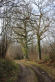
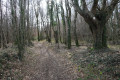
The Horst’s wealth is therefore not only geological or palaeontological, but also economic, thanks to the materials it provides and the chestnut coppices it supports. Indeed, the nature of the soil is well-suited to this species, which occupies the bulk of the commune’s wooded area. This is no small matter, as it accounts for over 40 per cent of the commune’s total area (1,179 ha) and makes Montalembert one of the most heavily forested communes in southern Deux-Sèvres. Chestnut trees have been, and continue to be, harvested for their timber, which has a variety of uses: stakes, joinery, parquet flooring, pallets, firewood…
The chestnut tree and its wood remain a source of local wealth and sectors with a promising future, and this is what prompted the municipality to establish the Maison de la Forêt et du Bois, a local development project par excellence. This municipal initiative won over the Poitou-Charentes Region, the Deux-Sèvres General Council and the European Union, all of which provided their support. Opened in June 1996, it is housed in the former school, a 19th-century building which closed its doors in 1991. The building, fitted with a wood-chip boiler, has been fully restored and refurbished, combining the preservation of its architectural features with adaptation to the requirements of its new functions.The Maison de la Forêt et du Bois is a centre of expertise bringing together the Sauzéenne Association for the Promotion of Cantonal Initiatives, the Association for the Promotion of the Chestnut Tree for Timber, the Regional Centre for Renewable Energy, Prom’Haies and Chauff’Bois Energie.By pooling the expertise of these five associations, the Maison de la Forêt et du Bois aims to promote the development of the timber and wood-energy sectors, environmental conservation and sustainable development.
In addition to the activities specific to each association, the Maison de la Forêt et du Bois regularly hosts exhibitions and makes its meeting rooms available for meetings or training days. It also played a part, in close collaboration with the Committee for Festivals, Events and Leisure (CFAL), in organising the Montalembert Fair, which, in its 1998 edition, was the first Forest Festival.
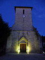
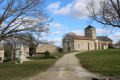
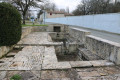
The Maison de la Forêt et du Bois is not the only facility in the town: Montalembert also has a library and a village hall, both managed by the CFAL. The CFAL’s slogan, “Montalembert is legendary”, stems from the fabulous Legend of the Mists. It tells how, on the morning after their wedding, Adélaïde and Guy de Montalembert discovered that a beautiful gold hairpin, brought back from the East, had gone missing. Almodis, the young chambermaid, was wrongly accused and sentenced to be burnt at the stake. Before her execution, she predicted that the smoke from the pyre would spread as a light mist and shroud the castle, the village and the hillside for centuries to come. During her execution, a spring gushed forth at the foot of the pyre, its waters rushing down the hill with a sound like sobbing. A few days later, the jewel was found in a magpie’s nest at the top of the keep. In memory of this tragic injustice, the fountain still flows at the top of the hill, and mist very often shrouds the woods of Montalembert. This Almodis Fountain is currently being restored as part of the ‘Chantiers des Maires’ scheme. The next heritage enhancement project scheduled concerns the Church of Saint Sylvestre, situated in the heart of the village. Despite the extensive alterations it underwent around 1860, this church is not without interest, thanks to its square bell tower and its main façade featuring three semicircular arches.
source: information compiled by Jean-Pierre Naud
The Church of Saint Sylvestre in Montalembert
Saint Sylvester, Pope from 314 to 335, was responsible for the construction of the great Roman basilicas following the Edict of Milan
(313) which established religious freedom.
The church in Montalembert is the only one in the diocese dedicated to him.
Within the parish boundaries, in Terruan, there was a priory of the Order of Grandmont, founded at the end of the 11th century by Étienne de Muret. After the founder’s death in 1124, the order left Muret to settle in Grandmont, within the parish of Saint-Sylvestre (Haute-Vienne). It is therefore likely that the church’s patronage was influenced by the Grandmont Order.
Before the Revolution, the parish was subject to the appointment of the Bishop of Poitiers.
In 1792, like a third of the priests in the diocese, the parish priest Pérotel refused to swear the oath to the
of the clergy. He took refuge in Spain, as did most of the refractory priests from the Deux-Sèvres. The parish
had no priest until 1810 and did not regain a resident parish priest until 1824. By 1790, the church was already too small to accommodate the congregation, and a rather unattractive shed had been built in front of the façade. In the 1860s, the church was extended by one bay to the west.
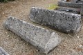
Today, one approaches the church via a small square fronted by a very old lime tree. Two large stone slabs are laid out on the square. One comes from a tomb, bearing the Montalembert cross on all its sides; the other resembles an altar table but lacks a consecration cross and is surrounded by a narrow, broken band known as the ‘Angevin band’.
Due to the extension, the west façade is a reconstruction. It features reused
, and the layout probably follows the original design: a portal flanked by blind arcades – a form found in around forty churches in the diocese – a central bay and an oculus, a remnant of a pre-Romanesque tradition. The door is also likely a reused element from the original façade.
Upon entering the church, one notices that this new bay is slightly wider than the other bays of the nave, with much thinner walls.
Source: PARVIS – 2004 Entry on Montalembert. Poitiers Theological Centre (extract) www.poitiers.catholique.fr/parvis
The “Sully” of Montalembert
One approaches the Church of Saint-Sylvestre via a small square fronted by a very old lime tree, which was planted on the orders of the Grand Voyer of France (1), Maximilien de Béthune, Baron of Rosny and Duke of Sully. He is the author of the famous saying: “Ploughing and grazing are the two breasts that nourish France, the true mines and treasures of Peru”.
In the words of the lime tree, classified as a ‘remarkable tree of France’: ‘Having stood here for over 400 years, I have witnessed many events, both joyful ones such as weddings, christenings and various celebrations, and far sadder ones such as funerals… And I have heard speeches and much idle chatter’.
(1) Voyer = ‘a seigneurial official collecting duties and customs, a judicial officer’.
''Source: article ‘Blessing of St Ignace, the bell of Montalembert Church, 10 March 1777 (excerpts)’ published on 13 February 2022 by Monique’'.



 Country:
 City:
City:



 Visorando Member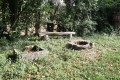
 Easy
Easy