Between Brenne and the Creuse Valley at Nuret-le-Ferron

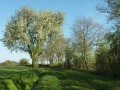
A lovely walk in the countryside between Brenne and the Creuse valley. The landscape alternates between wetlands, hedgerows and cereal fields.

Details

n°559617
Creation:
Last update:
Last review:
  • Walking
    Activity: Walking
  • ↔
    Distance: 5.06 mi
  • ◔
    Average duration: 2h 25 
  • ▲
    Difficulty: Easy

  • ⚐
    Back to start: Yes
  • ↗
    Ascent: + 148 ft
  • ↘
    Descent: - 167 ft

  • ▲
    Highest point: 545 ft
  • ▼
    Lowest point: 449 ft

Photos

Description of the walk

The route starts at the car park of the village hall – a stopover lodge – situated on the D129 towards Chasseneuil (blue signposting)

(S/E) Take the D129 towards Chasseneuil. Continue along the D129, passing a road on your left. As you come out of the hairpin bend, take the tarmac path on your left towards Les Feuillis.

(1) Take the track on the right in front of the first house and carry on, ignoring a track on the right further on. You’ll reach the edge of the Bois de l’Effe.

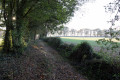
(2) At the junction, take the path on the right and go round the small pond on your right. Continue along the main path, which is grassy and very often damp. You’ll come to a T-junction.

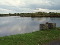
(3) Take the path that climbs slightly to your left. You’ll arrive near the Étang de la Menaigue.

(4) Turn right onto the first path and continue to the D129.

(5) Cross the road and follow the grassy path leading down almost directly opposite, 10 metres to your right. Pass close to a pond on your left. You’ll come to a four-way junction.

(6) Ignore the blue signposting on your right and the yellow signposting on your left, and take the road straight ahead. Head down towards Madagascar.

(7) Cross the D11 road (watch out for traffic) and take the tarmac path leading uphill straight ahead on the right. After the houses, the tarmac path gives way to a dirt track.

(8) Take the path on your right (GRP® yellow and red markings). This path winds its way through the trees.

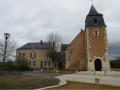
(9) As you emerge from the woods, after the house, take the path on the right (GRP® markings). This path leads into the heart of the village, to the Place des Marronniers (church). Take the street on the right to return to the starting point after crossing the D11 (S/E).

Waypoints

  1. S/E : mi 0 - alt. 489 ft - Stopover lodge
  2. 1 : mi 0.67 - alt. 512 ft - La Musetterie
  3. 2 : mi 1.07 - alt. 502 ft - Y-junction
  4. 3 : mi 1.62 - alt. 489 ft - Junction
  5. 4 : mi 1.89 - alt. 525 ft - White path
  6. 5 : mi 2.12 - alt. 502 ft - Crossing the D129
  7. 6 : mi 2.5 - alt. 512 ft - the Caberlotterie
  8. 7 : mi 2.86 - alt. 463 ft - Crossing the D11
  9. 8 : mi 3.66 - alt. 528 ft - Junction with the GRP
  10. 9 : mi 4.59 - alt. 512 ft - The Street
  11. S/E : mi 5.06 - alt. 489 ft - Stopover lodge

Notes

Wet sections: waterproof shoes or even wellies are recommended between points (2) and (3).

Reviews and comments

3.7 / 5
Based on 3 reviews

Reliability of the description
4.3 / 5
Ease of following the route
3.7 / 5
Route interest
3 / 5
Lafalla
Lafalla

Overall rating : 3.7 / 5

Date of your route : Feb 17, 2025
Reliability of the description : ★★★★☆ Good
Ease of following the route : ★★★☆☆ Average
Route interest : ★★★★☆ Good
Very busy route : No

A pleasant walk, but one best undertaken only during dry spells, as the paths near the ponds were cut off by water and the fields above weren’t any better. There was a lot of tidying up to do on arrival.

Machine-translated

lili.lili.36
lili.lili.36

Overall rating : 4 / 5

Date of your route : Dec 02, 2024
Reliability of the description : ★★★★★ Very good
Ease of following the route : ★★★★☆ Good
Route interest : ★★★☆☆ Average
Very busy route : No

A pleasant countryside walk, which was somewhat spoiled by too many very, very damp sections and very tall grass (the path is not maintained)
This walk is best done during the dry season, when it will be more enjoyable.

Machine-translated

Claiwet
Claiwet

Overall rating : 3.3 / 5

Date of your route : Aug 21, 2018
Reliability of the description : ★★★★☆ Good
Ease of following the route : ★★★★☆ Good
Route interest : ★★☆☆☆ Disappointing

A lovely walk in the countryside along a quiet path. This walk isn’t particularly representative of the Brenne landscape (you’ll come across one or two small ponds). There are long stretches exposed to the sun, so a hat is highly recommended! There’s a picnic area at the start of the walk.

Machine-translated

Other walks in the area

For more walks, use our search engine .

The GPS track and description are the property of this route's author. Please do not copy them without permission.