Nuret-le-Ferron route, from valleys to heathland

This lovely walk allows you to explore the surroundings of the village of Nuret-le-Ferron, situated in the Brenne Regional Nature Park.

Details

192956
Creation:
Last update:
Last review:
  • Walking
    Activity: Walking
  • ↔
    Distance: 8.00 mi
  • ◔
    Average duration: 3h 50 
  • ▲
    Difficulty: Moderate

  • ⚐
    Back to start: Yes
  • ↗
    Ascent: + 144 ft
  • ↘
    Descent: - 154 ft

  • ▲
    Highest point: 545 ft
  • ▼
    Lowest point: 427 ft

Photos

Description of the walk

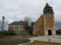
Start at Place de l’Église in Nuret-le-Ferron.

(S/E) Head south-east along the small road leading to the RD11, near the town hall. Cross it to take the D129 road opposite to the east; the main signposting is yellow.

(1) Once past the water tower, take the small road on the right, cross Les Fragnets and follow the track on the right, heading south.

(2) Continue straight on along the small road leading to La Caberlotterie. Then carry on along the track, still heading south, and descend to a junction where you leave the track on the left.

(3) At the bend in the main track, leave it and take the footpath that climbs southwards.

(4) Turn right onto the track leading down to the hamlet of Bien Assis; it then becomes a tarmac road and climbs back up to the RD11. Cross with care.

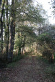
(5) Take the narrow path leading up into the woods of La Combe Noire, which continues along the edge of the forest.

(6) At the junction of the woodland and several fields, turn right (north) onto the BrenneGRP® trail until you reach the hamlet of La Rue, then continue for about 100 metres beyond it.

(7) Leave theGRP® on your right and continue straight on northwards to join the RD20. Cross it towards the Château Ringuet estate, which you’ll go round via a track suitable for vehicles. The track then becomes grassy.

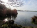
(8) At the crossroads, turn right, heading east, towards the Blusseaux estate, then, 250 metres further on, turn left towards the north-west. Continue along a path through meadows which leads to the Étang de la Grande Gorce.

(9) When you reach a wide track, near a building used by hunters and anglers, turn left towards the west for a lovely view of the lake, then retrace your steps and continue along the track to the east.

(10) At the RD11, turn right for 50 metres, then turn left towards the hamlet of Les Boisdiments.

(11) Just before Les Chervis, at the crossroads, take the track on the right which heads south towards Nuret-le-Ferron.

(12) Follow the small road to the right, skirting the cemetery, then join the RD11, which you follow to the left, heading south.

(13) 50 metres after the junction with the RD20, turn right onto Rue du Vieux Puits, which takes you back to the starting point (S/E).

Waypoints

  1. S/E : mi 0 - alt. 499 ft - Church Square
  2. 1 : mi 0.58 - alt. 509 ft - Les Fragnets on the right
  3. 2 : mi 1.34 - alt. 509 ft - Go straight on along the small road
  4. 3 : mi 1.71 - alt. 433 ft - Short path heading south
  5. 4 : mi 1.88 - alt. 495 ft - Turn right
  6. 5 : mi 2.21 - alt. 449 ft - Take the path at the edge of the woods
  7. 6 : mi 2.68 - alt. 528 ft - On the right, the Brenne GRP
  8. 7 : mi 3.62 - alt. 509 ft - Go straight on (GRP to the left)
  9. 8 : mi 4.53 - alt. 472 ft - Turn right towards Les Blusseaux
  10. 9 : mi 5.27 - alt. 456 ft - Grande Gorce Pond - Yoson (rivière) - Affluent de la Claise
  11. 10 : mi 6.08 - alt. 469 ft - Take the RD11 to the right, then left towards Les Boisdiments
  12. 11 : mi 6.51 - alt. 459 ft - At Les Chervis, take the path on the right
  13. 12 : mi 7.36 - alt. 499 ft - Turn right towards the cemetery
  14. 13 : mi 7.92 - alt. 492 ft - Turn right onto Rue du Vieux Puits
  15. S/E : mi 8 - alt. 499 ft - Church Square

Notes

No water points.
Depending on the season, please wear waterproof footwear as some areas may be damp.

Note: route amended on 18 October 2018.

Worth a visit

Reviews and comments

4.3 / 5
Based on 3 reviews

Reliability of the description
5 / 5
Ease of following the route
4.3 / 5
Route interest
3.7 / 5
User 3812981

Overall rating : 4.3 / 5

Date of your route : Feb 02, 2026
Reliability of the description : ★★★★★ Very good
Ease of following the route : ★★★★☆ Good
Route interest : ★★★★☆ Good
Very busy route : No

Shaved

Machine-translated

E2237758
E2237758

Overall rating : 4 / 5

Date of your route : Apr 13, 2021
Reliability of the description : ★★★★★ Very good
Ease of following the route : ★★★★☆ Good
Route interest : ★★★☆☆ Average
Very busy route : No

Machine-translated

jchbdn44
jchbdn44

Overall rating : 4.7 / 5

Date of your route : Feb 17, 2019
Reliability of the description : ★★★★★ Very good
Ease of following the route : ★★★★★ Very good
Route interest : ★★★★☆ Good

In fact, we combined the two Nuret routes, making for an 18 km route (19 km if you take the outermost paths). There are few signposts, but with the map, GPS and route description, it’s not a problem.
I really appreciate your route guides.
Kind regards
J Ch B

Machine-translated

Other walks in the area

For more walks, use our search engine .

The GPS track and description are the property of this route's author. Please do not copy them without permission.