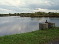
In the heathland of Nuret-le-Ferron

A walk that follows theGRP® trails of the Brenne and the Mille Étangs.

Details

n°732985
Creation:
Last update:
Last review:
  • Walking
    Activity: Walking
  • ↔
    Distance: 8.85 mi
  • ◔
    Average duration: 4h 10 
  • ▲
    Difficulty: Moderate

  • ⚐
    Back to start: Yes
  • ↗
    Ascent: + 85 ft
  • ↘
    Descent: - 85 ft

  • ▲
    Highest point: 574 ft
  • ▼
    Lowest point: 482 ft

Photos

Description of the walk

Start from the town hall car park – stopover lodge. Take the D129 towards Chasseneuil (yellow and blue signposts +GR®).

(S/E) Take the D129 to Les Fragnets, leaving Rue de la Mare on your right and the first road on your left.

(1) After the 90° right-hand bend, take the road on the left towards “Les Feuillis”. Continue straight on until you reach this hamlet, leaving the blue-marked path on your right. At this point, the road becomes a track (GR® markings). Follow the hedge.

(2) Turn onto the grassy path on the left. It is just beyond the hedge and a field.

(3) Cross the D20. Follow it for a few metres before taking the path opposite (GR® markings).

(4) Turn left onto the road to enter “Les Caillots”. Ignore the first road on the right towards Les Murailles. Take the second road on the right, then the path on the left, following theGR® markings. The white path turns into a grassy track running alongside a pond and some woodland.

(5) At the junction, turn right. Walk alongside the two ponds and take the path on the right running alongside the second pond. Continue along this path. Walk alongside the first pond, pass the first path on the left as you leave the woods, then three paths on the right. Walk alongside the second pond.

(6) At the junction, turn right onto the white track and join the D20 road. Cross it and take the road towards Les Moreaux. Walk through the hamlet.

(7) Take the small road on the right towards La Flaveleau. Follow the path on the right. It is tarmac from Les Laurets Grands onwards.

(8) At the next junction, carry on straight ahead. The road turns into a track once you’ve passed Les Laurets Petits.

(2) Follow the route taken on the way there to the town hall car park (S/E).

Waypoints

  1. S/E : mi 0 - alt. 489 ft - Town hall car park – stopover lodge
  2. 1 : mi 0.63 - alt. 512 ft - Les Fragnets
  3. 2 : mi 0.84 - alt. 512 ft - Les Feuillis
  4. 3 : mi 1.39 - alt. 512 ft - Crossing the D20
  5. 4 : mi 2.12 - alt. 515 ft - Turn left towards Les Caillots
  6. 5 : mi 3.09 - alt. 489 ft - Les Fenets
  7. 6 : mi 4.57 - alt. 492 ft - Boundary between Nuret-le-Ferron and La Pérouille
  8. 7 : mi 5.99 - alt. 568 ft - Les Moreaux
  9. 8 : mi 6.91 - alt. 531 ft - Les Laurets
  10. S/E : mi 8.85 - alt. 489 ft - Town hall car park – stopover lodge

Notes

No water sources.
Wet sections: Waterproof footwear

Always be cautious and plan ahead when you're outdoors. Visorando and the author of this route cannot be held responsible for any accidents occurring on this route.

The GR® and PR® markings are the intellectual property of the Fédération Française de Randonnée Pédestre.

Reviews and comments

3.8 / 5
Based on 2 reviews

Reliability of the description
4.5 / 5
Ease of following the route
5 / 5
Route interest
2 / 5
jchbdn44
jchbdn44

Overall rating : 3.5 / 5

Date of your route : Feb 17, 2019
Reliability of the description : ★★★★☆ Good
Ease of following the route : Not used / Not applicable
Route interest : ★★★☆☆ Average

In fact, we combined the two Nuret routes, making for a 19 km ride. It was pleasant, but not quite the real Brenne yet.
Kind regards
J Ch

Machine-translated

BANANE36
BANANE36

Overall rating : 3.7 / 5

Date of your route : Sep 03, 2018
Reliability of the description : ★★★★★ Very good
Ease of following the route : ★★★★★ Very good
Route interest : ★☆☆☆☆ Very disappointing

Nothing of interest to see. What’s more, there’s a lot of road to cover, few pleasant paths, and the ponds are barely visible from the paths.
No interesting architecture, lots of uninhabited and deserted places…
In short, it’s not at all interesting, unlike other walks in the area

BUT thank goodness we had the route description from Visorando to hand, as there are NO physical signposts at all

Machine-translated

Other walks in the area

For more walks, use our search engine .

The GPS track and description are the property of this route's author. Please do not copy them without permission.