Country:
 City:




The starting point is at Place de l’Hôtel de Ville, by information panel no. 1 on the historical route. See the ‘Practical Information’ section for parking details.
(S/E) With your back to the town hall, head towards Rue Grande (D134) in the direction of the Tourist Office (blue signposting). Follow it to the right to reach Place de l’Église and signpost no. 2.
With your back to the church, walk along Rue Pierre Canals for 50 metres westwards and turn right into Rue du Marché. Turn left into a cobbled alleyway to reach the car park at Place Henri Hefti (sign no. 3).
Turn right onto Rue Grande. Follow it to the left and continue straight on at the next junction to reach the Notre-Dame de la Pitié Chapel on Place du Champ de Foire (sign no. 4).
(1) Walk along the left-hand side of Place du Champ de Foire (sign no. 5). Pass Rue Pierre Canals on your left and turn left onto the next street towards the municipal campsite and the banks of the Creuse.
Head down Rue de Limage on the right and, at the end, take the footbridge leading to the Îlon.
(2) Turn left, head towards information panel no. 7 on the Îlon, then no. 8 on the mill and the power station at the end of the Îlon. Then take the small footbridge to reach Rue du Cheval Blanc, which you should go up on the right (signpost no. 8).
At the top of the street, head right towards the church, then right again towards the secondary school (sign no. 9 for the Priory).
Walk down Rue de Creuse, which is tarmac-surfaced at first and then turns to grass. At the end, turn right (sign no. 10 for the lock) then veer sharply left (sign no. 11 for Morlonne and the secondary school).
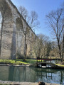
Then follow the path running alongside the River Creuse to the north-east, passing behind a wash house. Reach information sign no. 12 about the Terrier de Grimouard (on the left) and continue straight on to pass under the stone bridge, known as the Pont de la Gare. Ignore the blue signposting, which directs you to take the steps on the left; instead, continue straight on along the banks of the Creuse for about 200 metres until you reach the Bonargent-Multon metal bridge.
(3) Go under the bridge to reach information panel no. 15. On a short detour of about a hundred metres to the left, you can find information panel no. 16 on the Combe lime kilns on the other side of Avenue de Lignac (panels 13, 14, 17 and 18 will be at the end of the route). Return to information panel 15.
(3) Continue along the banks of the Creuse towards the east, following the yellow markings. Pass the first path on the left and turn into the next one to head back up onto Avenue de Lignac; follow this to the right until you reach No. 17.
(4) Pass the path on the left that leads up to the Espace Collet to reach the picnic area set up by the old lime kilns (sign no. 19 in the hamlet of Lignac). Head towards the roundabout and go round it on the right to reach the opposite side (yellow markings). Shortly afterwards, turn left onto the access road to the hamlet of Les Pauduats. Pass under the D951, then head up to the right towards the hamlet. You will arrive at Impasse du Puits.
(5) At the old well, carry on straight ahead for 40 metres, then turn left into Rue des Jarriges. Leave Chézal-dessus on your right and continue down the hill.
Turn right, then left to pass under the D951 again. Then turn right and follow the small road to reach a shopping centre and the junction with the Route de Buzançais before the cemetery.
(6) At the junction, by a cross, cross the road carefully and turn right. You’ll reach a roundabout; go round it carefully on the left to reach the industrial estate and a veterinary practice. Follow Rue du Champ des Noyers to the left. At the end, turn left to walk along the lower side of the D951 for a few dozen metres, then take the small road on the right. Stay on this small road, which, after a wide left-hand bend, heads due west and reaches a junction at a place called Les Bouderands.
(7) Carry on straight ahead and follow the farm track down to the Chézeaux stream. Cross the ford via a footbridge and continue along the path on the left (marked with yellow and red signs for the BrenneGRP® ) until you reach the entrance to the hamlet of Chézeaux.
(8) Pass the wash house, continue straight on along the street then turn right to cross the hamlet. At an old well, turn right after the Stop sign, following the yellow markings; then, at the exit, carefully follow the D46 to the right. Pass the Château des Chézeaux and continue to the next junction.
(9) Go up the small road on the left towards Les Terrières. Just after the boundary wall of the Les Terrières estate, head down the path on the left. Walk along the right-hand side of the D951 for 50 metres to reach the junction with the Route de Rivarennes. Cross the D951 carefully and turn left onto the Greenway towards Saint-Gaultier.
(10) At the next junction, ignore the yellow signposting heading straight ahead and turn right onto a track, which is more pleasant than the tarmac of the Voie Verte. It branches off to the left and later runs alongside the Voie Verte. The end of the track leads to a junction by a retention basin.
(11) Turn left, then immediately right to rejoin the Voie Verte. Continue to the viaduct over the Creuse (beautiful view) and carry on to the road.
(12) Turn left to follow Avenue Jean Rochette to a roundabout. Take Avenue Charles de Gaulle towards Saint-Gaultier and cross the Gare Bridge (signs no. 13 on the panorama and no. 14 on the Gare Bridge). You will reach Avenue de Lignac again.
(13) Leave the yellow markings on your right and follow the blue markings on your left. Pass sign no. 17 for the Château de Lignac near a burrow, leave Rue des Remparts on your right and continue straight on along Rue Grande to reach the Terrier de Grimouard.
30 metres further on, head down to the left into a small grassy square to find the final sign, No. 18, on the ramparts. Head back up to Rue Grande, follow it to the left and return to the car park at Place de la Mairie (S/E).


 Visorando Member
 Easy