On the slopes of the Creuse in Saint-Gaultier

This walk allows you to explore the hamlet of Les Chézeaux and its traditional houses, as well as the steep-sided valley of the Ruisseau des Chézeaux and the Côte des Nobles.

Details

554560
Creation:
Last update:
Last review:
  • Walking
    Activity: Walking
  • ↔
    Distance: 4.74 mi
  • ◔
    Average duration: 2h 20 
  • ▲
    Difficulty: Easy

  • ⚐
    Back to start: Yes
  • ↗
    Ascent: + 177 ft
  • ↘
    Descent: - 180 ft

  • ▲
    Highest point: 505 ft
  • ▼
    Lowest point: 325 ft
  • ⚐ Country: France
  • ⚐ City: Rivarennes (36800)
  • ⚑
    Start/End: N 46.640796° / E 1.397308°
  • ❏
    IGN map(s): Ref. 2026SB
  • Hour-by-hour weather

Photos

Description of the walk

Park in a small car park at the entrance to the village of Les Chézeaux, on the D46 towards Migné. Blue signposting.

(S/E) Facing the roundabout, take the road on the left towards the village.

(1) Turn left, then keep left at the next two junctions.

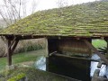
(2) At the next junction, go straight on (north-east). Then, carry on straight ahead. The tarmac road turns into a track at a wash house. Continue straight on along the Ruisseau des Chézeaux.

(3) Turn left to ford the stream. The track then veers right, running perpendicular to the stream, to go round a small pond and begins to climb slightly.

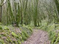
(4) Take the path that climbs up to your left. The path is wide and shaded for almost the entire way. Stay on the main path, ignoring two turn-offs to the left and then one to the right.

(5) At a junction, turn off to the right and head north-north-east, then north-east. Leave the woodland and reach a crossroads.

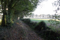
(6) Take the path on your right. This path is barely visible; it winds along the edge of the woods and descends towards the bottom of the steep, wooded valley (the Côte des Nobles). You’ll reach the Ruisseau des Chézeaux.

(7) Take the path on your right, which runs alongside the stream and climbs slightly before descending again.

(4) Carry on straight ahead and follow the same path as on the way out.

(2) Turn left. At the T-junction, turn right and carry on straight ahead to return to the starting point (S/E).

Waypoints

  1. S/E : mi 0 - alt. 328 ft - Entrance to the village of Les Chézeaux, on the D46
  2. 1 : mi 0.09 - alt. 348 ft - Village entrance
  3. 2 : mi 0.25 - alt. 341 ft - Junction
  4. 3 : mi 0.48 - alt. 338 ft - Ford
  5. 4 : mi 0.6 - alt. 348 ft - Junction
  6. 5 : mi 1.53 - alt. 482 ft - Junction
  7. 6 : mi 2.26 - alt. 482 ft - High point – on the right
  8. 7 : mi 3.42 - alt. 361 ft - Junction – turn right
  9. S/E : mi 4.74 - alt. 328 ft - Entrance to the village of Les Chézeaux, on the D46

Reviews and comments

4.7 / 5
Based on 2 reviews

Reliability of the description
5 / 5
Ease of following the route
4.5 / 5
Route interest
4.5 / 5
ruma_wi
ruma_wi
• Edited:

Overall rating : 5 / 5

Date of your route : Jul 28, 2021
Reliability of the description : ★★★★★ Very good
Ease of following the route : ★★★★★ Very good
Route interest : ★★★★★ Very good
Very busy route : No

In a damp summer, there are lots of mosquitoes

Machine-translated

grandgibus
grandgibus

Overall rating : 4.3 / 5

Date of your route : Feb 24, 2020
Reliability of the description : ★★★★★ Very good
Ease of following the route : ★★★★☆ Good
Route interest : ★★★★☆ Good

A really lovely walk.
Exploring the hamlet of Les Chézeaux
You walk alongside the stream – it’s very pleasant.
Watch out for the change in elevation

Machine-translated

Other walks in the area

For more walks, use our search engine .

The GPS track and description are the property of this route's author. Please do not copy them without permission.