A large circular route starting from Sasbachwalden.

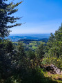
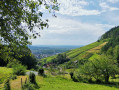
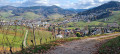
Waterfalls, an old castle, imposing rocks, beautiful views of the Rhine plain, forests everywhere and, finally, vineyards and schnapsbrunnen. In October, there are also colours and chestnuts.

Details

2662542
Creation:
Last update:
Last review:
  • Walking
    Activity: Walking
  • ↔
    Distance: 11.32 mi
  • ◔
    Average duration: 7h 25 
  • ▲
    Difficulty: Difficult

  • ⚐
    Back to start: Yes
  • ↗
    Ascent: + 2,530 ft
  • ↘
    Descent: - 2,539 ft

  • ▲
    Highest point: 2,690 ft
  • ▼
    Lowest point: 981 ft

Photos

Description of the walk

Access to the start: in Sasbachwalden, look for the restaurant Zum Fässlewirt, 1 Rue Murberg. It is signposted on the main road. Drive past the restaurant and park shortly afterwards in the free car park.

(S/E) Leaving the car park, go up the road to the right.

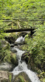
(1) Shortly afterwards, take the path called Alde Gott Panoramarunde on the right. This is the start of the climb along the small Brandbach stream, which has formed a series of small waterfalls called Gaishölle Wasserfälle (Goat Hell Waterfalls). After the waterfalls, cross the road towards Brigittenschloss. After 10 metres, turn right into the street "Am Sclossberg".

(2) After 100 metres, take the stairs on the left, then cross the street. Continue along Wilhelm Ganter Weg, turn left at the next street (Felsenweg) and go up the first street on the right, which becomes a path. Stay on this path.

(3) Turn left at the T-junction towards Brigittenschloss. Turn right before the barn and go up the path bordering the forest. Go up the path on the right. Continue along the path on the left until you reach the crossroads.

(4) Turn right. Turn right and climb up to Birgittenschloss Castle.

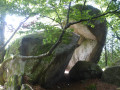
(5) From the castle, climb the path on the right to reach the Fuchschroffen rock (fox escarpment). Below, you can see a paragliding launch site. Continue along the path towards the Katzenstein rock (cat rock).

((6) After Katzenstein, turn left at the next path towards Breitenbrunnen. At the next crossroads, go straight ahead.

(7) Take the first path on the right (no sign). Ignore the paths on the left and right.

(8) Take the second road (Markteichstrasse), which is paved at the beginning, on your left. Stay on this road until you reach Breitenbrunnen. This road is also used by mountain bikers and even cars.

(9) Cross the road and take the path opposite towards Lauf.

(10) Climb the path on the left towards Sodmattweg. You will arrive at another paragliding launch site. Enjoy the bench and the view over the Rhine plain.

(11) At the next junction, turn right. Turn left at the next path and continue to Hohritt. Go to the junction and take the path on the right.

(12) Turn left immediately towards Grobekopf / Sasbachwalden.

(13) Turn left onto the next path towards Sasbachwalden/Lauf.

(14) Go down the path on the right (marked with a yellow diamond). Cross two paths that meet at this point.

(15) Cross another path and descend the trail. Turn right onto the next path, which then curves to the left. You will come out onto a road.

(16) Turn right towards the Fatimagrotte. You are now on the Schnapsbrunnenweg (schnapps fountain trail). When you reach the houses, take the path on the left. At the next houses, cross the road.

(17) Turn left. You are now on the Ortenauerweinpfad (Ortenau Wine Trail) and still on the Schnapsbrunnenweg.

(18) Take the path on the left that crosses the vineyard. We are now on the Alte Gott Panoramarunde trail. Follow this trail to Rue Murberg. Walk down the street to the car park (S/E).


Waypoints

  1. S/E : mi 0 - alt. 1,106 ft - Car park on Murberg Street.
  2. 1 : mi 0.07 - alt. 1,158 ft - Access to the Gaishöllewasserfälle waterfalls.
  3. 2 : mi 0.66 - alt. 1,670 ft - Stairs.
  4. 3 : mi 1.17 - alt. 2,090 ft - Crossroads
  5. 4 : mi 1.55 - alt. 2,336 ft - Crossroads
  6. 5 : mi 1.97 - alt. 2,493 ft - Trail to Katzenstein.
  7. 6 : mi 2.26 - alt. 2,379 ft - Path on the left.
  8. 7 : mi 2.49 - alt. 2,477 ft - Path on the right.
  9. 8 : mi 2.93 - alt. 2,198 ft - Markteichstrasse road and path on the left.
  10. 9 : mi 5.55 - alt. 2,687 ft - Breitenbrunnen crossroads.
  11. 10 : mi 6.24 - alt. 2,572 ft - Fork in the road to the left.
  12. 11 : mi 7.08 - alt. 2,510 ft - Path on the right.
  13. 12 : mi 7.52 - alt. 2,316 ft - Path on the right.
  14. 13 : mi 8.22 - alt. 2,067 ft - Chelin on the left.
  15. 14 : mi 8.38 - alt. 2,011 ft - Trail on the right.
  16. 15 : mi 8.66 - alt. 1,814 ft - Trail opposite.
  17. 16 : mi 9.14 - alt. 1,391 ft - Road on the right.
  18. 17 : mi 9.73 - alt. 984 ft - Road on the left.
  19. 18 : mi 10.24 - alt. 991 ft - Vineyard path on the left.
  20. S/E : mi 11.32 - alt. 1,093 ft - Car park on Murberg Street.

Notes

No water sources except in Sasbachwalden.
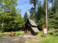
Shelters near Fuchschroffen, Breitenbrunnen and Hohritt.

Worth a visit

Sights to see:
- The Gaishöllewaserrfälle waterfalls.
- Brigittenschloss Castle.
- The Fuchsschroffen and Katzenstein rocks.
- Several viewpoints over the Rhine plain.
- The vineyards of Sasbachwalden.

Reviews and comments

4.4 / 5
Based on 8 reviews

Reliability of the description
4.5 / 5
Ease of following the route
4 / 5
Route interest
4.6 / 5
ChristopheM6267
ChristopheM6267

Overall rating : 4.7 / 5

Date of your route : Feb 22, 2026
Reliability of the description : ★★★★★ Very good
Ease of following the route : ★★★★★ Very good
Route interest : ★★★★☆ Good
Very busy route : No

A lovely route dotted with beautiful scenery. A little too many wide paths for my taste, but that's part of the scenery.
Total walking time: 3 hours 45 minutes.

Machine-translated

as2trefle69
as2trefle69

Overall rating : 5 / 5

Date of your route : Feb 23, 2025
Reliability of the description : ★★★★★ Very good
Ease of following the route : ★★★★★ Very good
Route interest : ★★★★★ Very good
Very busy route : No

the hike is on the majority of the shaded course an advantage in summer, dice the departure one goes up during approximately 1h15 with 1h30 thus good physical condition required, a very beautiful sight of the castle then the remainder of the excursion is done on forest way of many point of view on the various valley is parish specific to Brittany sunny little frequented in this month of February.

Machine-translated

JimmyAce
JimmyAce

Overall rating : 4.3 / 5

Date of your route : May 12, 2024
Reliability of the description : ★★★★☆ Good
Ease of following the route : ★★★★☆ Good
Route interest : ★★★★★ Very good
Very busy route : No

Very nice walk, no tracking problems with the GPS.
Remark: At point 4, the yellow diamond marking is not visible but you will find it higher up ... behind you.
Be careful not to confuse the mountain bike tracks with the footpaths, they go downhill very quickly.
For parking, beware that many car parks are private.

Have a good ride

Machine-translated

patrick067
patrick067

Overall rating : 4.3 / 5

Date of your route : Jan 18, 2024
Reliability of the description : ★★★★☆ Good
Ease of following the route : ★★★★☆ Good
Route interest : ★★★★★ Very good
Very busy route : No

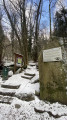
Lovely walk in winter with a light veil of snow. The route gets off to a great start and winds around the magnificent waterfall, which is superbly accessible. The route is varied and ends in the vineyards... I'll certainly be doing it again in the spring!

Machine-translated

krippleben patrick
krippleben patrick

Overall rating : 3.3 / 5

Date of your route : Jul 23, 2023
Reliability of the description : ★★★☆☆ Average
Ease of following the route : ★★☆☆☆ Disappointing
Route interest : ★★★★★ Very good
Very busy route : No

This route is very badly signposted, and your description is hard to understand. I've finished the route but I'm not at all sure whether it corresponds to your description. On your sheet, at number 4, you say to turn left, marking the yellow diamond (specify 10 m to the left as the path is not very visible and the diamond no longer exists). In number 7 you say to take the first path on the right without signs and at the same time you say to leave the path on the left and right, but what does that mean? In any case, I've never taken the right path. In 8 you say to go to Breitennbrunnen, but what is that? I thought it was a village but it's actually a building. The end of the route can be found by deduction and the last junction isn't very clear. Fortunately there were hikers and I speak German.
Conclusion: nice tour to do, but you'll have to rethink it! And as a result, I'm hesitant to book other tours!

Machine-translated

Pascalitu
Pascalitu

Overall rating : 4.7 / 5

Date of your route : Aug 01, 2021
Reliability of the description : ★★★★★ Very good
Ease of following the route : ★★★★☆ Good
Route interest : ★★★★★ Very good
Very busy route : No

Lovely loop around Sasbachwalden, with forest, vineyards, viewpoints and schnapps fountains.

Machine-translated

Gurtegh
Gurtegh

Overall rating : 4.3 / 5

Date of your route : Jul 03, 2021
Reliability of the description : ★★★★★ Very good
Ease of following the route : ★★★★☆ Good
Route interest : ★★★★☆ Good
Very busy route : No

the walk was very beautiful. you cross the black forest which is really pretty. there are people who do mountain biking and paragliding. Parish specific to Brittany. Really recommend

Machine-translated

Claude Metzger
Claude Metzger

Overall rating : 4.3 / 5

Date of your route : Jul 20, 2020
Reliability of the description : ★★★★★ Very good
Ease of following the route : ★★★★☆ Good
Route interest : ★★★★☆ Good
Very busy route : Yes

A beautiful circuit with a very busy first part (waterfalls) and another part much less frequented.
But very interesting overall, with some great views 👍

Machine-translated

Other walks in the area

For more walks, use our search engine .

The GPS track and description are the property of this route's author. Please do not copy them without permission.